
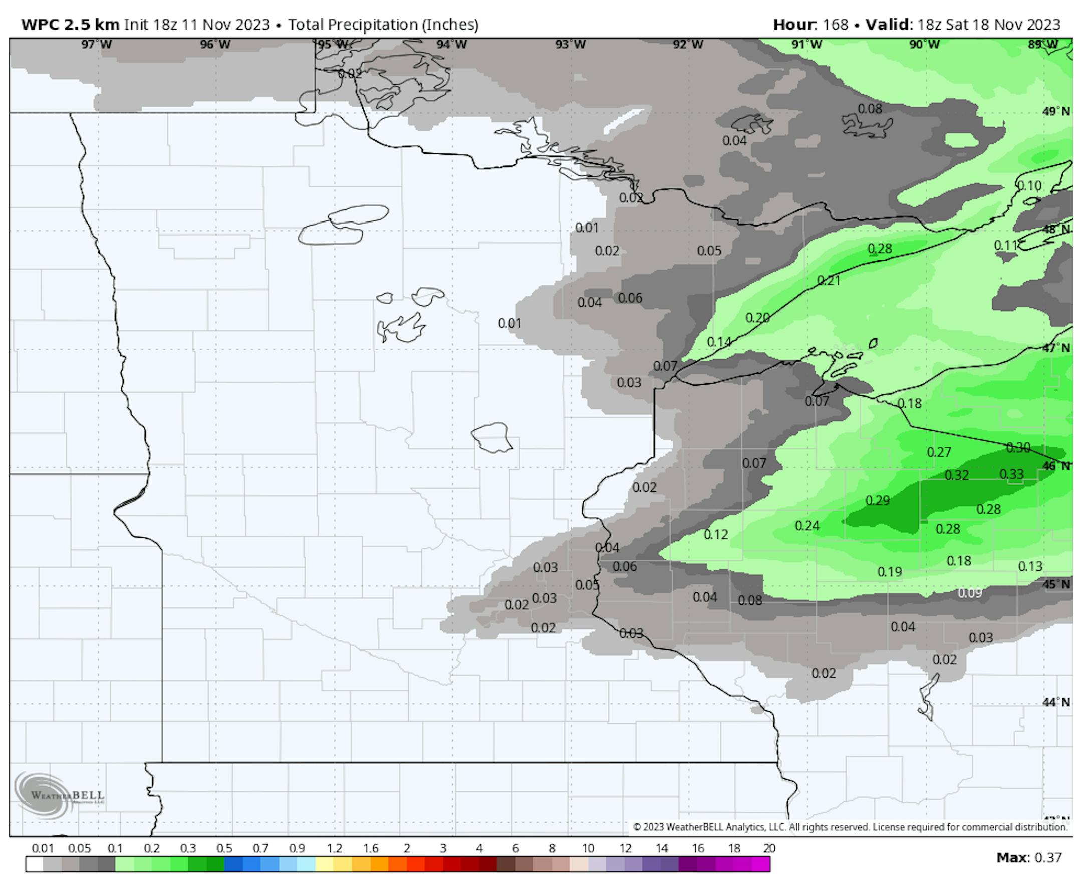
Precipitation Outlook
The extended precipitation outlook through the weekend shows very minimal precipitation. Much of the region will stay dry with only a few hundredths possible north and east of the metro.
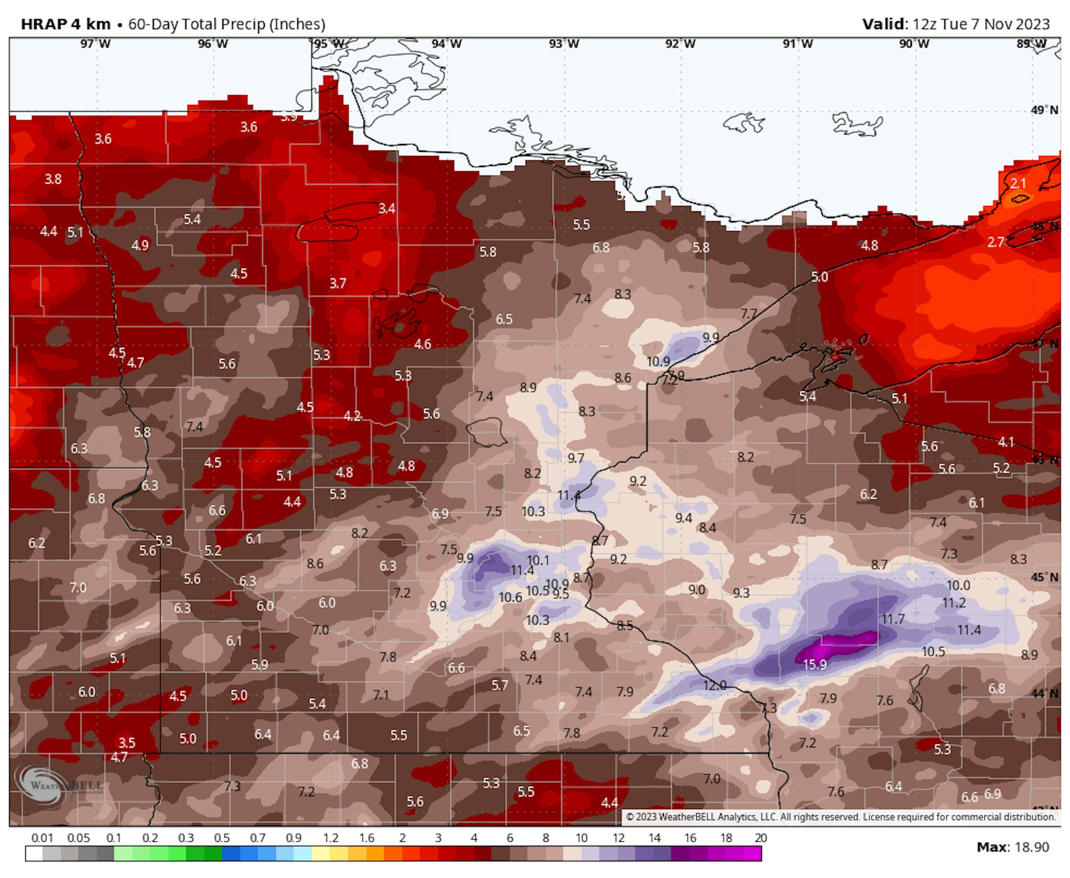
Precipitation Over The Last 60 Days
Extraordinary levels of rainfall have been witnessed in various regions of the state since September 23rd. Remarkably, specific areas in the vicinity of the Twin Cities, delineated in white and blue, have received nearly 10 inches or more of precipitation in just over a month.
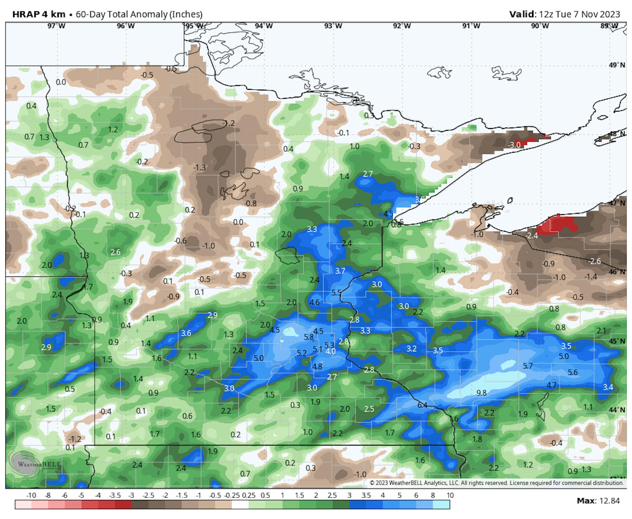
60 Day Precipitation Anomaly
Thanks to some recent heavy rains parts of the state are now in a surplus over the last 60 days. Some of the biggest surpluses are showing up in blue in pockets across parts of central Minnesota, including the Twin Cities and into western Wisconsin. It has been a very soggy last 7 weeks.
Drought Update
Recent heavy rains since late September have helped the drought situation quite a bit in across the state. With that being said, nearly 18% of the state is still in a severe drought, which has improved from 34% nearly 3 months ago.

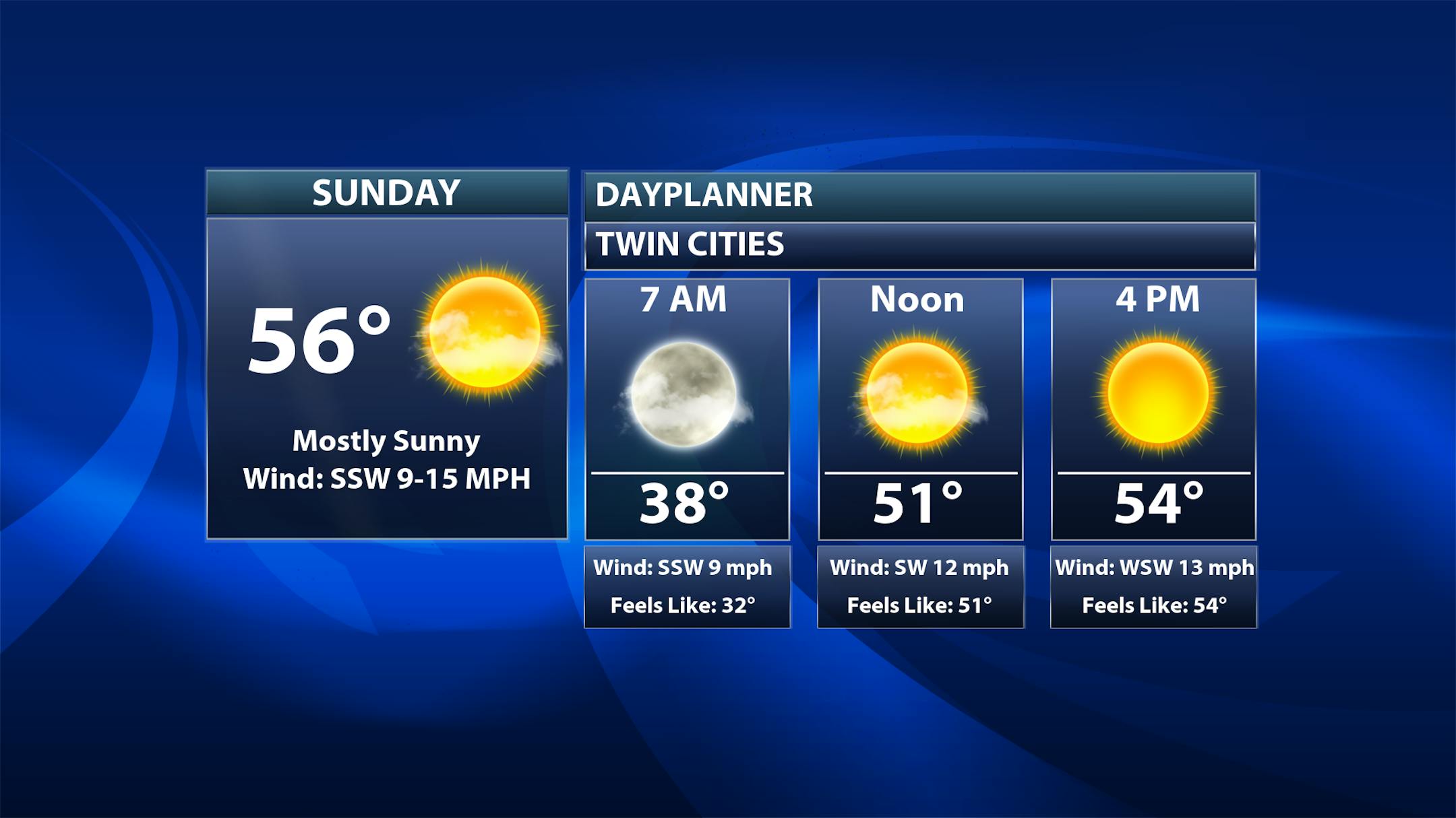
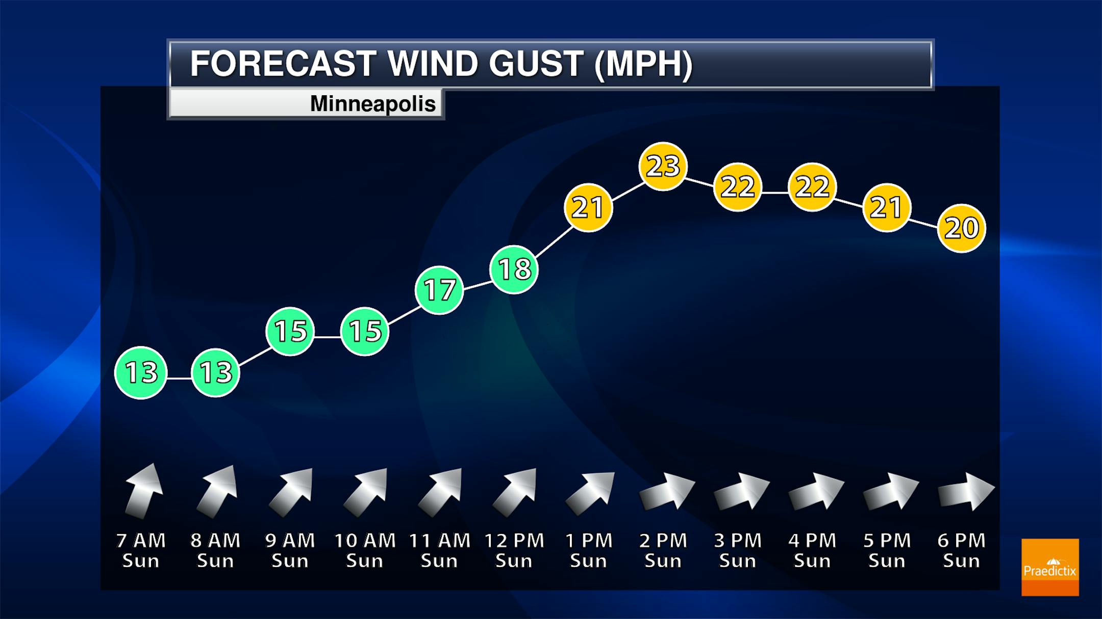
Twin Cities Weather Outlook For Sunday
The weather outlook for the Twin Cities on Sunday, November 12th will be nearly +10F above average for this time of the year. WSW winds will be breezy during the afternoon with gusts approaching 25mph at times.
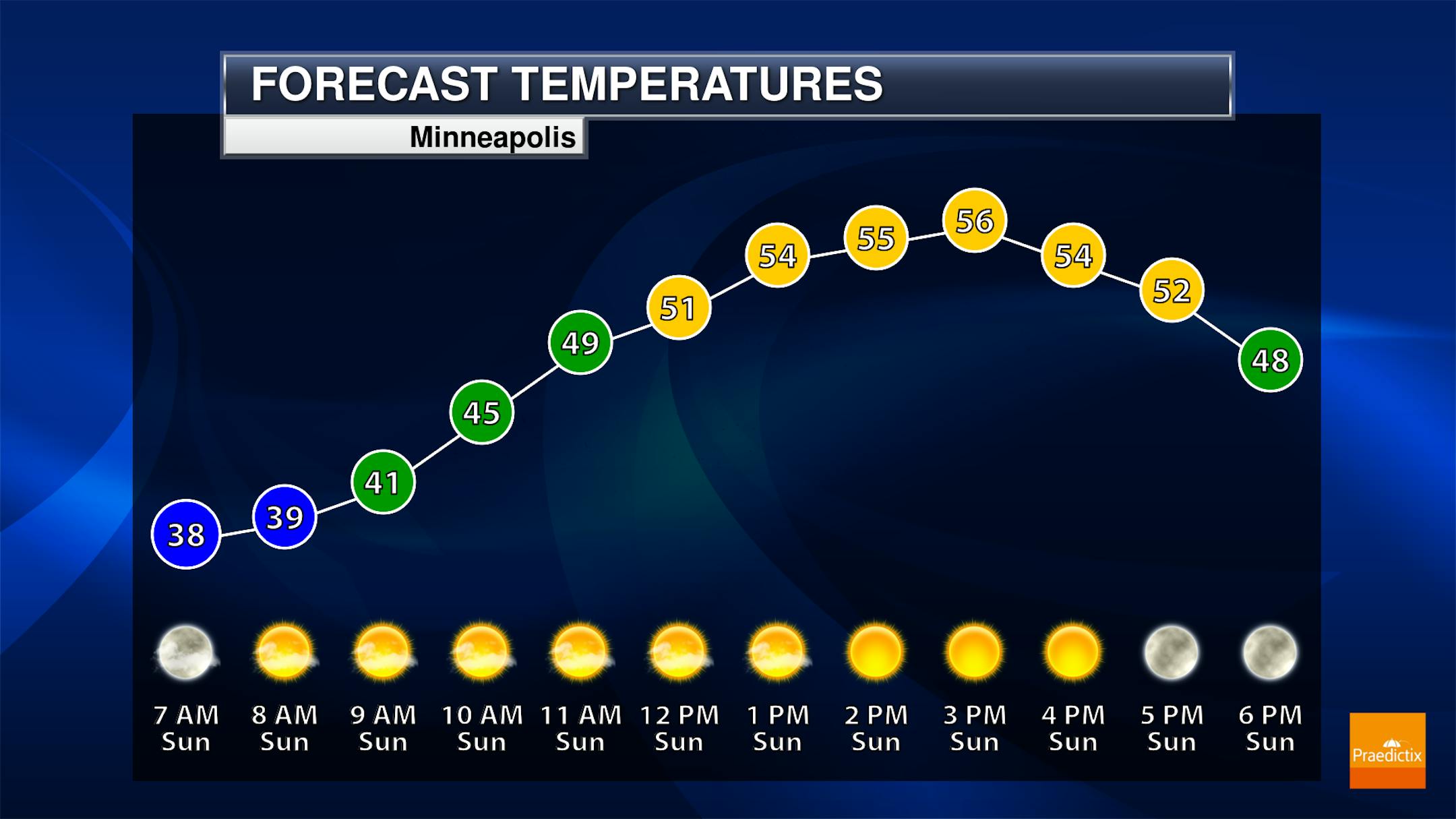
Meteograms For Minneapolis
Temperatures in Minneapolis will start in the upper 30s in the morning and will warm into the mid 50s by the afternoon. Skies will remain dry and sunny with gusty WSW winds around 20mph to 25mph at times.
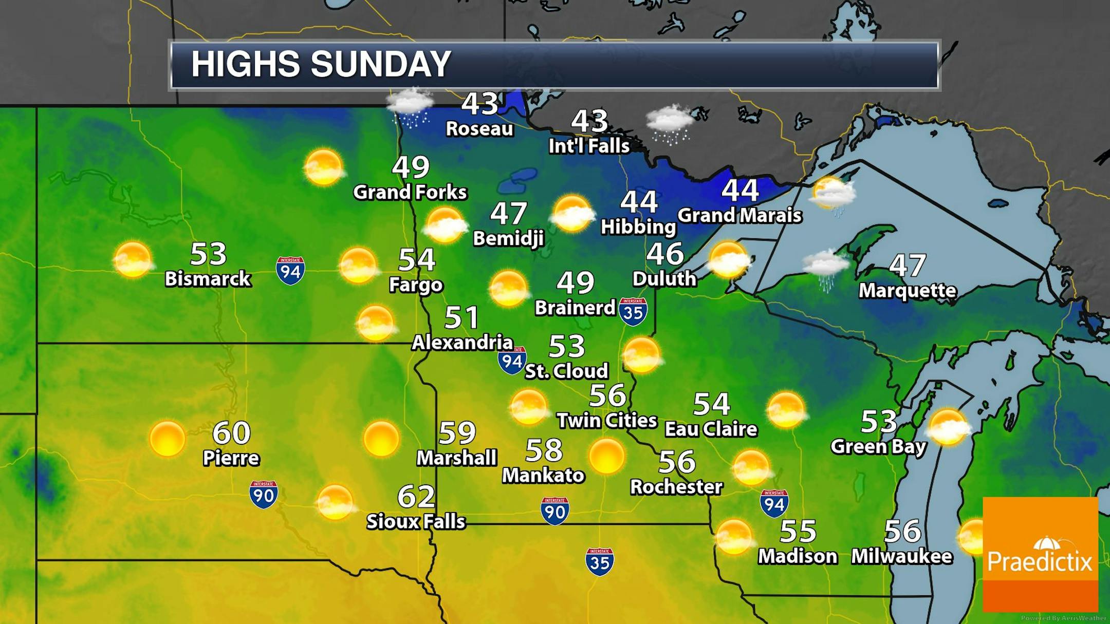
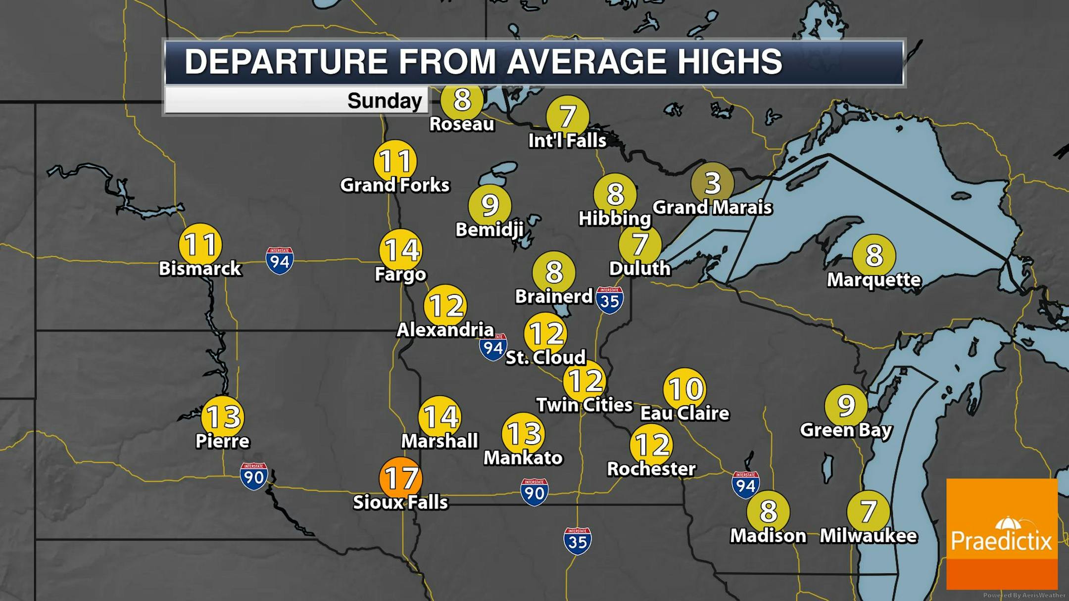
Weather Outlook For Sunday
The weather outlook for Sunday will be nearly +10F to +15F above average for this time of the year with mostly dry and sunny weather in place. There could be a few light rain/snow showers across the far northern reaches of the state.
Extended Temperature Outlook For Minneapolis
The 5 day temperature outlook for Minneapolis shows mild temperatures returning later this weekend and into the week ahead with highs warming into the 50s and 60s, which will be nearly +10F to +20F above average for this time of the year.


