

Bitterly Cold Weather Returns For Friday
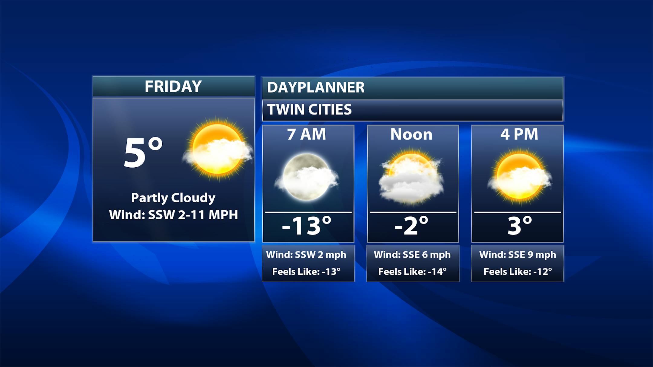
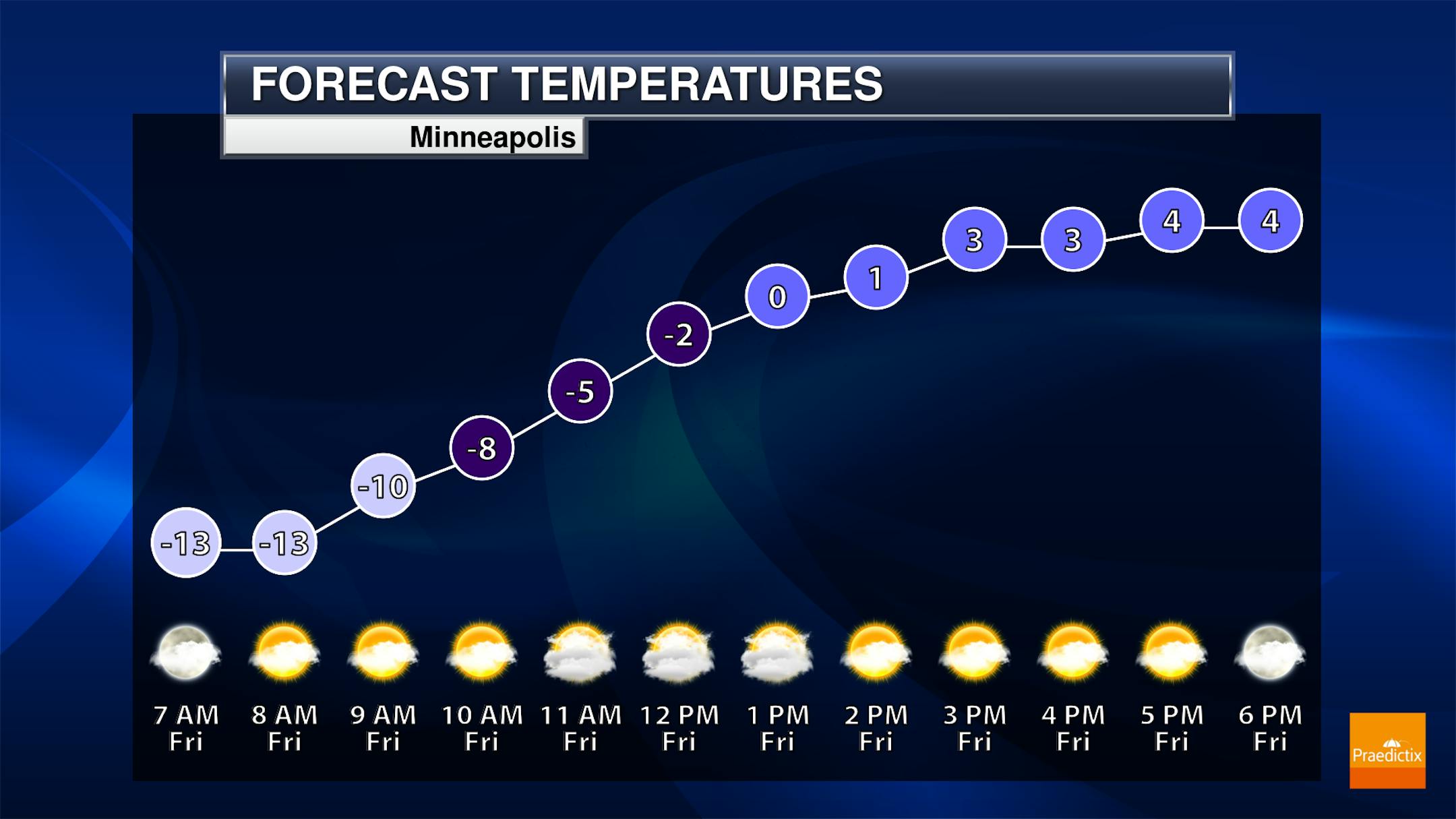
Well, the break from the cold weather didn't exactly last long, did it? We'll wake up in the teens below zero Friday morning, only climbing into the mid-single digits during the afternoon hours. We'll see a mix of sun and clouds across the metro. Winds will be on the increase during the day, so it'll continue to feel like the teens below zero even into the afternoon hours.
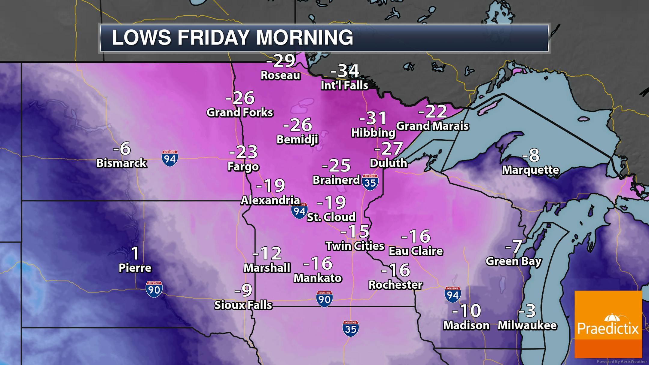
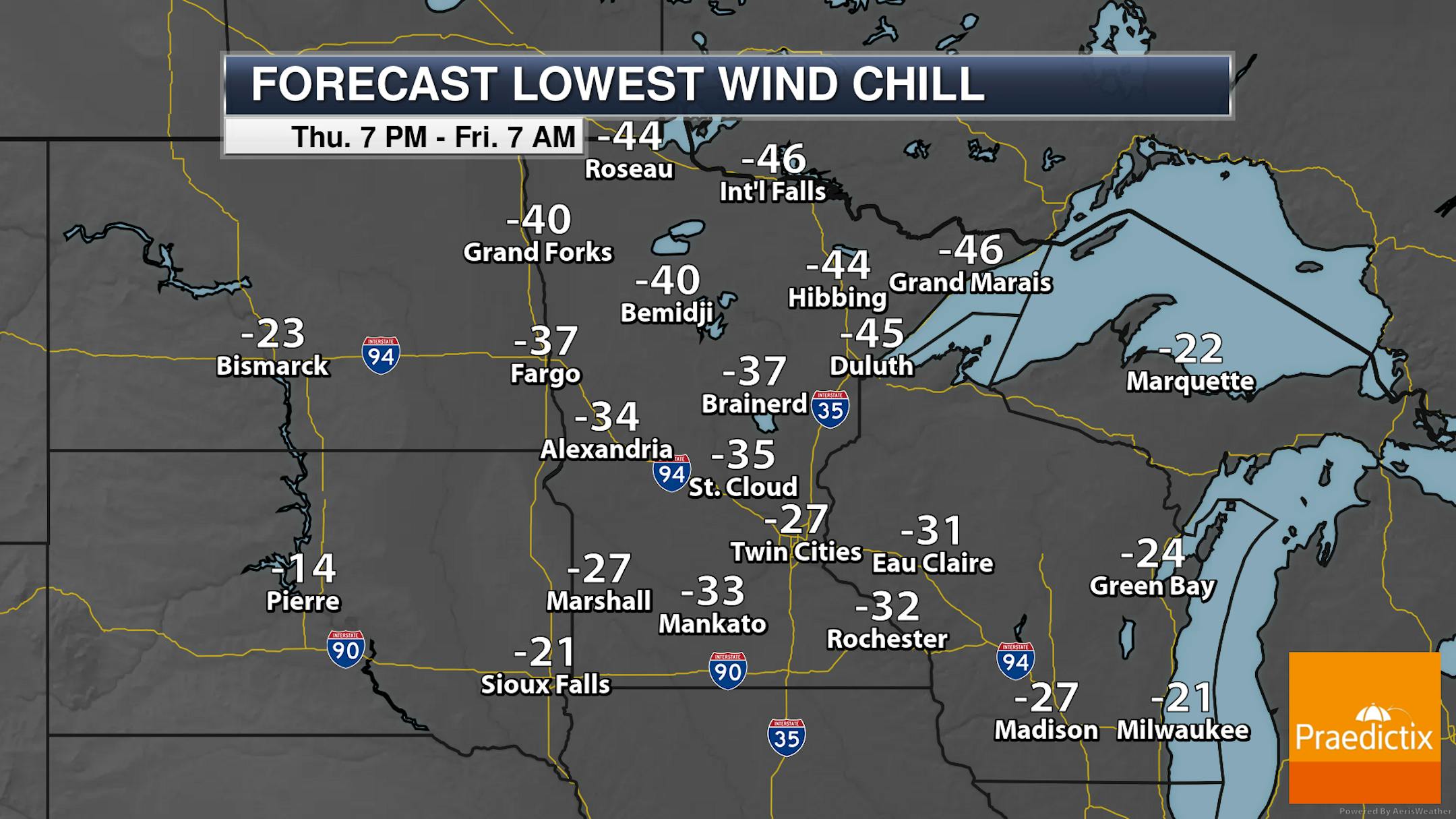
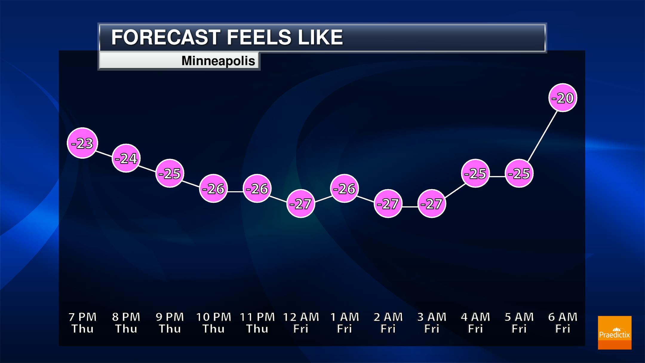
As we start off Friday morning, wake-up temperatures will range from the teens below zero in southern Minnesota to the -30s in northern areas. However, with stronger northwest winds across the region, it'll feel more like the -30s and -40s in most locations overnight Thursday into early Friday morning. All of Minnesota is under either a Wind Chill Warning or Wind Chill Advisory.
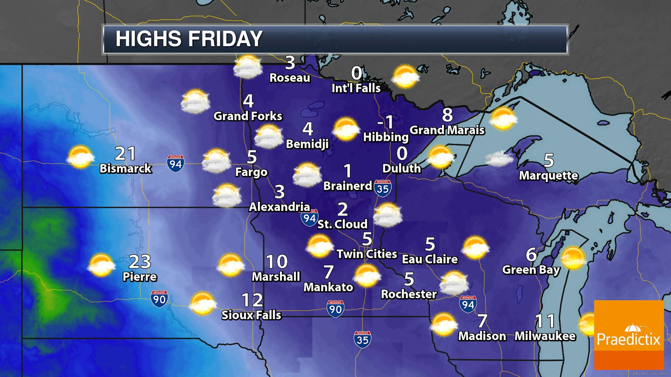
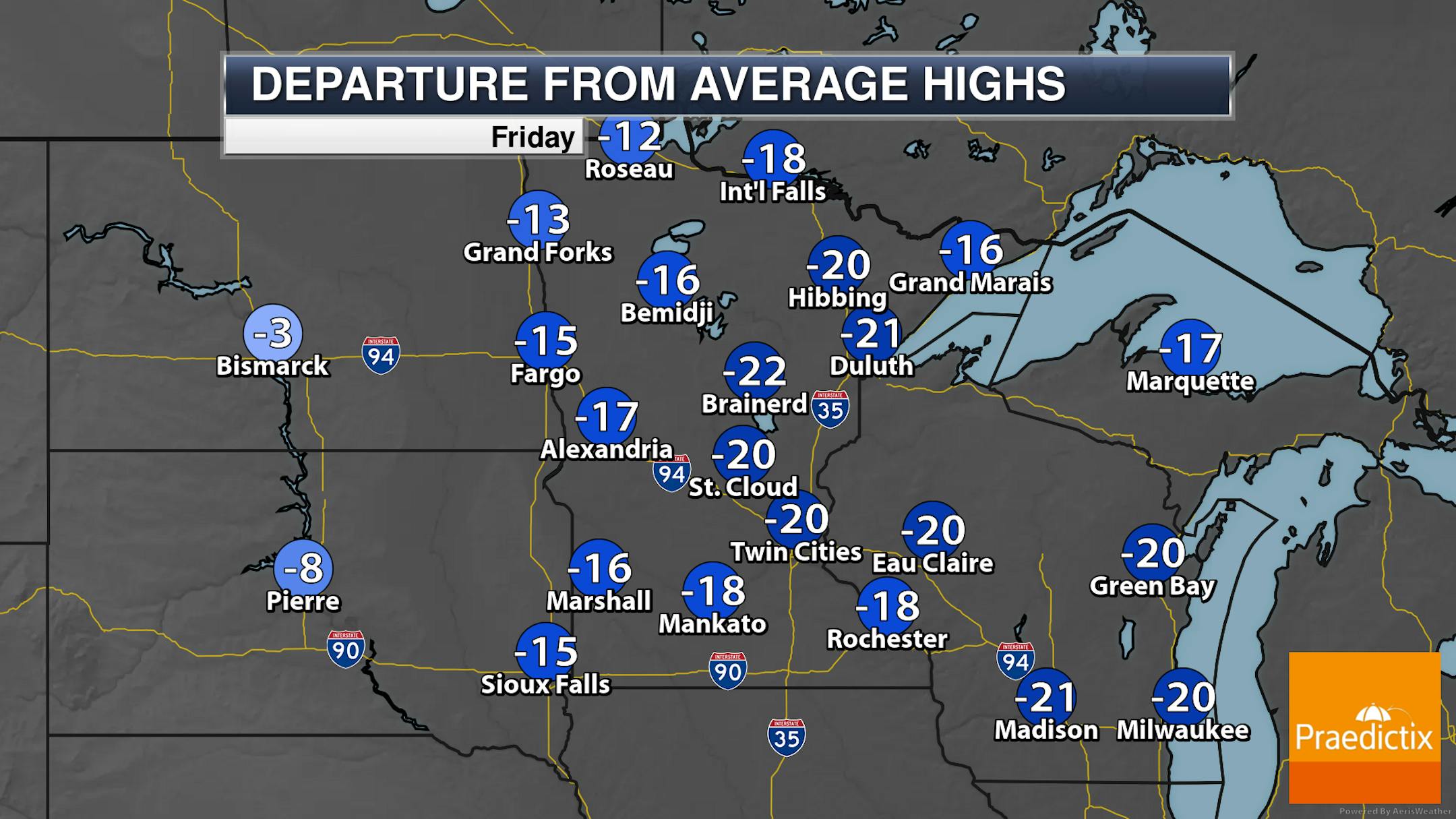
A mix of sun and clouds can be expected across the state on this cold, cold Friday. Highs in most areas will only climb into the single digits above zero. Some areas up north could stay slightly subzero.
_______________________________________________
Warmer Weekend Weather
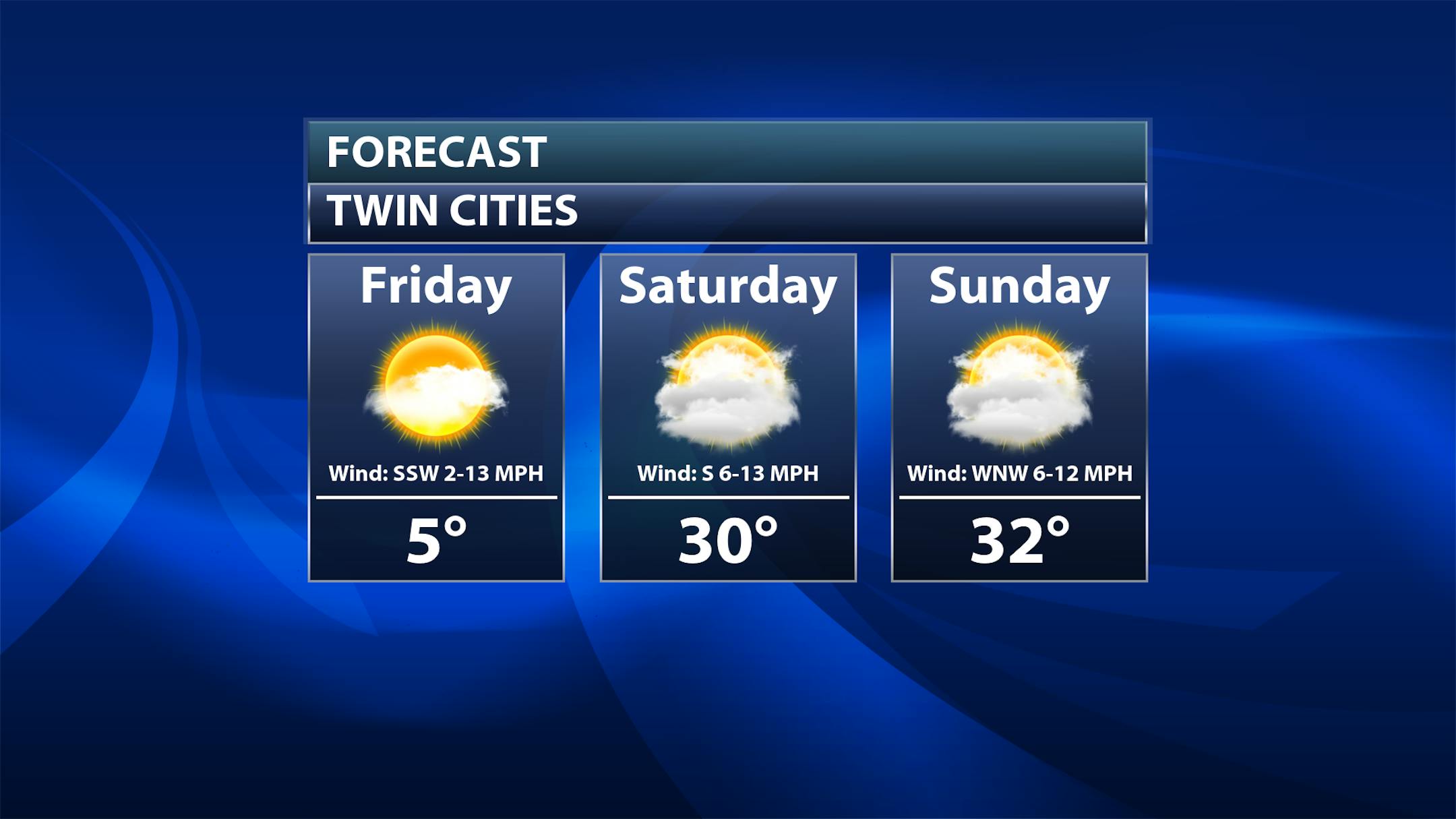
The good news is that this cold blast will be short-lived, and 30s will return for the first time since last Friday as we head into Saturday and Sunday. Unfortunately, the cloud cover returns with mostly cloudy skies expected both days - however, I'll take 30s and cloud cover over highs only in the single digits!
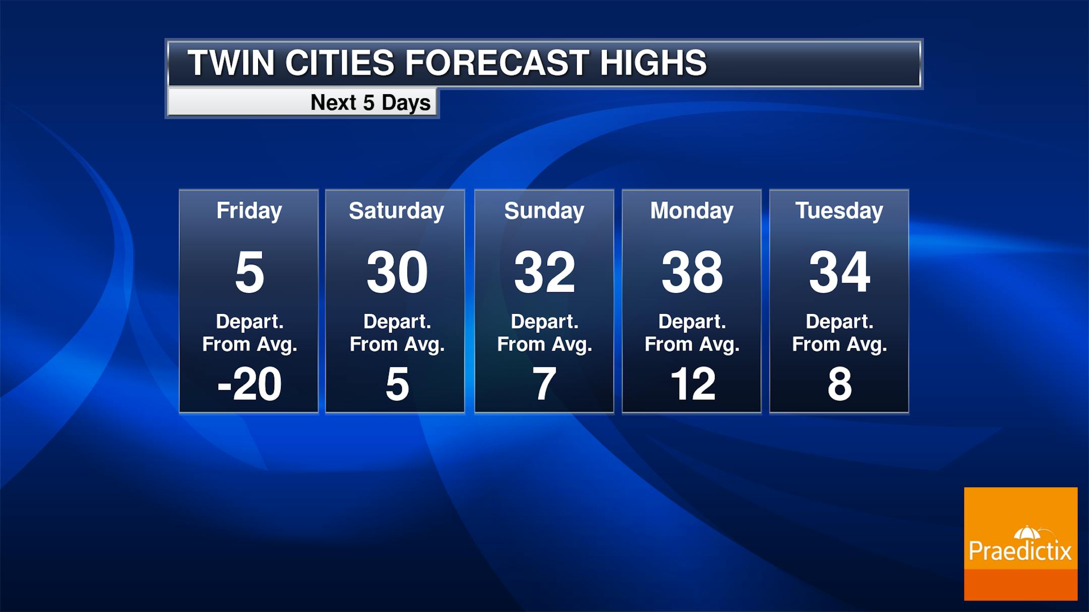
And the even better news? This warmer air LASTS into next week as well! Highs through at least the middle of next week look to remain in the 30s - and 5-15F degrees above average certainly feel better than 20F degrees below average! Models hint at the potential of a slight cool down late next week - and by slight, I mean the upper 20s for highs. What that does mean, though, is there are no additional Arctic blasts in sight over the next week and a half to two weeks once we get past Friday.
_______________________________________________
Arctic Breeze Gives Way To Weekend Thaw
By Paul Douglas


