

First Images from the James Webb Space Telescope
The dawn of a new era in astronomy has begun as the world gets its first look at the full capabilities of NASA's James Webb Space Telescope, a partnership with ESA (European Space Agency) and CSA (Canadian Space Agency). The telescope's first full-color images and spectroscopic data were released during a televised broadcast at 10:30 a.m. EDT (14:30 UTC) on Tuesday, July 12, 2022, from NASA's Goddard Space Flight Center in Greenbelt, Maryland. These listed targets below represent the first wave of full-color scientific images and spectra the observatory has gathered, and the official beginning of Webb's general science operations. They were selected by an international committee of representatives from NASA, ESA, CSA, and the Space Telescope Science Institute. These first images from the world's largest and most powerful space telescope demonstrate Webb at its full power, ready to begin its mission to unfold the infrared universe.
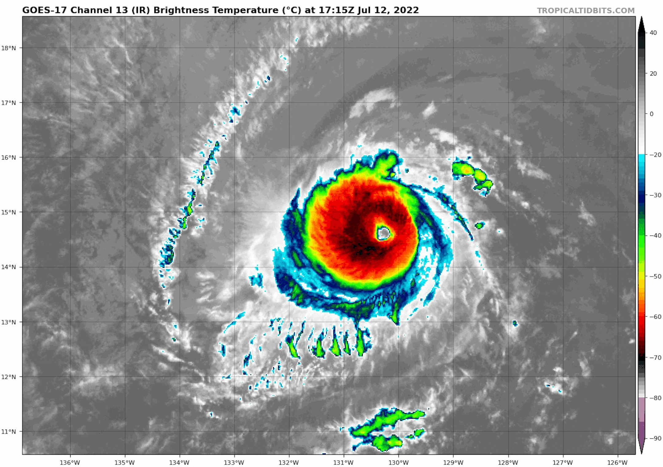
Hurricane Darby in the Eastern Pacific
Hurricane Darby continued as a Major Hurricane on Tuesday with 125mph sustained winds. This has been the first major hurricane of either of the Eastern Pacific or Atlantic basin of the 2022 season. Darby is tracking west and is expected to gradually weaken as it approaches Hawaii late weekend/early next week. Stay tuned.
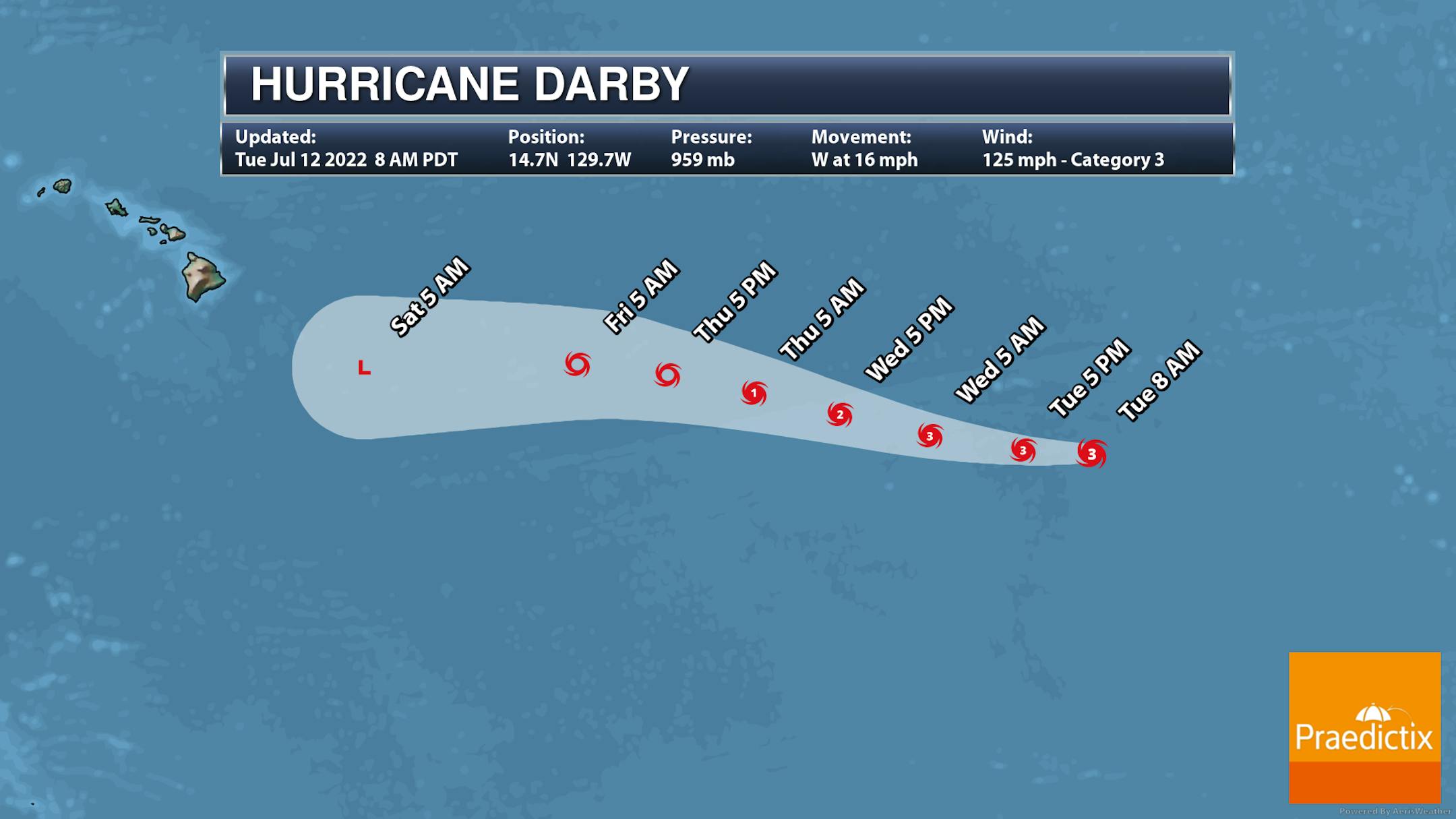
Tracking Darby
Here's the track for Hurricane Darby over the next several days. According to NOAA's NHC, Darby will gradually weaken through the week and upcoming weekend as it approaching the Hawaiian Islands. Stay tuned...
Simulated Radar For The Week Ahead
Here's the weather outlook from 7AM Wednesday to 7AM Monday. Things will be rather quiet on Wednesday, but a round of showers and storms will be possible late Thursday into AM Friday. Another round could develop PM Friday into Saturday with pockets of locally heavy rainfall.
Extended Precipitation Outlook
Here's the weather outlook through the rest of the week and into the weekend. Late week could feature thunderstorm activity with pockets of locally heavy rainfall possible in spots.
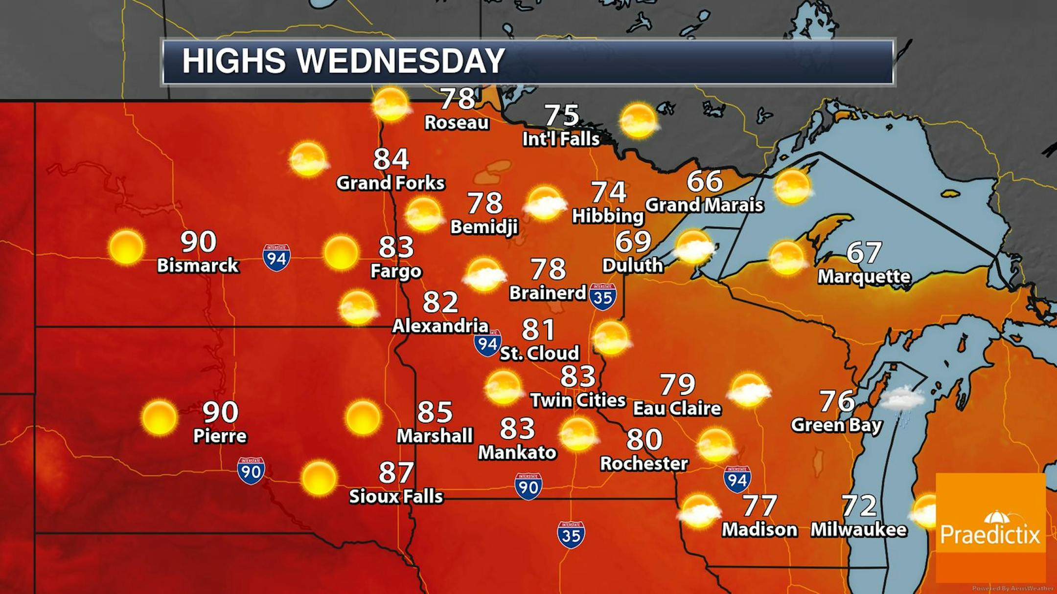
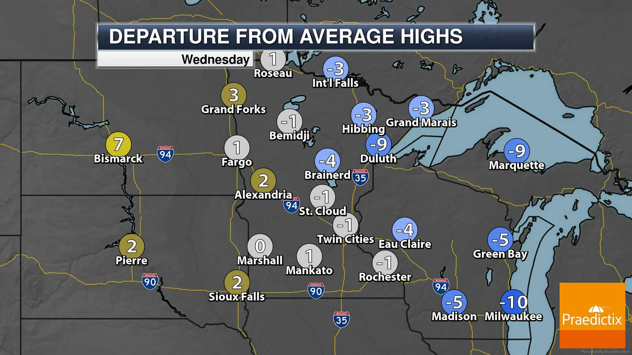
Weather Outlook on Wednesday
The weather outlook for Wednesday shows temps running close to average for Mid July with readings warming into the 70s and 80s statewide. It'll be a little cooler in the Arrowhead as a cooler wind blow off of Lake Superior. Highs will only warming into the 60s, which will be nearly -5F to -10F below average. Much of the region will be dry and sunny with few clouds.
Precipitation So Far This July
Here's how much rain has fallen across the region so far this July. Note that the Twin Cities has seen less than 0.50", which is one of the top 40 driest starts to any July on record. Duluth has seen nearly 1.50" and several locations across southern Minnesota have seen more than 1" of rain so far this month. Meanwhile, Huron, South Dakota has seen nearly 6.25" of rain already this month, which is the wettest start to any June on record.


