

Key Weather Messages Heading Into The Holiday Weekend
- Winds continue to ramp up Thursday Night into Friday with numerous gusts of 35-50 mph, causing whiteout conditions.
- Road closures were already happening in southern Minnesota as of Thursday evening.
- Blizzard Warnings in place across parts of central/southern Minnesota.
- Saturday and Sunday will be the better days for travel through Christmas, though Saturday will still be breezy.
- Cold weather sticks around through the holiday weekend. Wind chills of -40F or below possible in western Minnesota, and around -30F in the metro.
_______________________________________________
Snow Totals From Wednesday
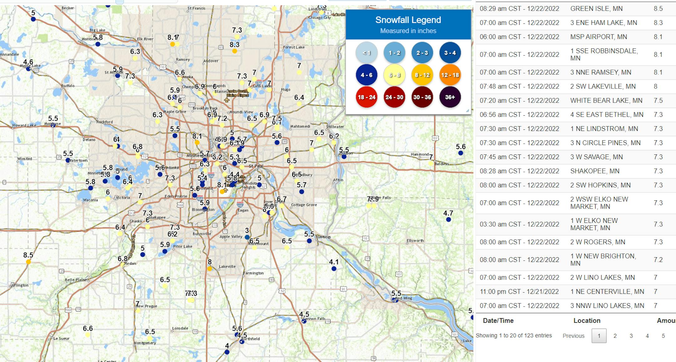
Snow totals up to 8.5" were reported from Wednesday's snowfall in the metro area, with that top total occurring in Green Isle. We also saw a total of 8.3" in Ham Lake, 8.1" at MSP and in Robbinsdale and Ramsey, and 8" in Lakeville. At MSP Airport, 7.4" of that fell on Wednesday (the rest technically fell on Thursday), which set a new record for Wednesday. The previous record for December 21st was 5.3" in 1920.
_______________________________________________
Roads Already Closing As Of Thursday Evening
As of posting time, no travel advisories were in place across a good portion of south-central and southwestern Minnesota, and MNDOT was closing parts of I-90 and Highway 60.
_______________________________________________
Strong Winds Continue Friday, Bringing Whiteout Conditions
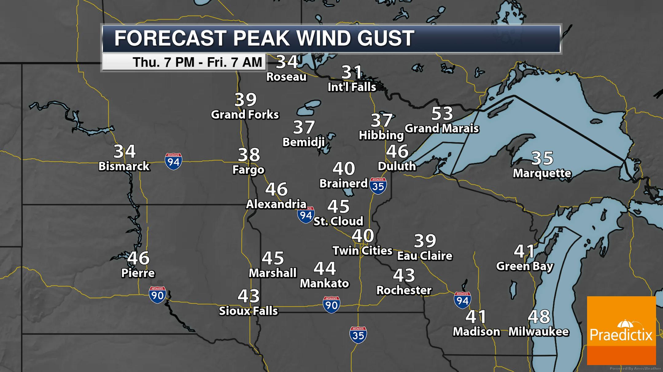
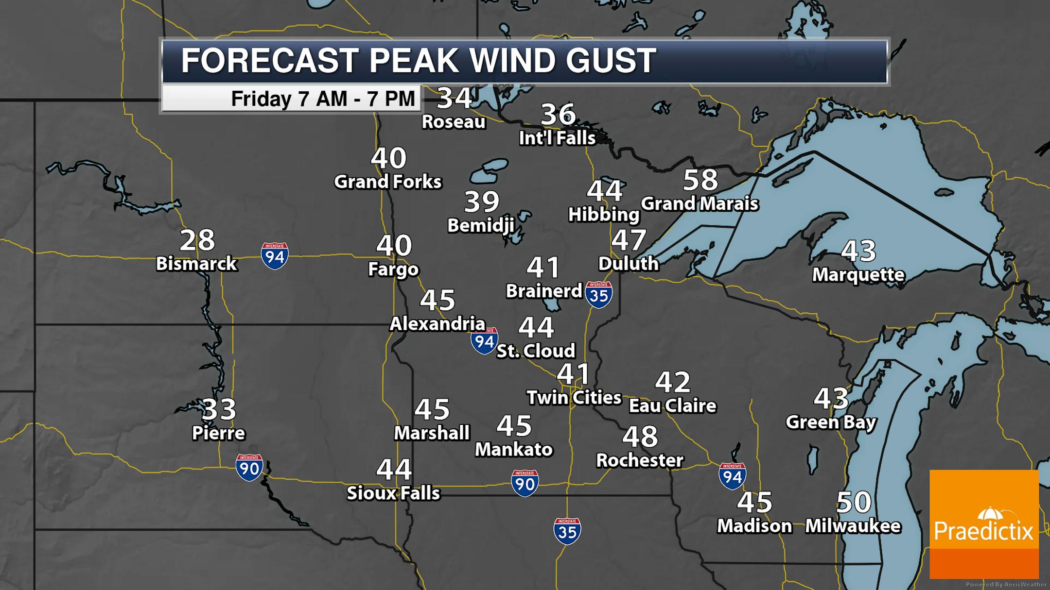
While we have pushed the snow out of the region (for the most part), phase two is underway: the whiteout/blizzard portion of this storm. Wind gusts of at least 40 mph can be expected across a good portion of the state Thursday Night into Friday, with some areas of the North Shore and southern Minnesota seeing wind gusts approaching 50 mph. Travel will be hazardous as we head through the next day or so across the region due to ground blizzards.
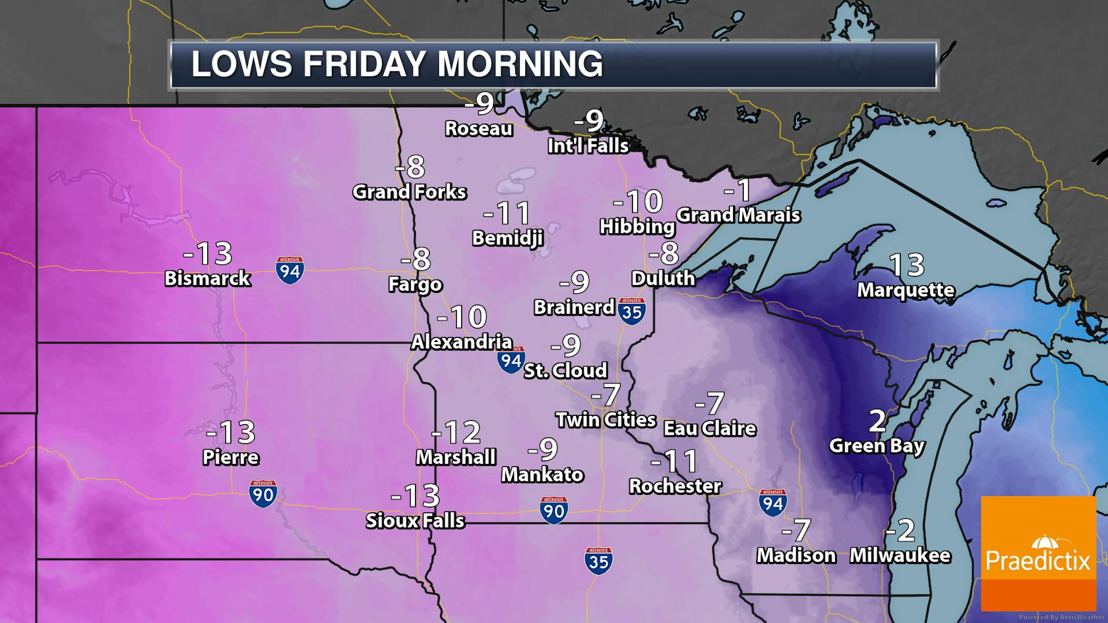
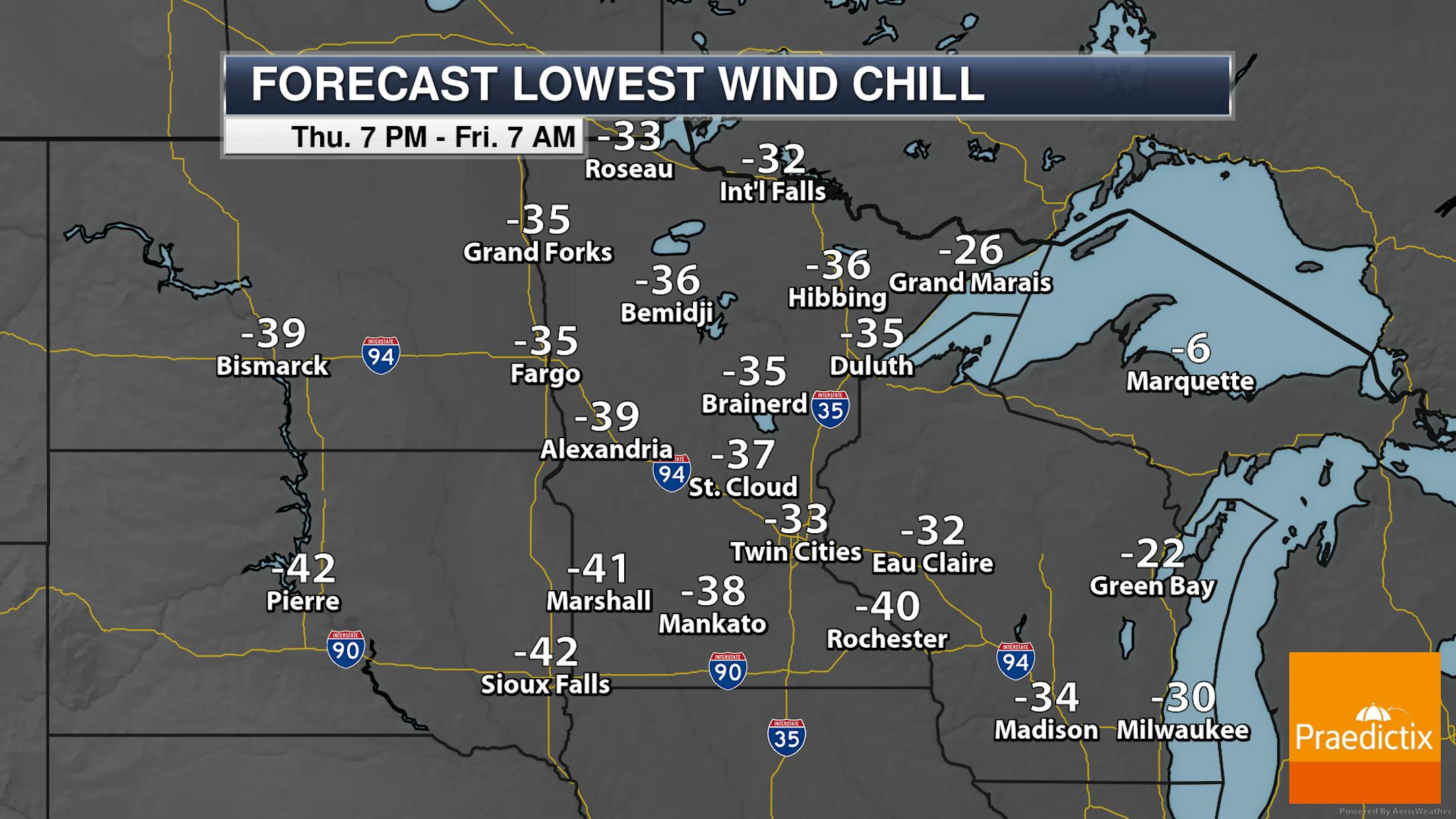
While it'll be in the single digits and teens below zero as we wake up Friday morning across the state, it'll feel more like the -30s and -40s out there with the expected strong winds.
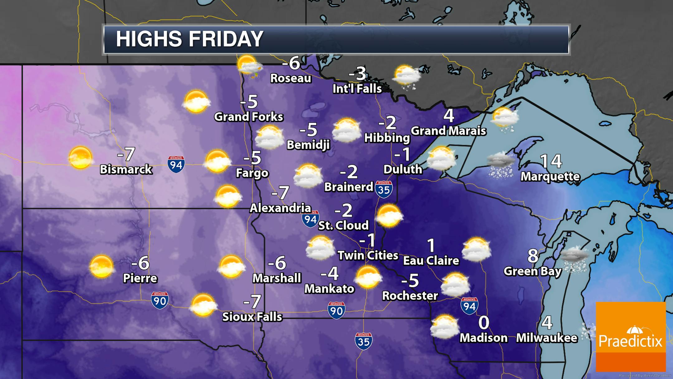
If you want above zero weather, you'll have to head up to Grand Marais and portions of the North Shore - though there you will get into some snowfall and the potential of 50-60 mph wind gusts. The rest of the state, under a mix of sun and clouds, will stay below zero for highs on Friday.


