

How Warm Did It Get Sunday?
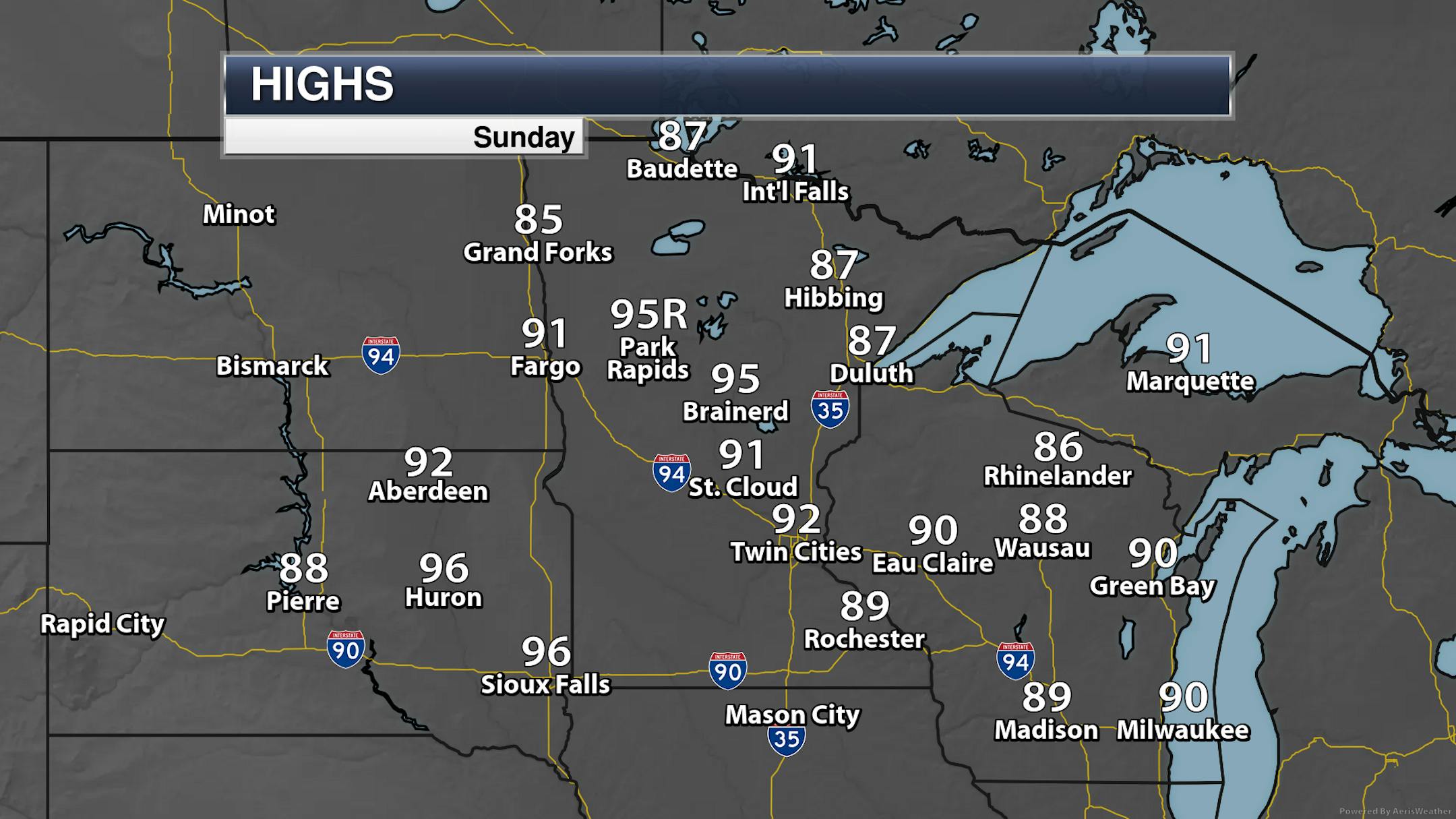
MSP airport made it to 92F on Sunday, marking the fourth consecutive day with a 90F+ high in the Twin Cities. The only record high set in the state was in Park Rapids.
Just remember, it could be the opposite:
_______________________________________________
Heat Continues Into The Work Week
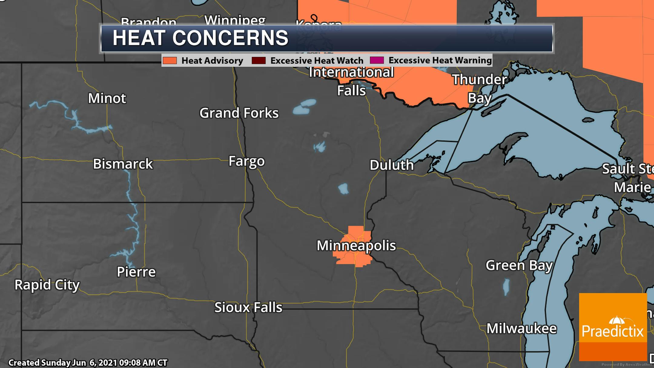
The Heat Advisory that was in place through Sunday evening has now been extended through 8 PM Thursday. This is due to the hot temperatures that will continue to be in the 90s for highs and lows in the mid-70s. These hot temperatures, with no real relief occurring at night, could cause heat illnesses.
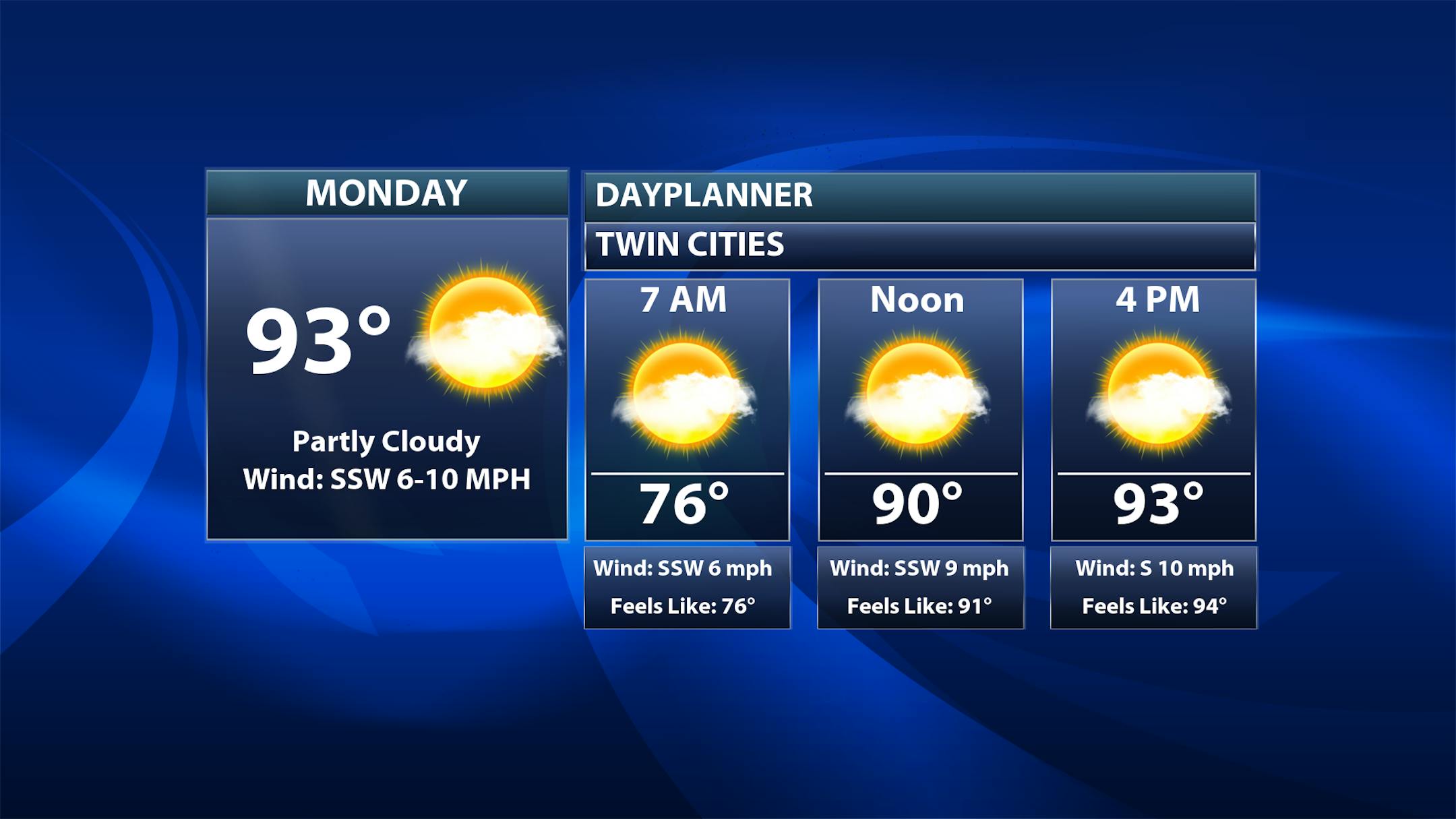

Not too much to say here as another hot day of weather is ahead on Monday in the Twin Cities under mainly sunny skies. Morning temperatures start off in the mid-70s with highs topping off in the low 90s.
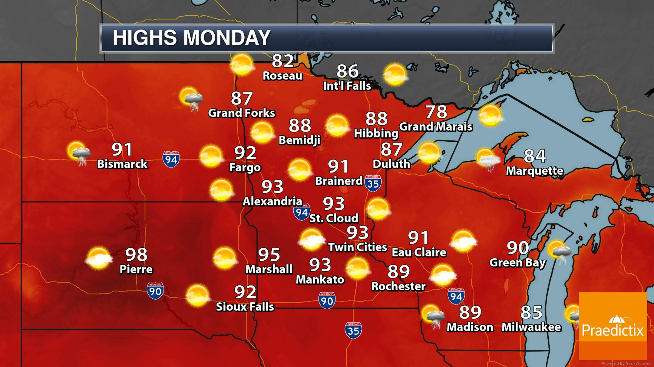
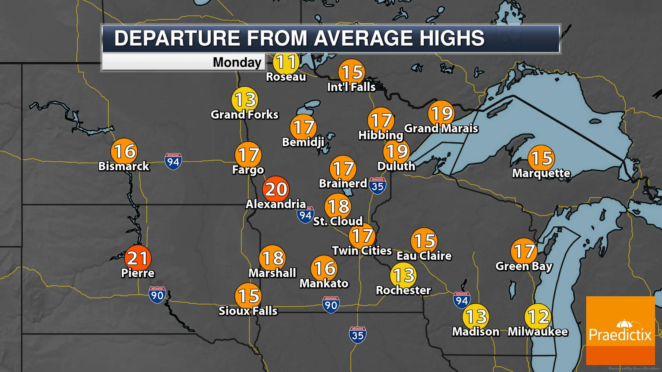
Looking statewide, another hot data is expected for most locations as highs climb into the 80s and 90s. The coolest temperatures will be near Lake Superior, where areas like Grand Marias will stay in the 70s. These highs will be 10F-20F degrees above average. A few storms could pop across northern Minnesota during the late afternoon or evening hours, otherwise, mainly sunny skies are expected.
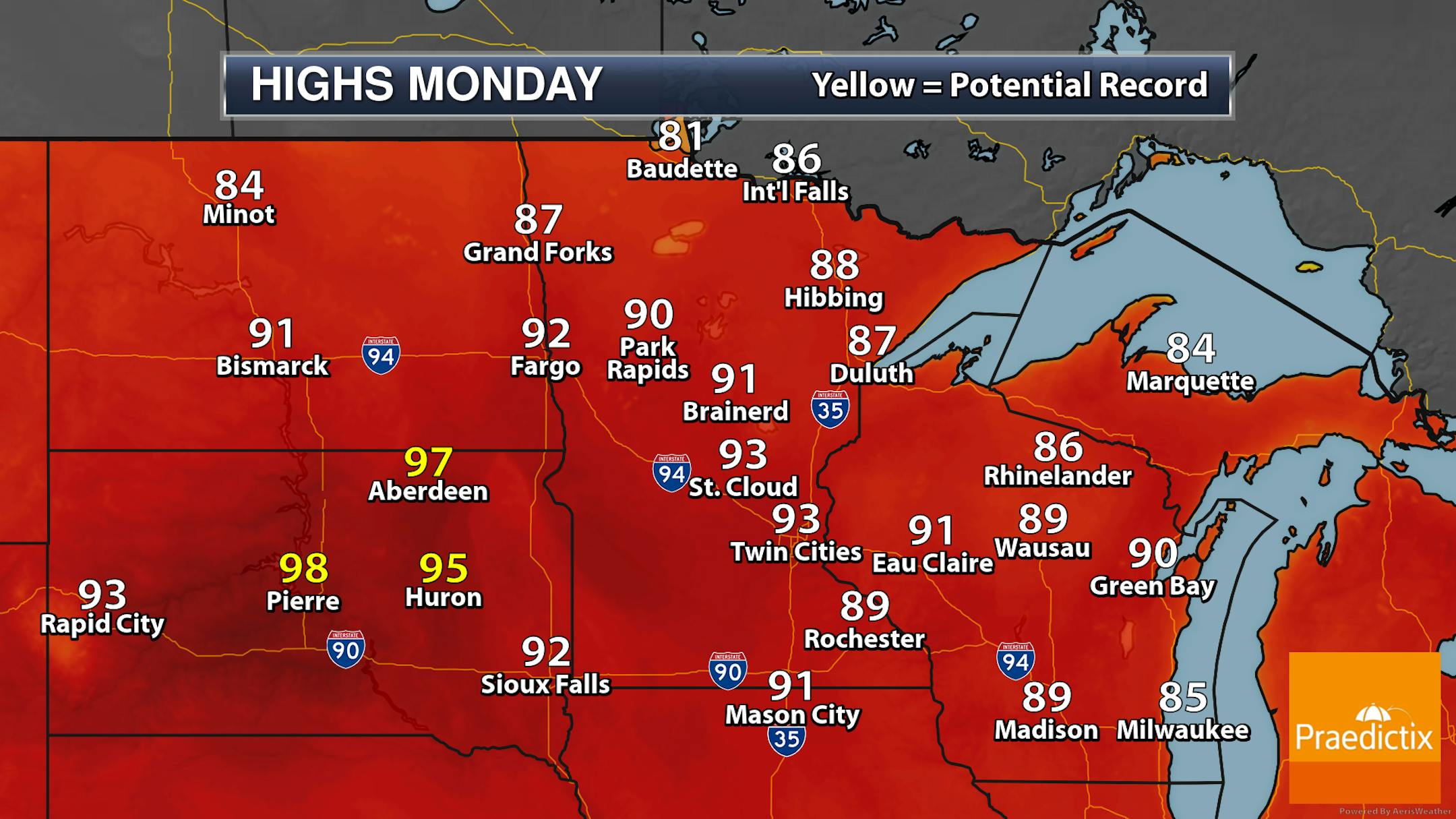
Highs at climate locations across the state Monday are expected to remain below the records for the day. Several locations out in South Dakota, however, could see record highs to begin the work week.
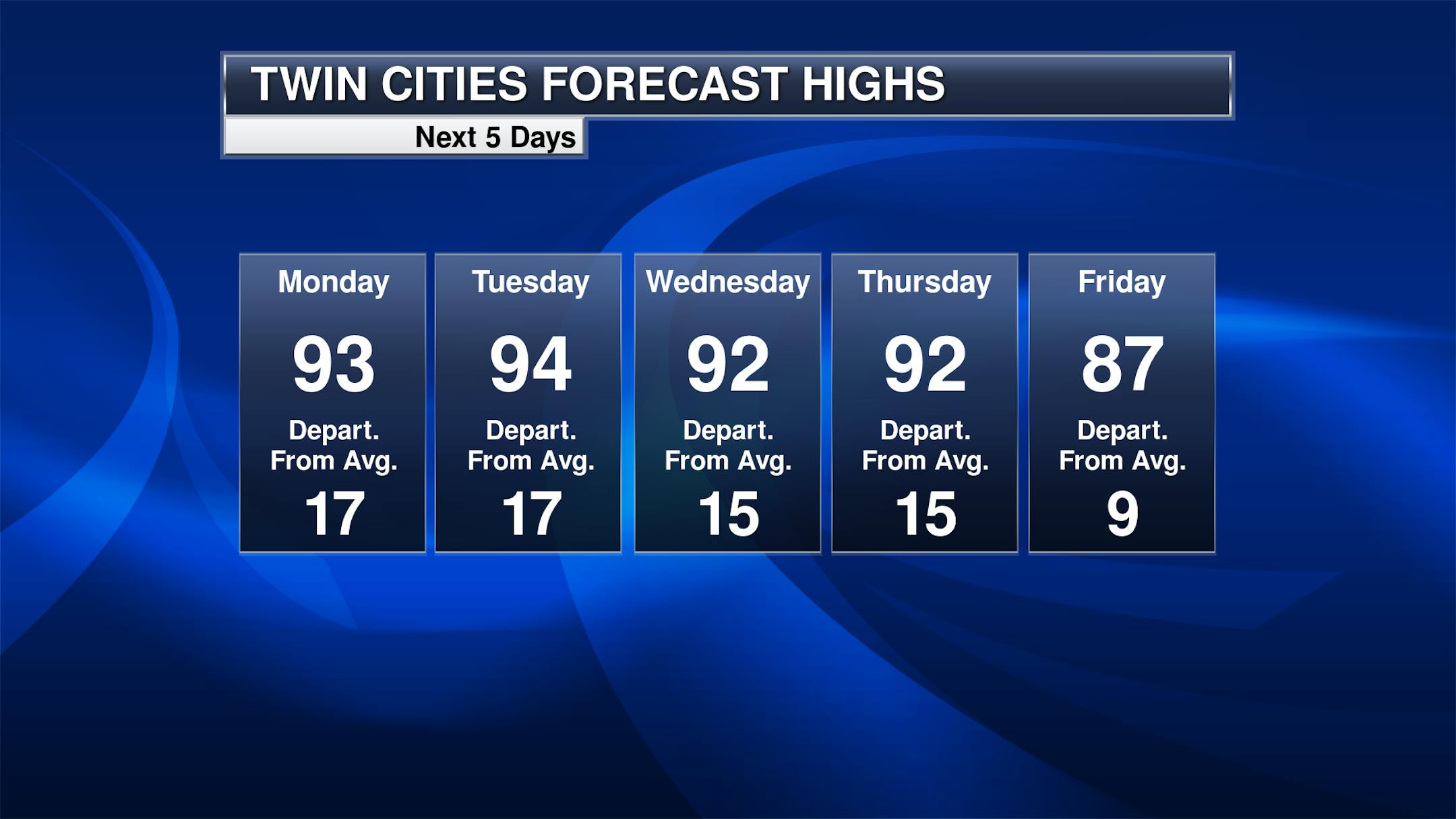
The heat wave continues over the next several days with highs in the 90s expected through at least Thursday in the Twin Cities. While the above graphic shows highs in the 80s on Friday, I do think there's still a chance we could hit 90F before a cold front moves through. There will be a chance of isolated afternoon storms Tuesday and Wednesday, but a better chance of rain moves in late Thursday into Friday as that cold front moves in.


