
Listen and subscribe to our podcast: Apple Podcasts | Spotify
At the river’s edge in the North Loop, rusting ruins from Minneapolis’ earliest days lie near the bank.
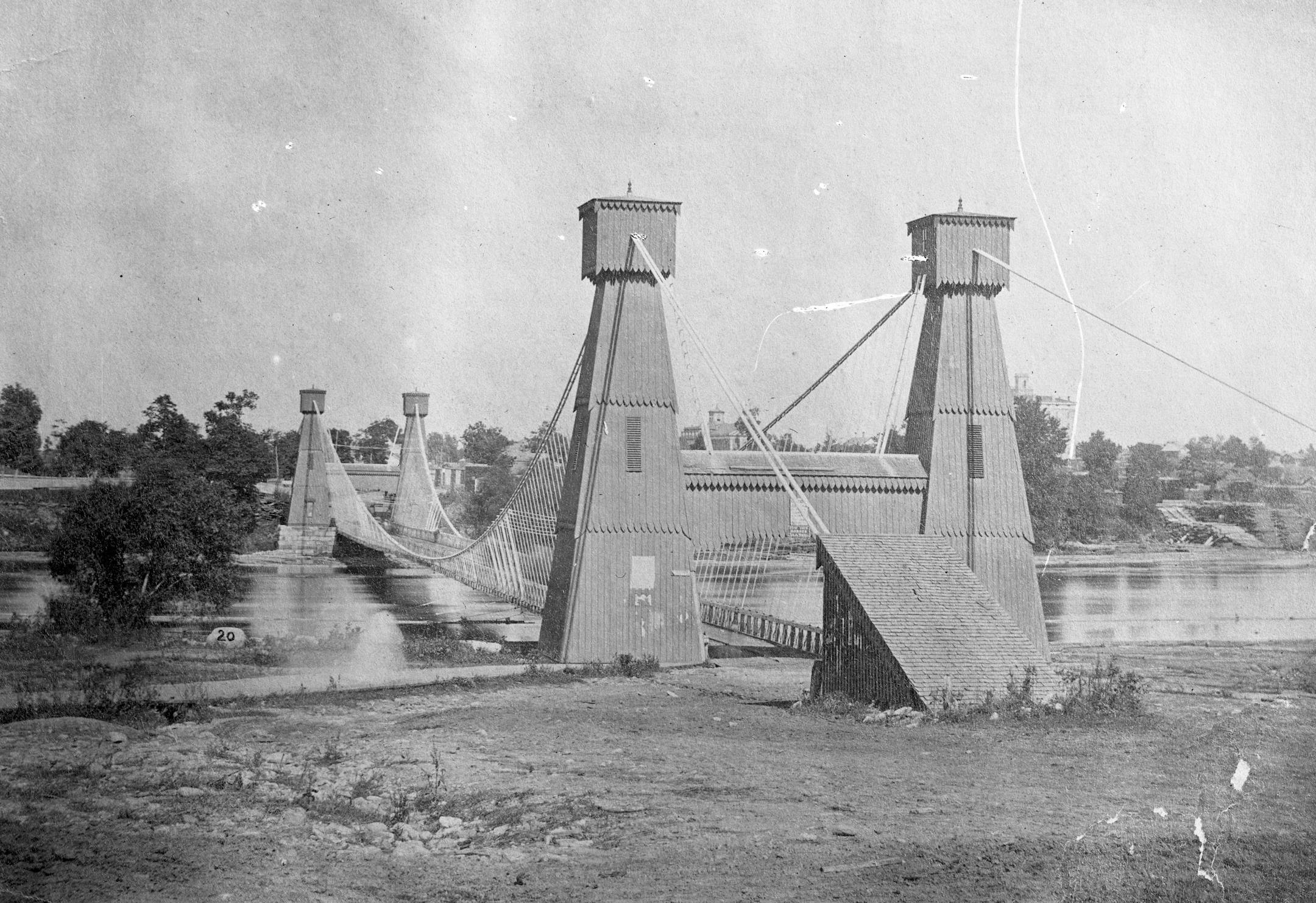
They are remnants of the city’s 1855 suspension bridge — the first permanent span across the Mississippi River anywhere along its length.
Today, the area is part of First Bridge Park. The Hennepin Avenue Bridge, which now looms above the park and stretches toward the neon Grain Belt Beer sign, was actually the fourth version to be built at this site.
A reader asked Curious Minnesota, the Strib’s reporting project fueled by great questions, for details about that first bridge. She also wondered: How did Minneapolis residents get across the river before it was built?
The point in the river above St. Anthony Falls where the bridge was constructed had long been a crossing place for Native Americans. And as Minneapolis grew, crossing in the winter was relatively simple — if sometimes dangerous. People walked a path across the ice, according to newspaper accounts from the time.
During warmer months, they used a rope ferry — a floating platform connected by pulleys to a rope that spanned the river — that was built in 1847.

The bridge was constructed above the rope ferry’s path. It was so important to the growing communities on each side of the river that the Minnesotian newspaper called its completion “an epoch.”


