
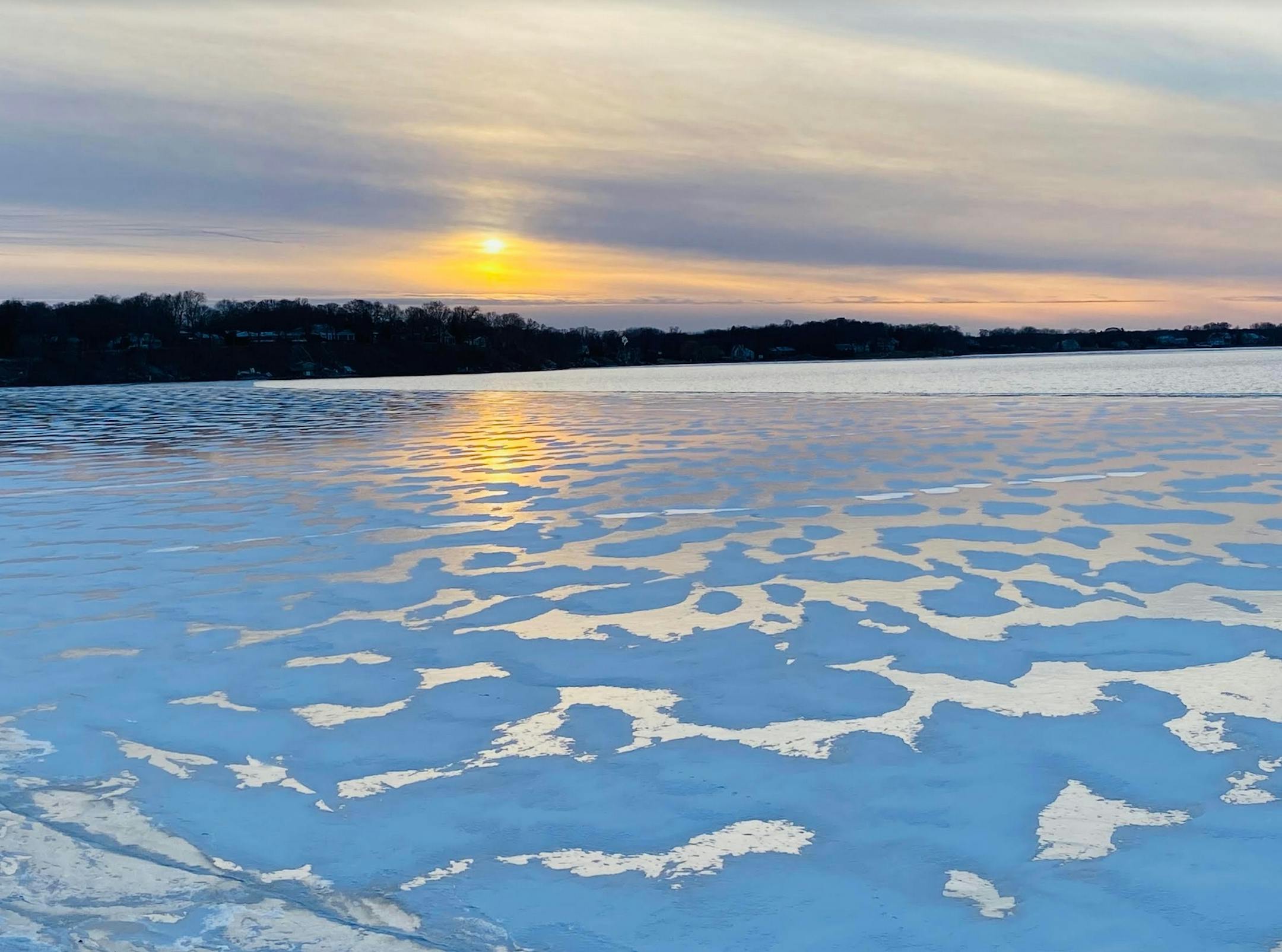
Smaller Snow Events Loom Larger Now
"Paul, back in my day we called an inch or two of snow FLURRIES!" I've seen variations of that theme over the years and I can't disagree. The paradox: as winters shrink, Decembers warm, snowfall becomes more erratic and brown Christmases proliferate, an ordinary, garden variety looms larger. Suddenly "nuisance storms" lead the news; headline-worthy events.
Although a mild signal will linger much of December, odds favor more numerous snowfall events and colder cold fronts in January, historically Minnesota's nippiest month of the year.
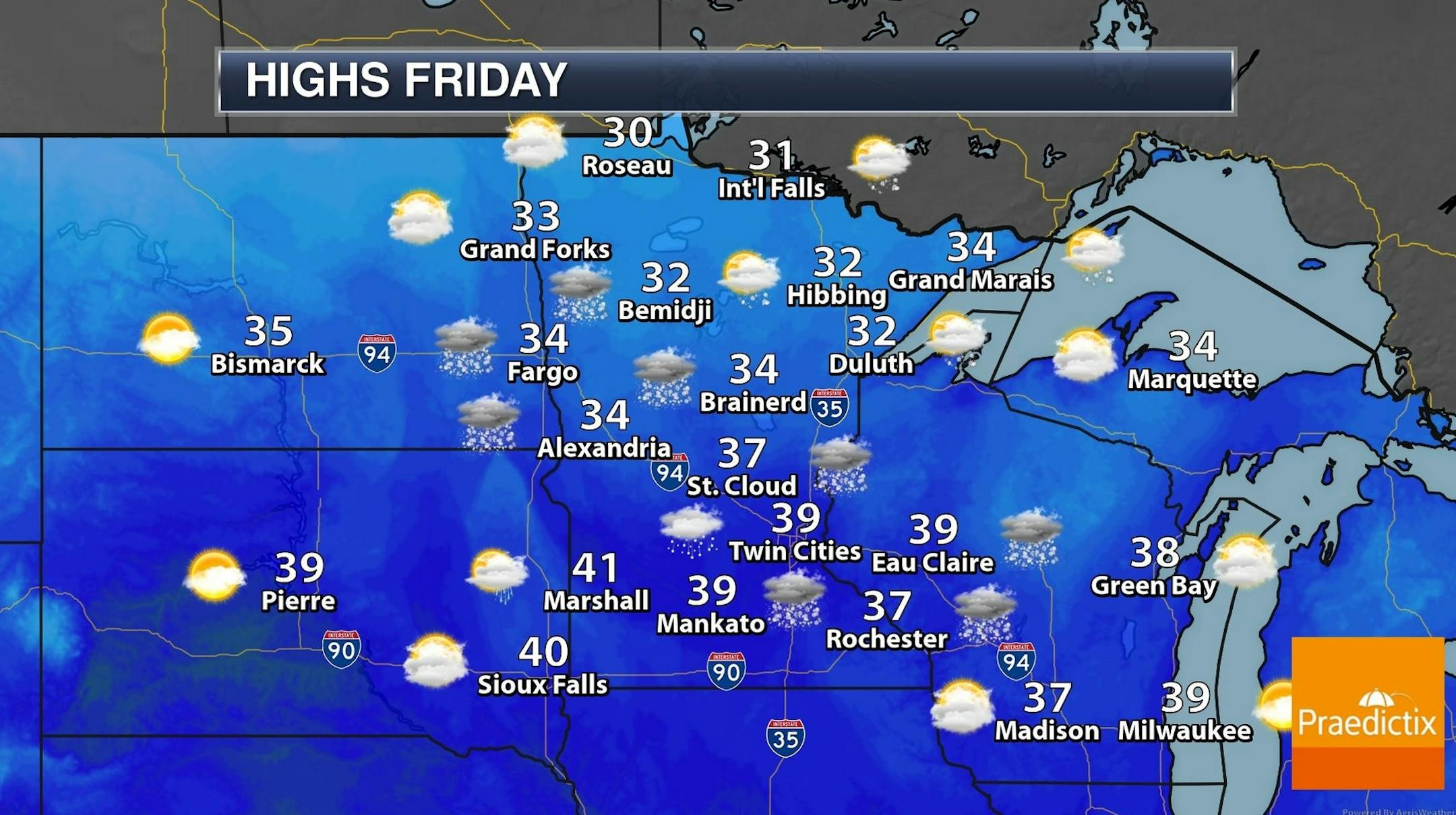
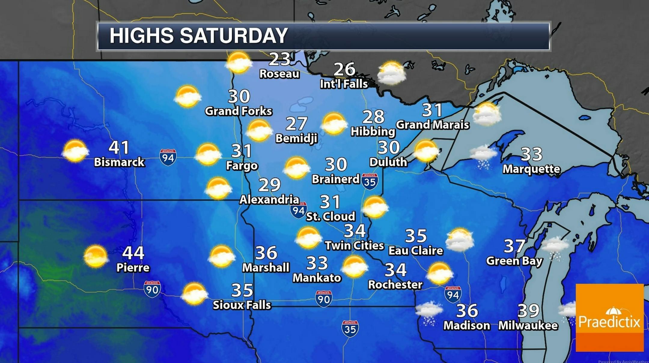
A pre-Christmas thaw is imminent, in fact daytime highs rise above 32F from Wednesday into December 23. Fast-moving clippers (starved for southern moisture) drop a brief coating of slush Friday night, Sunday night - again Christmas Eve. But an old fashioned December 25 with knee-deep snow? Not going to happen.
NOAA's GFS model hints at much colder weather as we approach January 1, which sounds right. Consider this: in 10 days daylight starts to increase again.
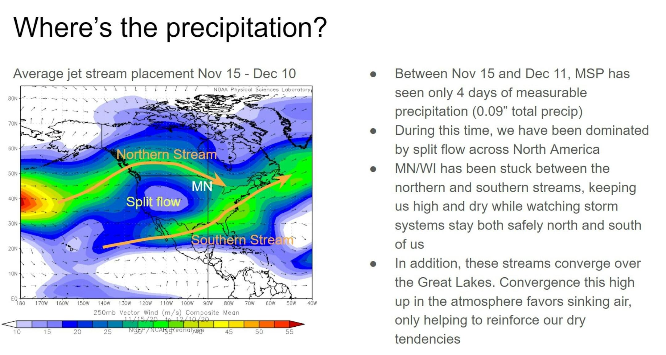
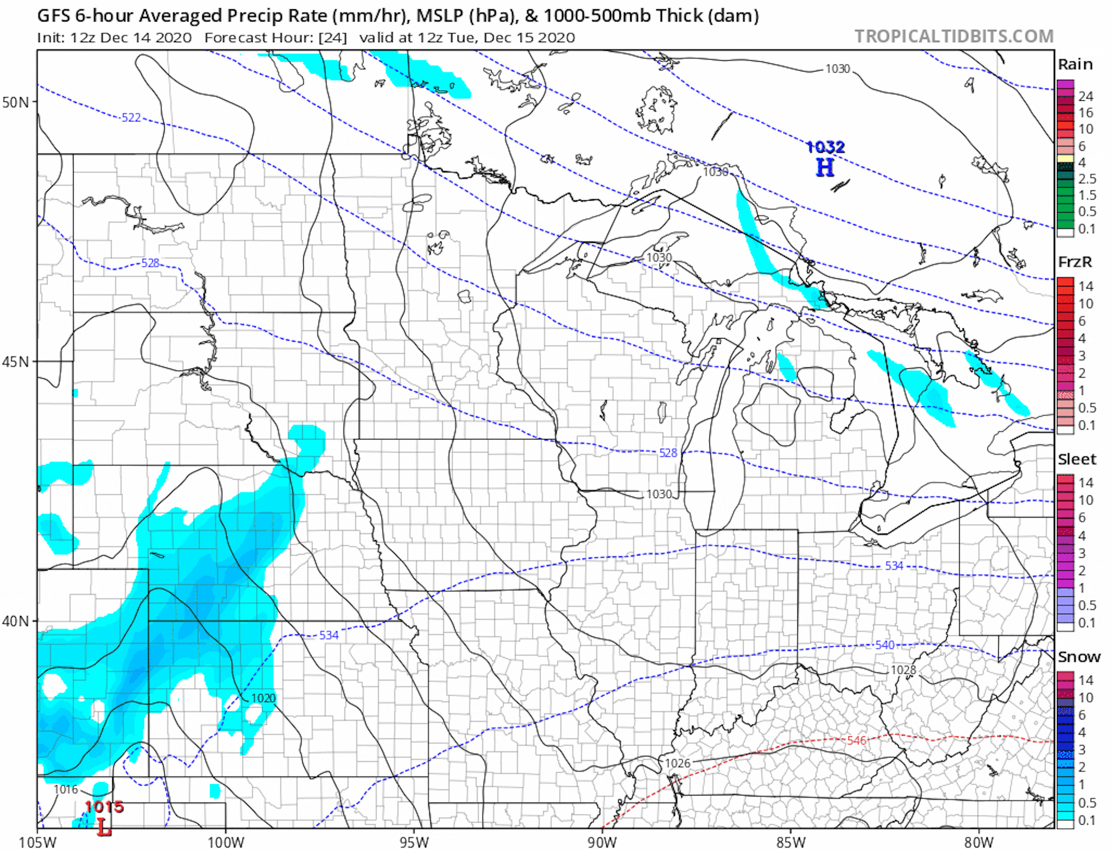
Southern Detour to the Storm Track. The 12 NOAA GFS model run sweeps the most significant moisture well south of Minnesota, a trend we've witnessed in recent weeks. I see no major deviation from this (dry, relatively mild) pattern until possibly the last few days of December.
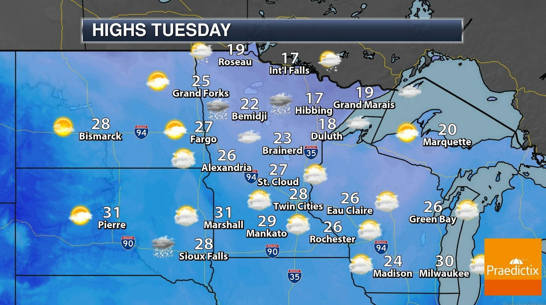
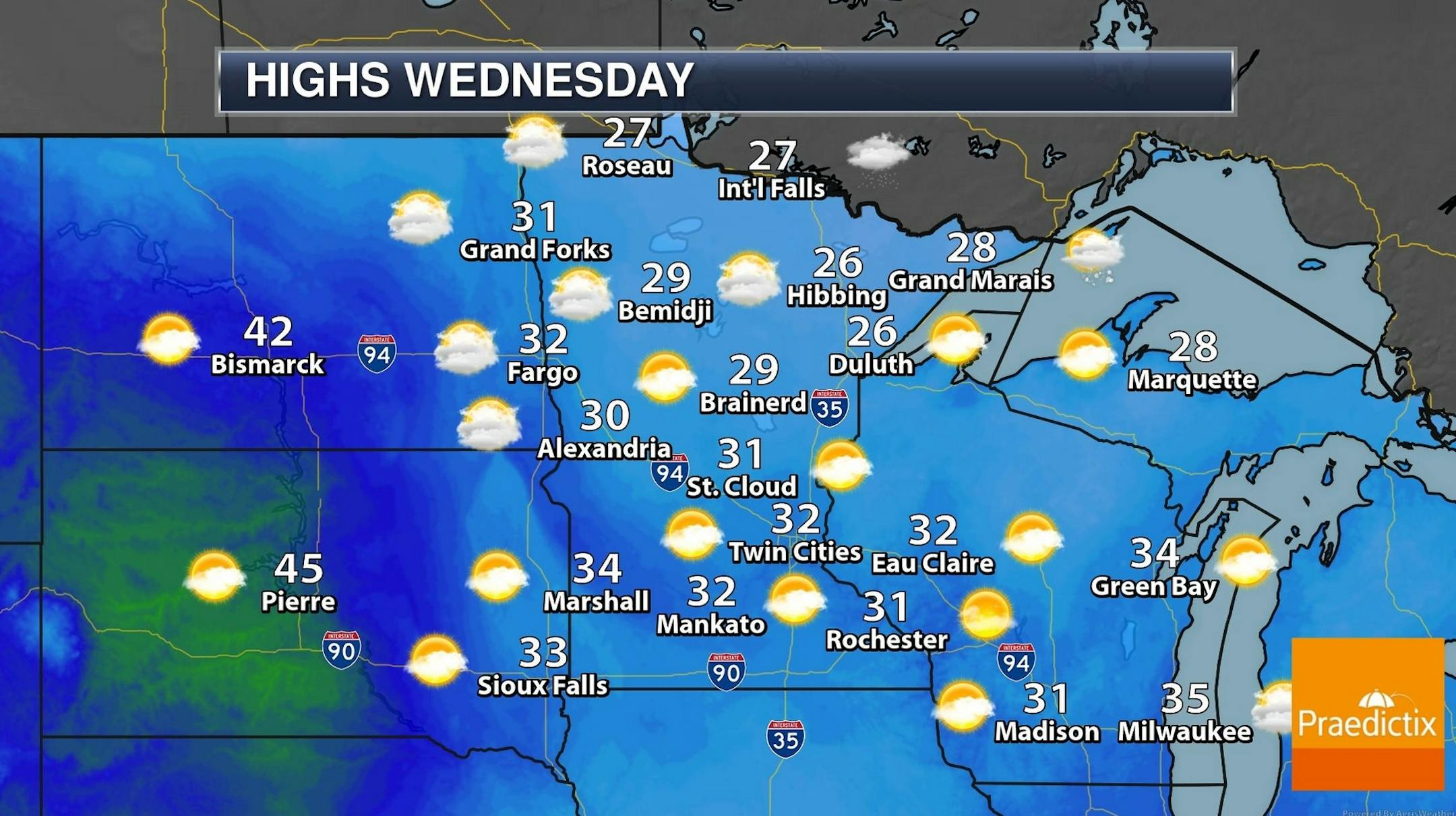
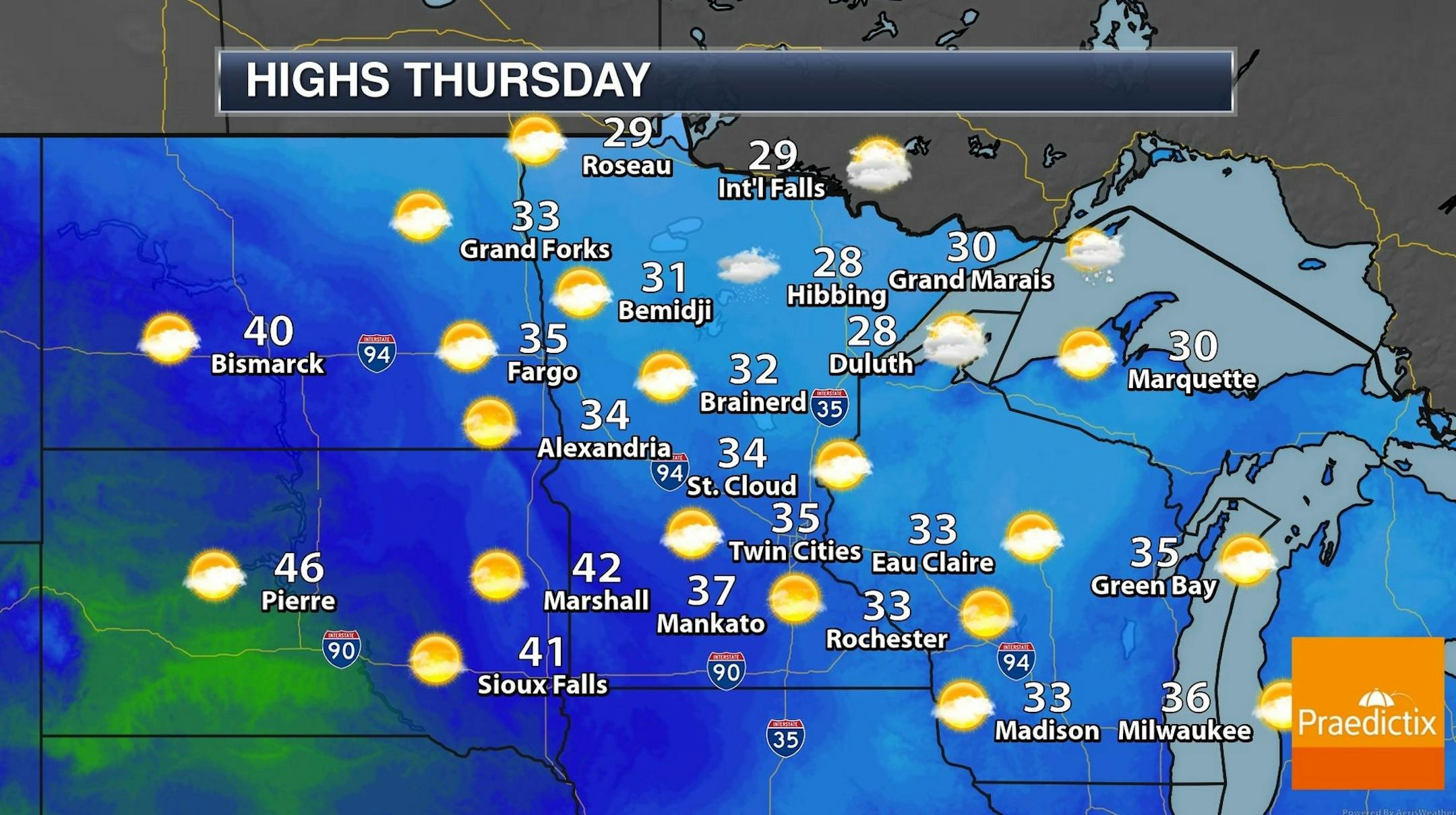
A Pre-Christmas Thaw. NOAA's NDFD numbers keep daytime highs above freezing from Wednesday into early next week, so that crystalline coating on your lawn will probably be gone by Thursday afternoon, and lawns may be green-ish on December 25.
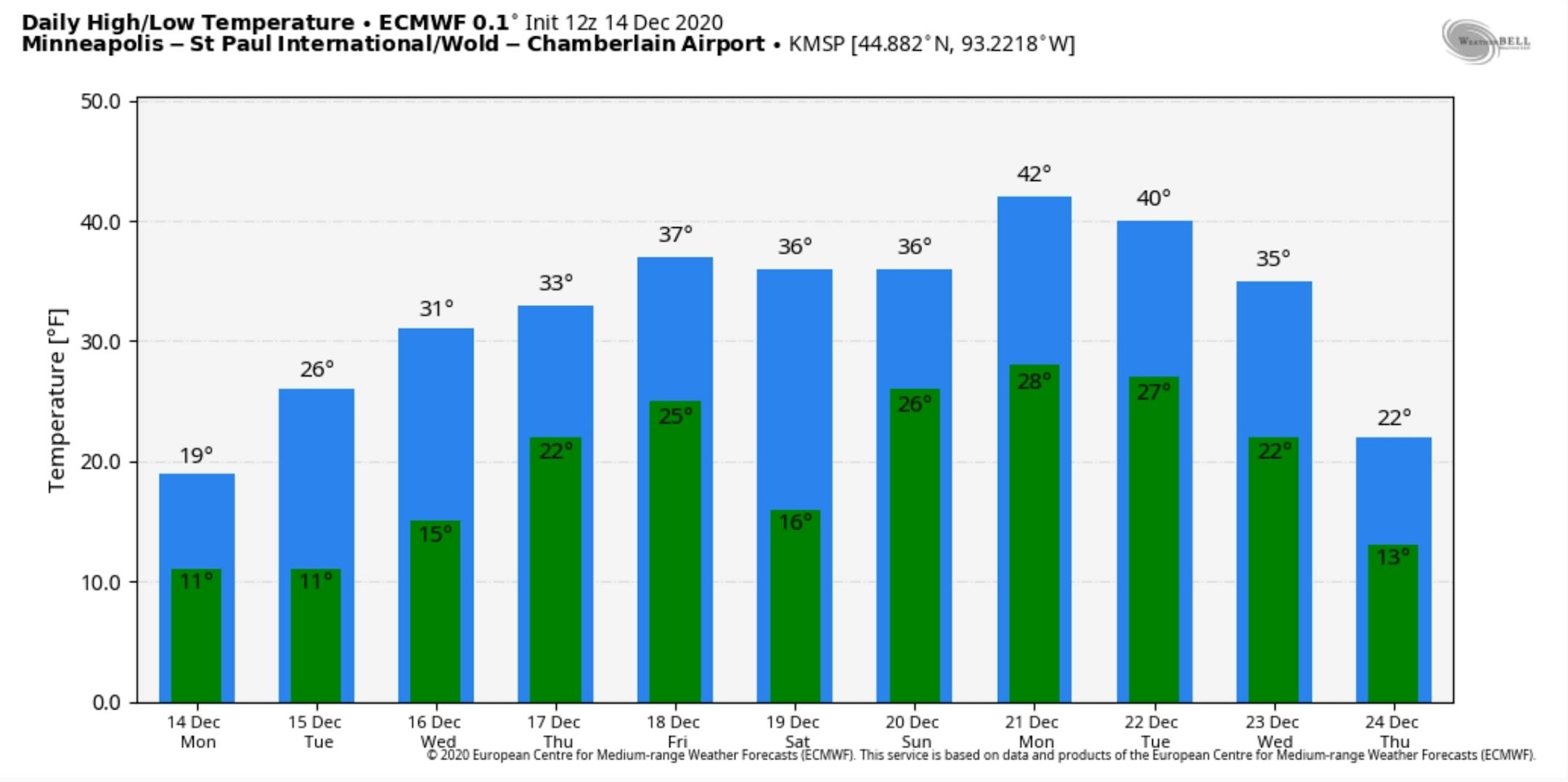
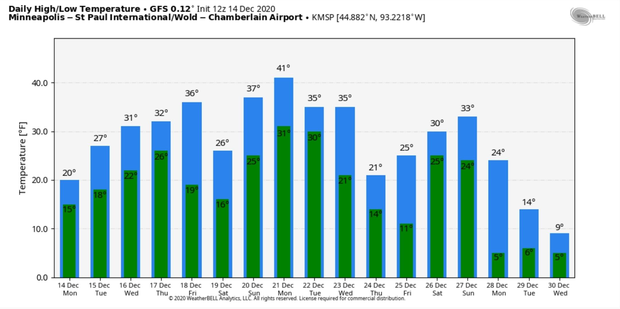
Colder Signal Last Few Days of December? ECMWF (above) shows a couple of days above 40F early next week before cooling off. GFS (below) is more aggressive with a late December cool-down. A white New Year's Day anyone?


