Soggy Monday Ahead
Here's the simulated radar from Monday into Tuesday, which shows widespread showers and storms across the region. Some of the storms could be strong to severe with locally heavy rainfall.

Rainfall Potential
Here's the rainfall outlook, which shows widespread 0.50" to 1.00" tallies across the region. There could be locally heavier rainfall amounts in some of the stronger storms.

Severe Threat Monday
Some of the storms could be strong to severe PM Monday with gusty winds and hail being the primary threat along and east of the Mississippi River Valley.

Monday Weather Outlook
Monday will be an unsettled day with scattered showers and storms across the region for much of the day. Gusty south winds will switch to the NW through the day allowing temps to fall late into the afternoon.

Meteograms for Minneapolis
Scattered showers and storms will push through the region on Monday as a cold front sweeps through. The cold front will also be responsible for falling temps through the day with highs nearly 20F cooler than they were yesterday.


Weather Outlook For Monday
Highs on Monday will be closer to average on Monday, but they will be falling through the day. Interestingly, they will be nearly 20F cooler than they were on Sunday.


Extended Temperature Outlook For Minneapolis
Behind the cool front, temps will be running slightly below average on Tuesday and Wednesday with highs only warming into the mid 60s. The rest of the week should remain dry, but temps will be closer to average.

7 Day Weather Outlook

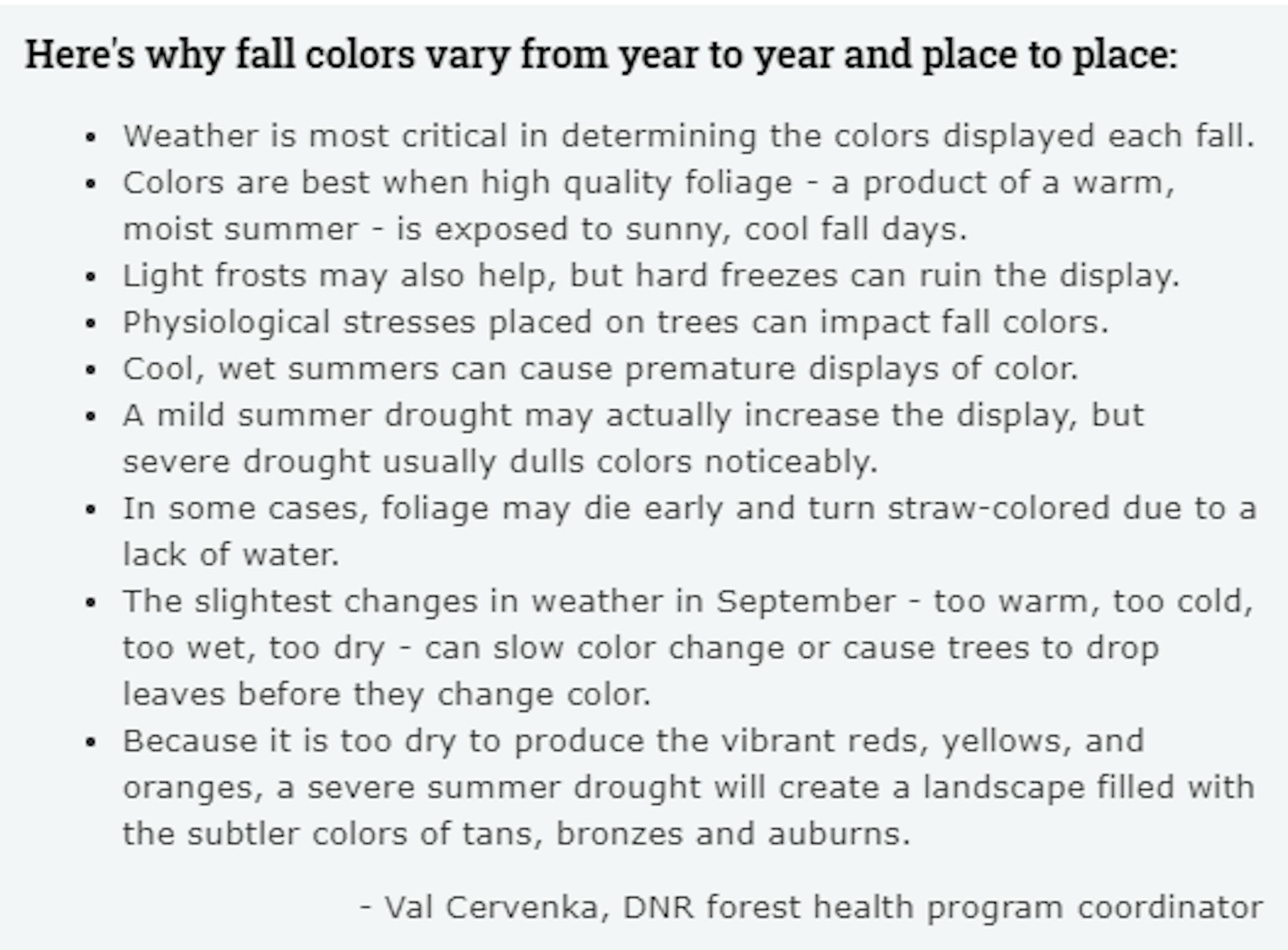
Fall Color Tracker
According to the MN DNR, much of the state is already experiencing minor changes in the fall color. Keep in mind that much of the summer was hot and dry, so some of the trees are a bit stressed and could be prematurely changing. With that being said, we are getting closer to that time of the year. See the latest update from the MN DNR HERE: