

Windy Weather For Sunday
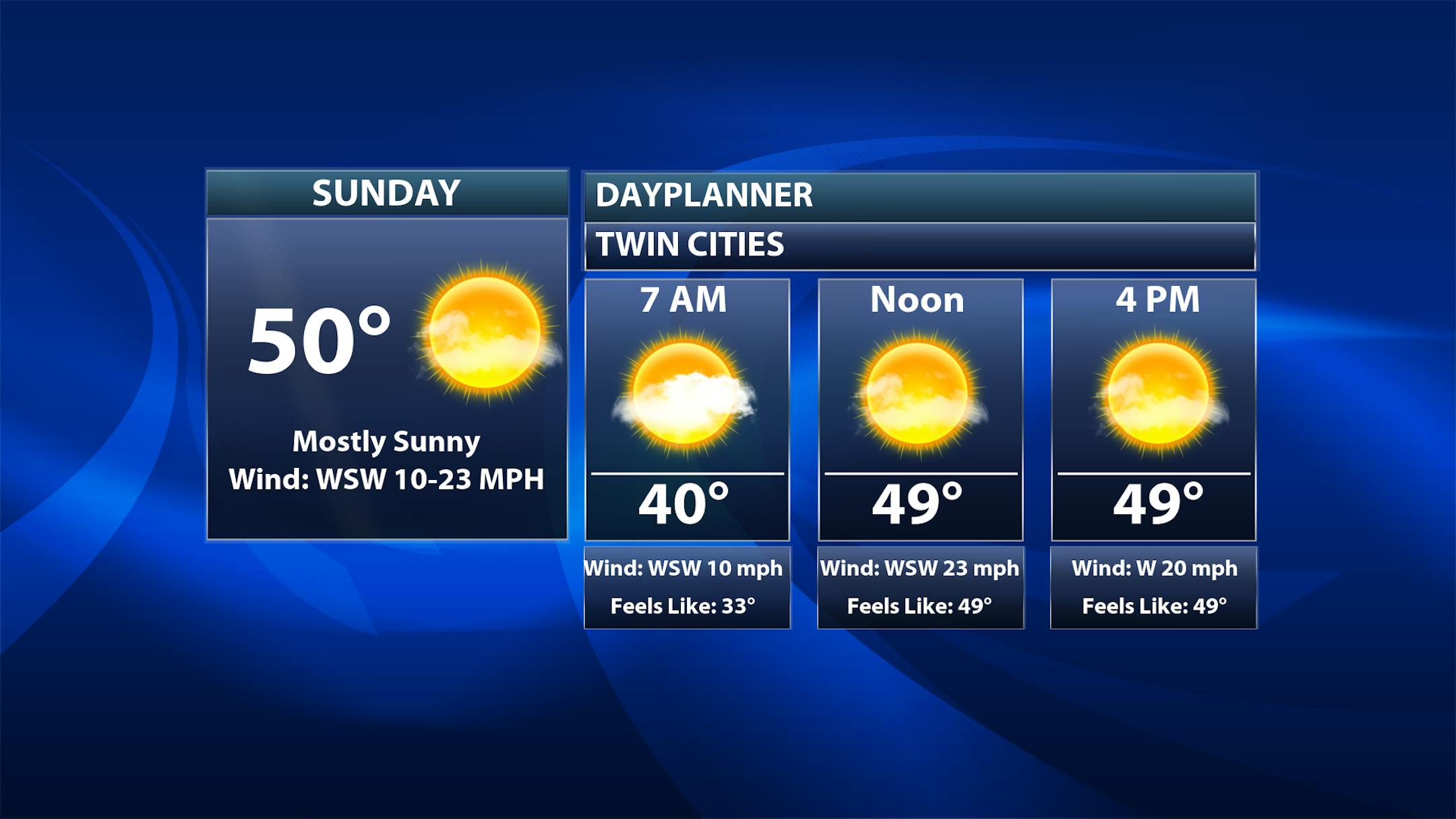
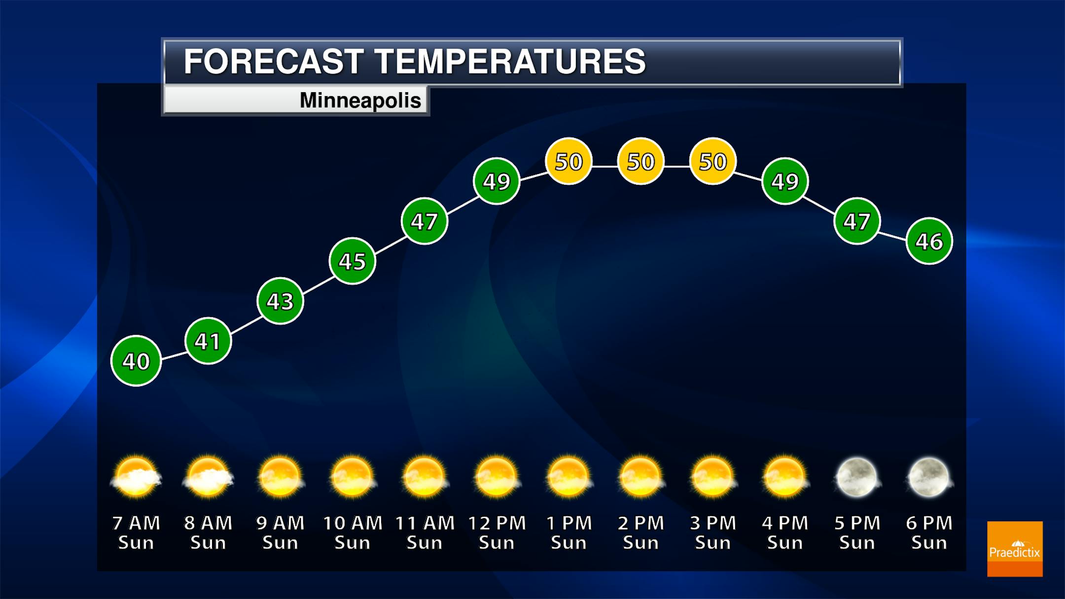
While an isolated shower could be possible in the metro early Sunday morning (mainly before 8 AM) due to a batch of precipitation moving through Saturday Night, most of the day will be dry with sunny skies. Morning temperatures will be around 40F with highs climbing to the low 50s.
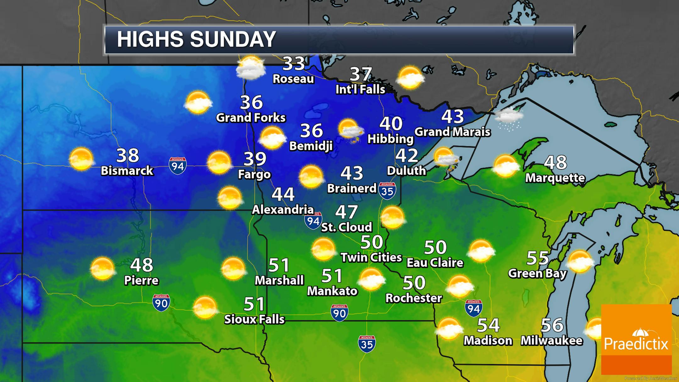
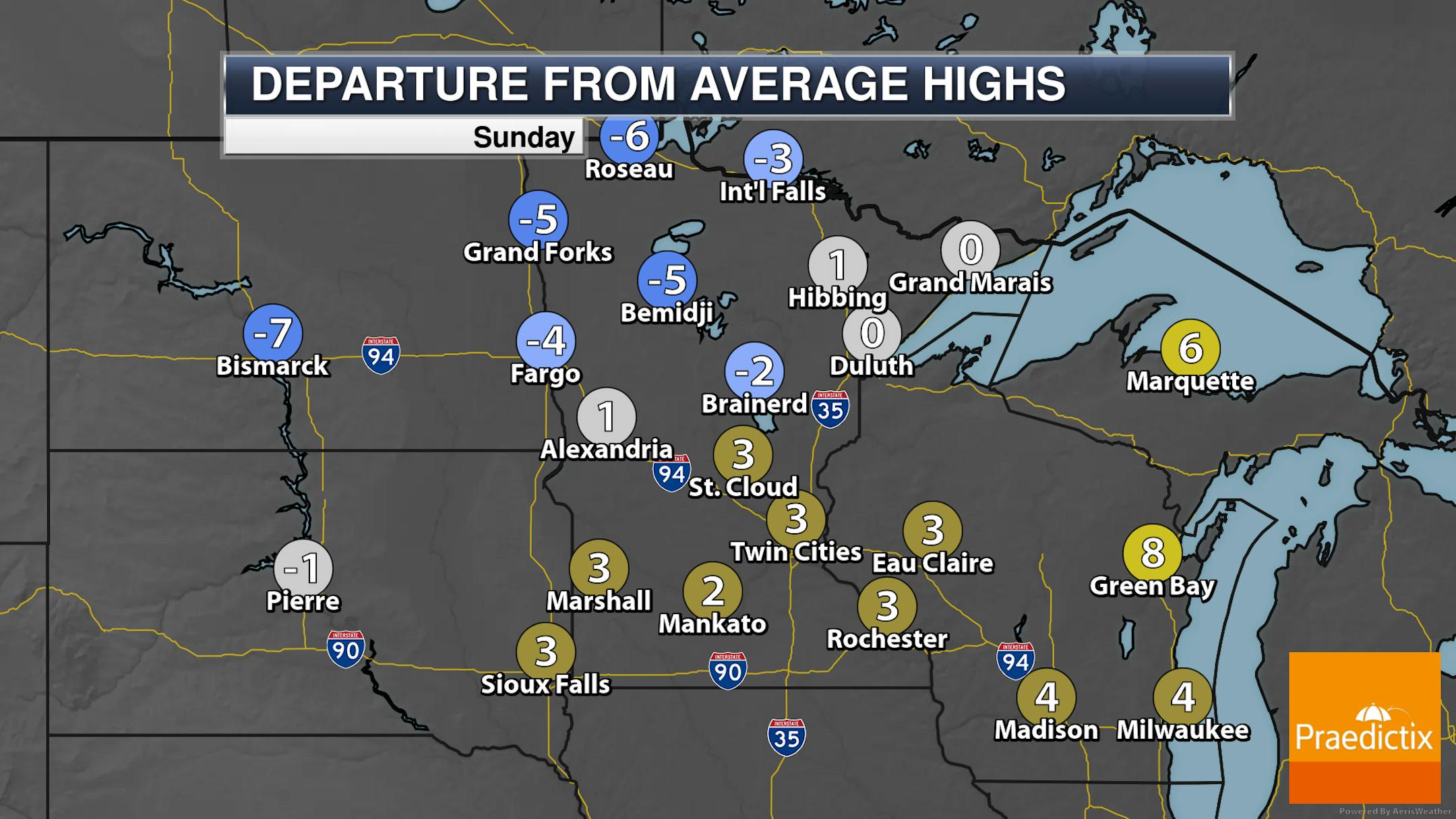
The best chances of rain/snow during the morning hours as a system departs will be across far eastern Minnesota and into the Arrowhead. Highs will range from the 30s up in far northern Minnesota to the 50s in southern Minnesota.
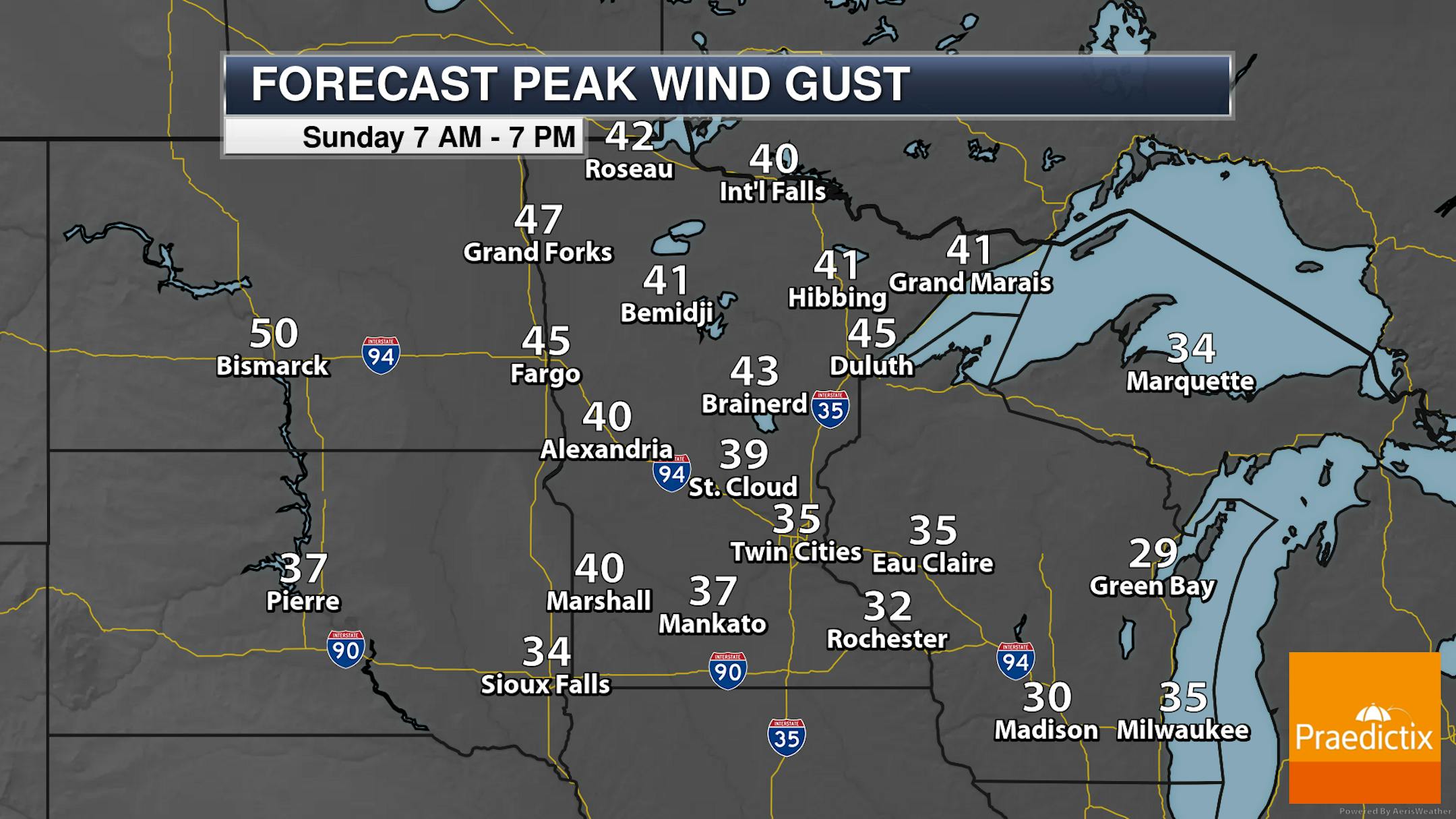
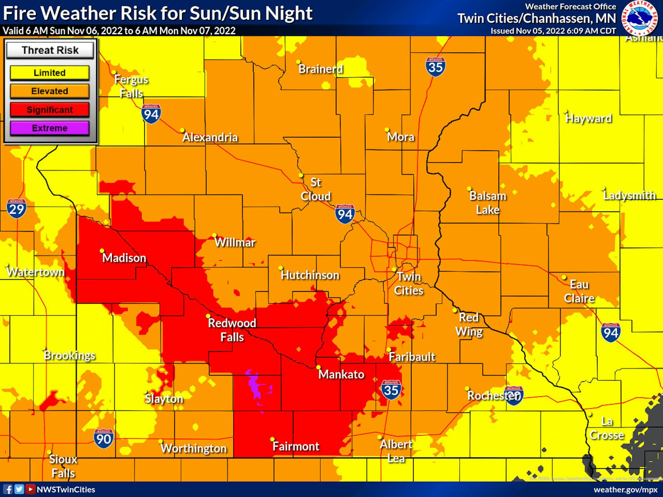
With strong westerly winds gusting over 35 mph across much of the state Sunday, we will be watching at least an elevated fire danger. The strongest winds and lowest expected humidity values will be along the Minnesota River Valley, where there will be critical fire weather conditions. These strong winds could also impact hunters up in the deer stands and definitely make it feel a bit cooler out than it actually is.

The strongest winds in the metro are expected to be from the midday hours into the afternoon.
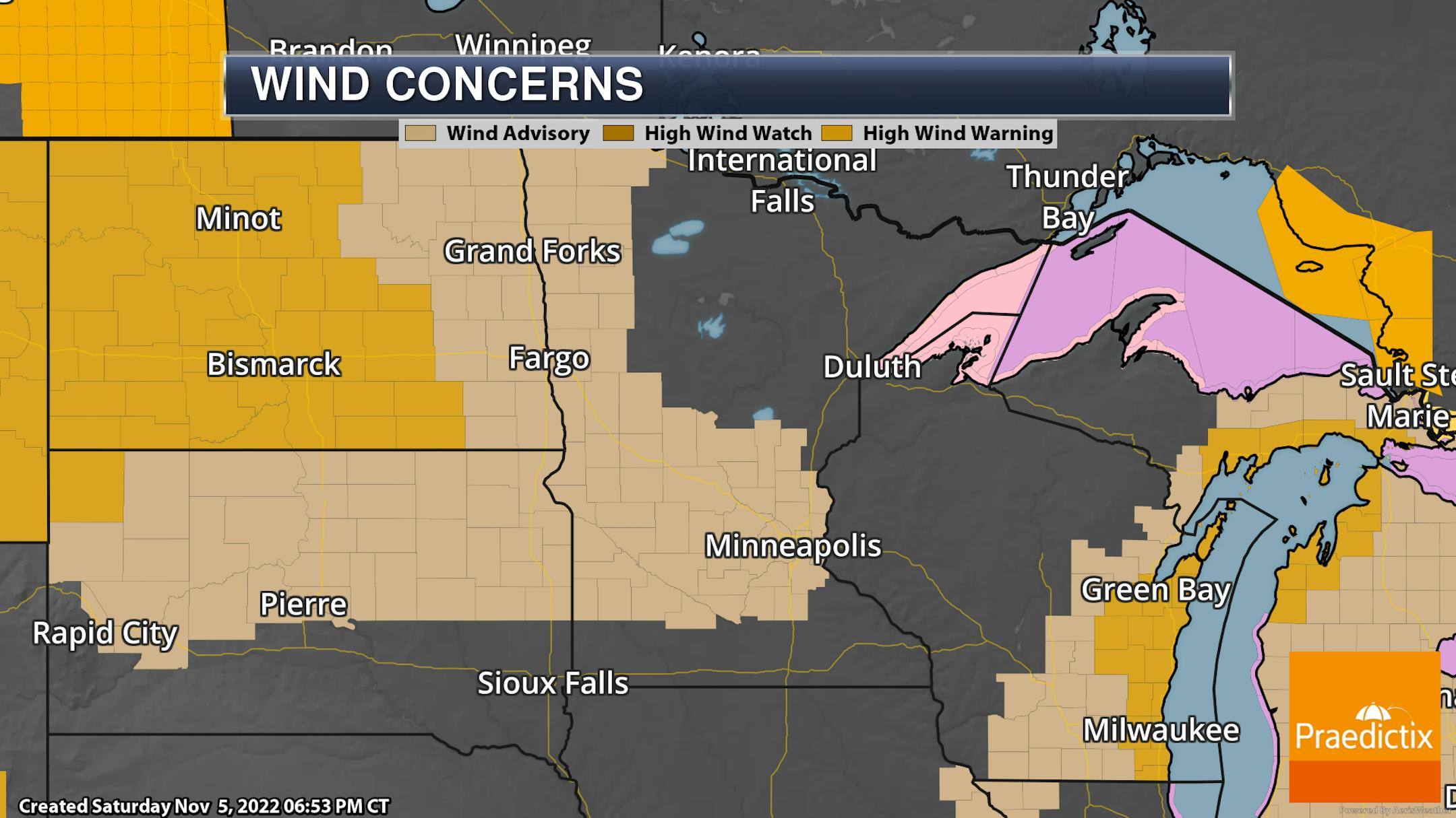
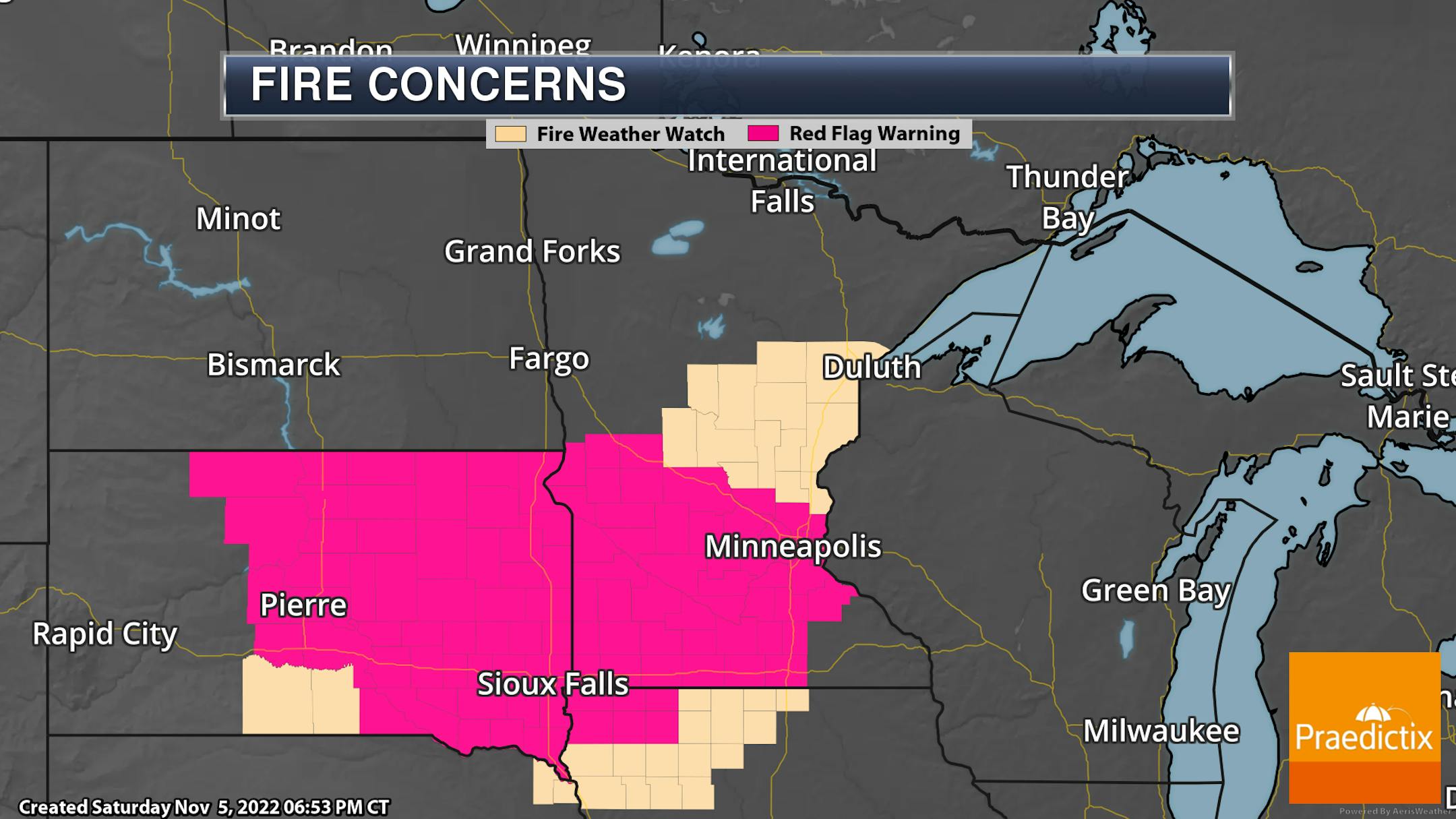
Due to the expected strong winds and fire weather concerns, Wind Advisories and Red Flag Warnings/Fire Weather Watches are in place. In the Metro, the Wind Advisory is in place Sunday from 10 AM to 6 PM for up to 45 mph westerly wind gusts. The Red Flag Warning is in place from Noon to 6 PM due to those strong winds and low humidity values, which would allow any fires that develop to rapidly spread.
_______________________________________________
Mid-Week Rain Chances Along With Warmer Weather
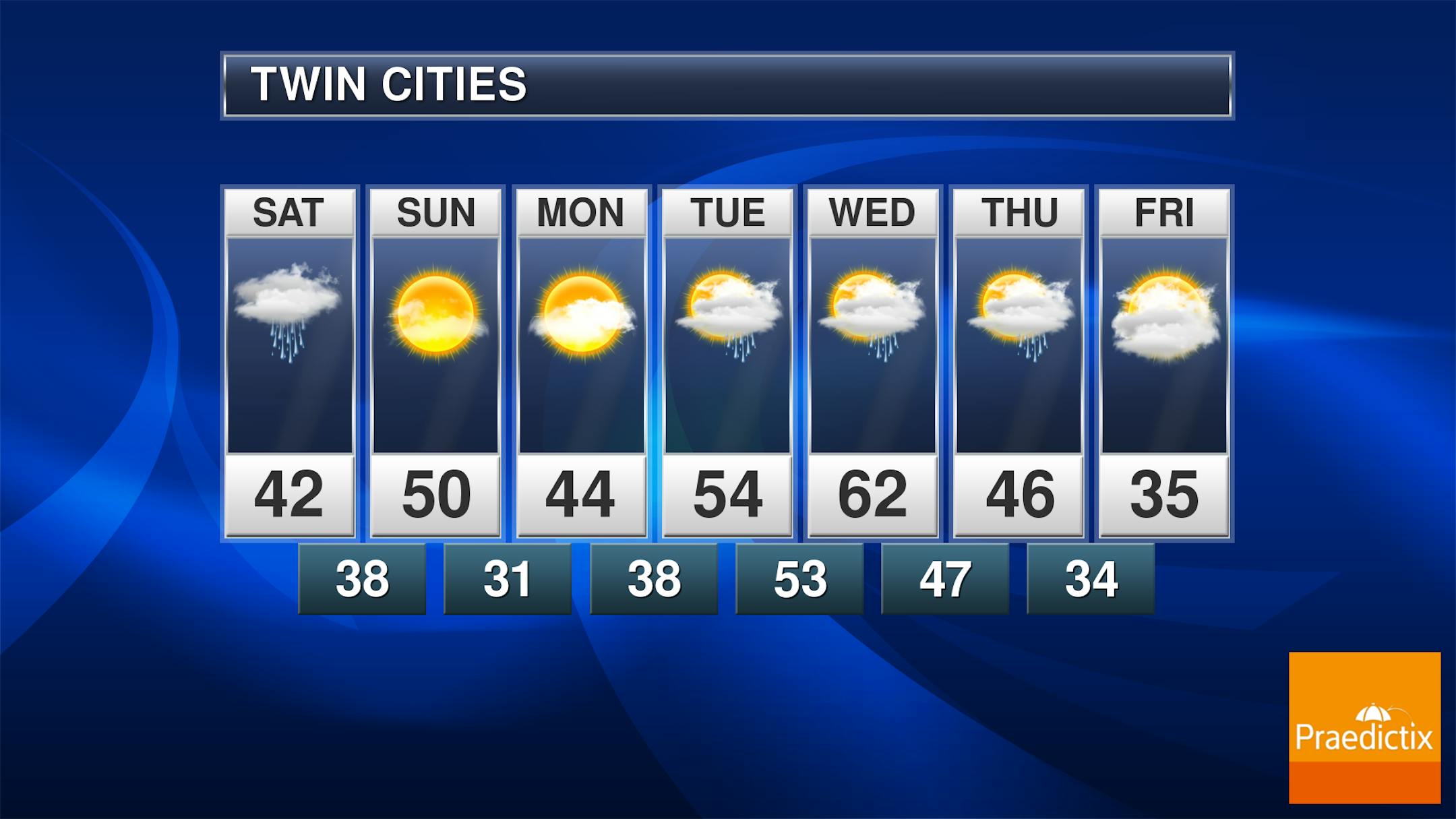
The start of the work week will see more clouds than sun in the metro with highs back in the mid-40s. As we head into the mid/end of week timeframe, there is the potential we will work into a more active pattern with more rain chances. If I go off of experience with the past several storms that showed a nice rain for the metro about 5-7 days out and then have materialized to be east of the metro... I am definitely leaning toward the "wait until we are a lot closer" camp on throwing out any totals at this time (as well as any exact timing). Highs look to climb into the low 60s on Wednesday before we start seeing another cooling trend into next weekend - one that, if the models are right, could last for an extended period of time.
_______________________________________________


