
Tropical Storm Ida
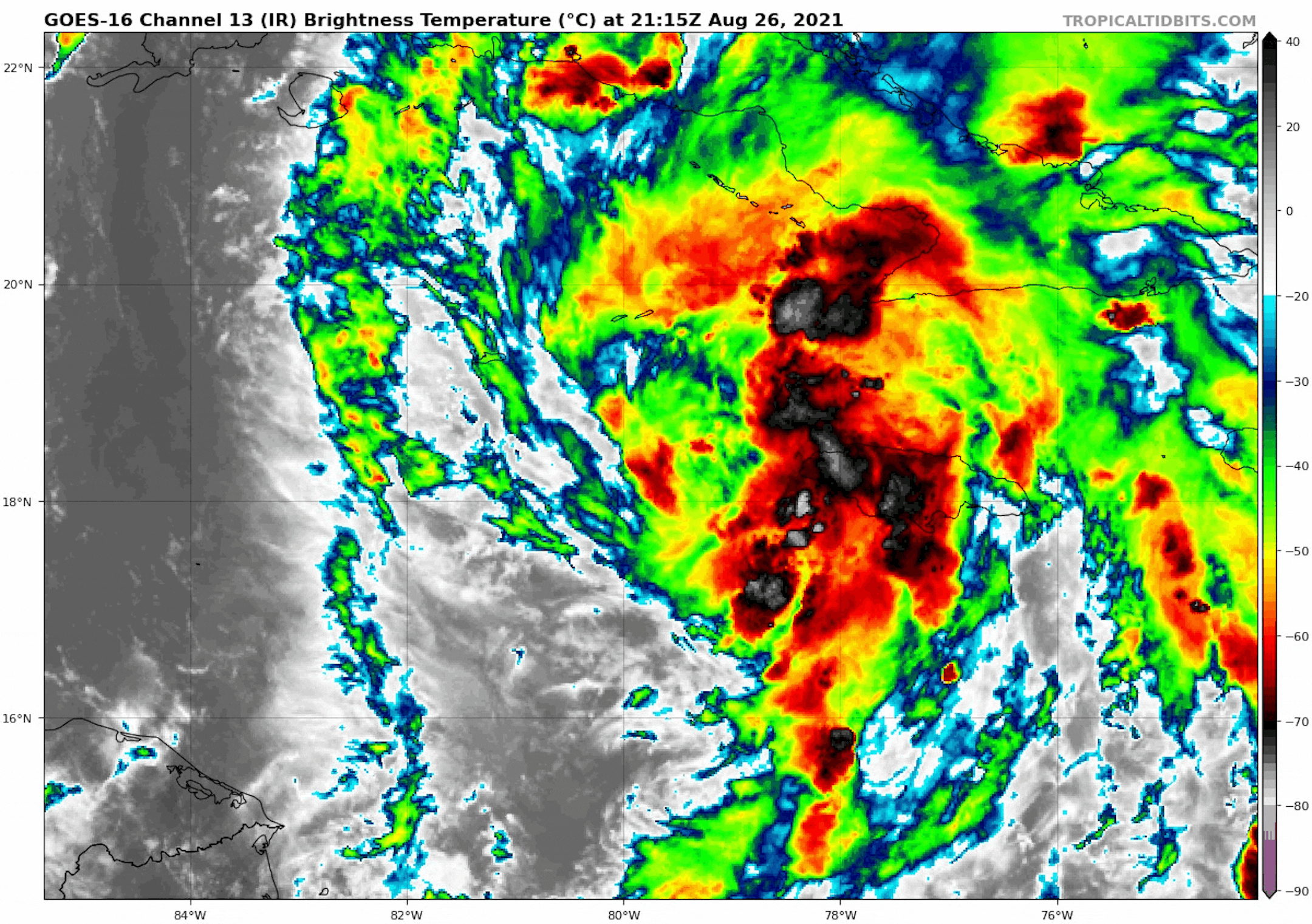
The IR Satellite from Thursday showed newly developed Tropical Storm Ida centered near Jamaica in the Caribbean. Areas of heavy rains, flooding and the potential of mudslides will continue as Ida lifts NW over through the end of the week.
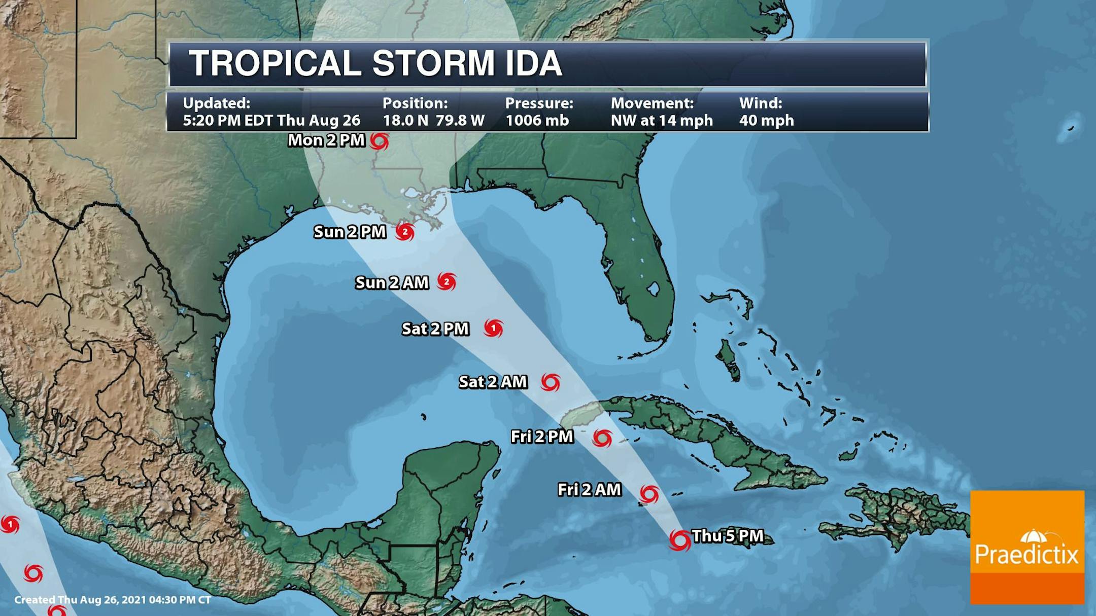
Tracking Ida
According to NOAA's NHC, Ida if forecast to become a Hurricane this weekend as it enters the Gulf. Interestingly, it could become a category 2 storm prior to landfall near the Louisiana Coast late Sunday
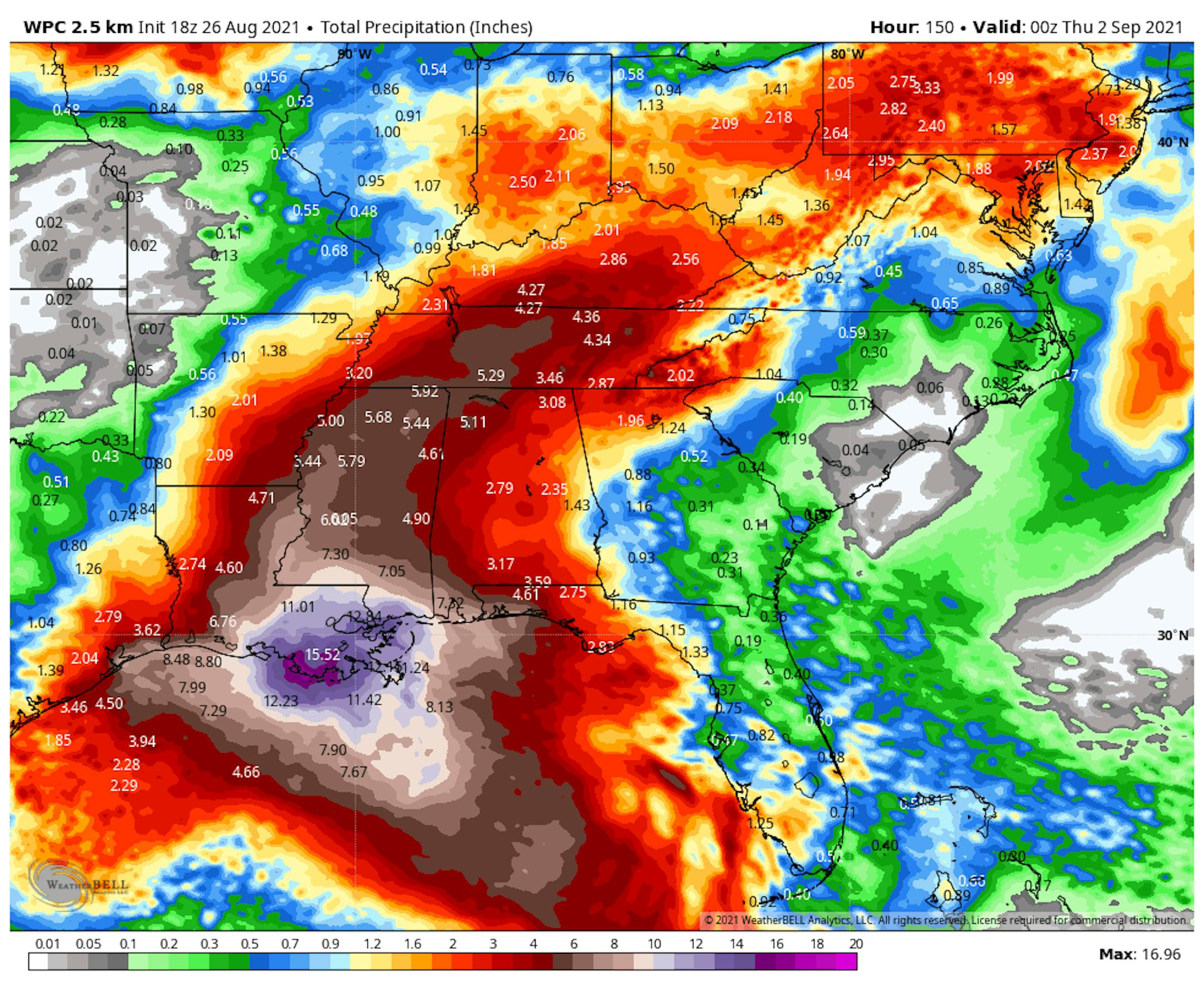
Heavy Rains From Ida
One of the biggest concerns will be heavy rainfall along the coast and places inland. The heaviest rains will be near the coast with significant flash flooding possible, but there will also be areas of heavy rain farther inland, where several inches of rain can't be ruled out through early next week.
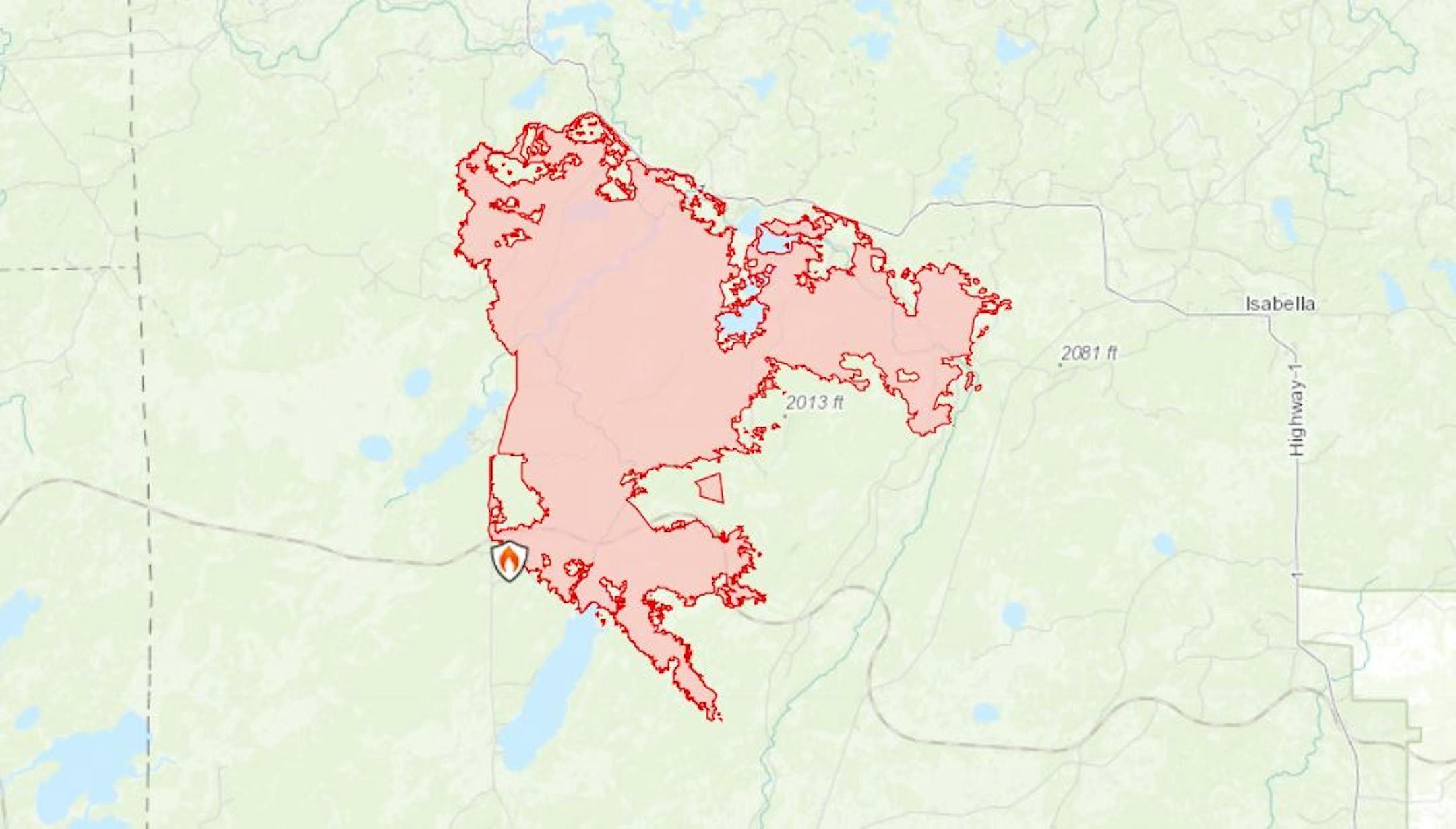
Greenwood Fire in Northern Minnesota
The Greenwood Fire in Northern Minnesota has burned more than 20,000 acres in the Superior National Forest. Due to several wildfire concerns, no more permits into the BWCA have been allowed. Hopefully rain chances will help fire fighting efforts over the coming days.
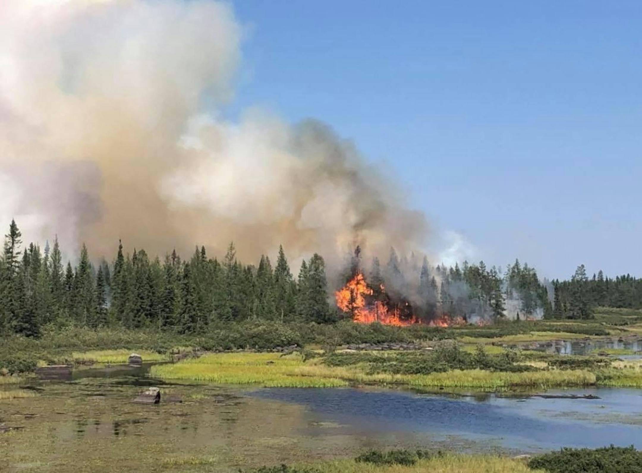
Greenwood Fire in Northern Minnesota
The footprint of the Greenwood fire is nearly 26,000 acres in size, which had explosive fire growth earlier this week due to strong southerly winds. Here's the latest weather information about the weather conditions: "Cloud cover increased across the region today, resulting in cooler temperatures and humidity trending wetter compared to Wednesday. Scattered showers also pushed east across northeastern Minnesota, with light rainfall falling over the fire. Easterly winds will increase tonight into Friday as an area of low pressure approaches from the west. Friday will be a cool, wet, and breezy, with periods of rain forecast during the day and through the evening. Another good chance of precipitation arrives Saturday afternoon through Saturday night, before we dry out Sunday and Monday."
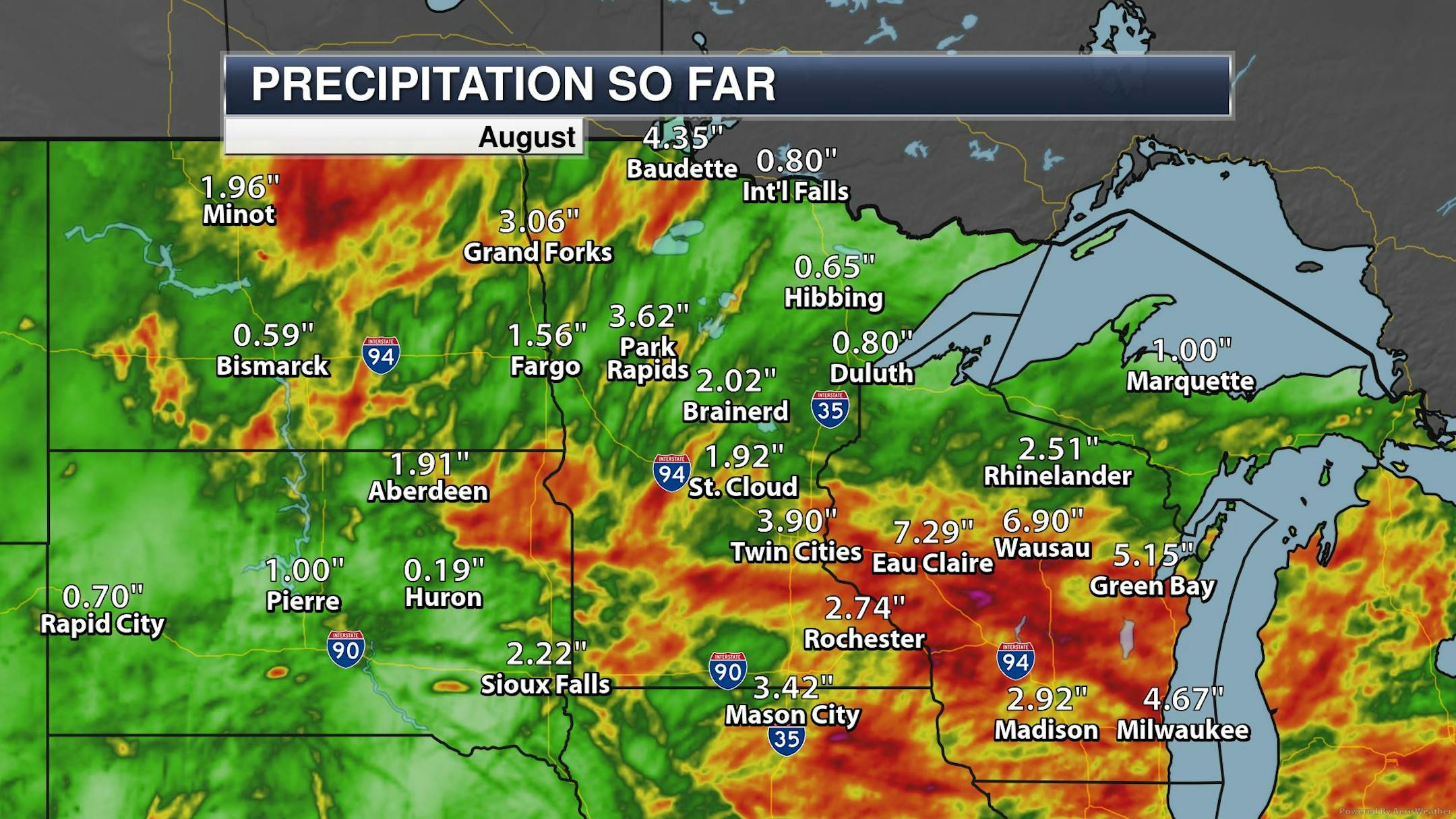
Drought Persists In Minnesota
Despite recent rains, much of Minnesota is in a drought with Exceptional Drought across parts of of Minnesota from near International Falls to Upper & Lower Red Lake and near Fargo, ND. This is where precipitation deficits are near -7.00" to -8.50" below average since January 1st

Precipitation From Average (January 1st - August 24th)
Here are the precipitation deficits since January 1st, which show readings that are several inches below average. Some of the biggest deficits are nearly more than 7" to 8" below average, where extreme and exceptional drought conditions are in place.


