Catastrophic Damage From Ian
"On September 29, the National Geodetic Survey (NGS) began collecting aerial damage assessment images in the aftermath of Hurricane Ian. Imagery is being collected in specific areas by NOAA aircraft, identified by NOAA in coordination with FEMA and other state and federal partners. Collected images are available to view online via the NGS aerial imagery viewer. View tips on how to use the imagery viewer. NOAA's aerial imagery aids safe navigation and captures damage to coastal areas caused by a storm. Aerial imagery is a crucial tool to determine the extent of the damage inflicted by flooding, and to compare baseline coastal areas to assess the damage to major ports and waterways, coastlines, critical infrastructure, and coastal communities. This imagery provides a cost-effective way to better understand the damage sustained to both property and the environment. View collected NOAA Emergency Response Imagery below. New imagery will be posted as soon as it is available."

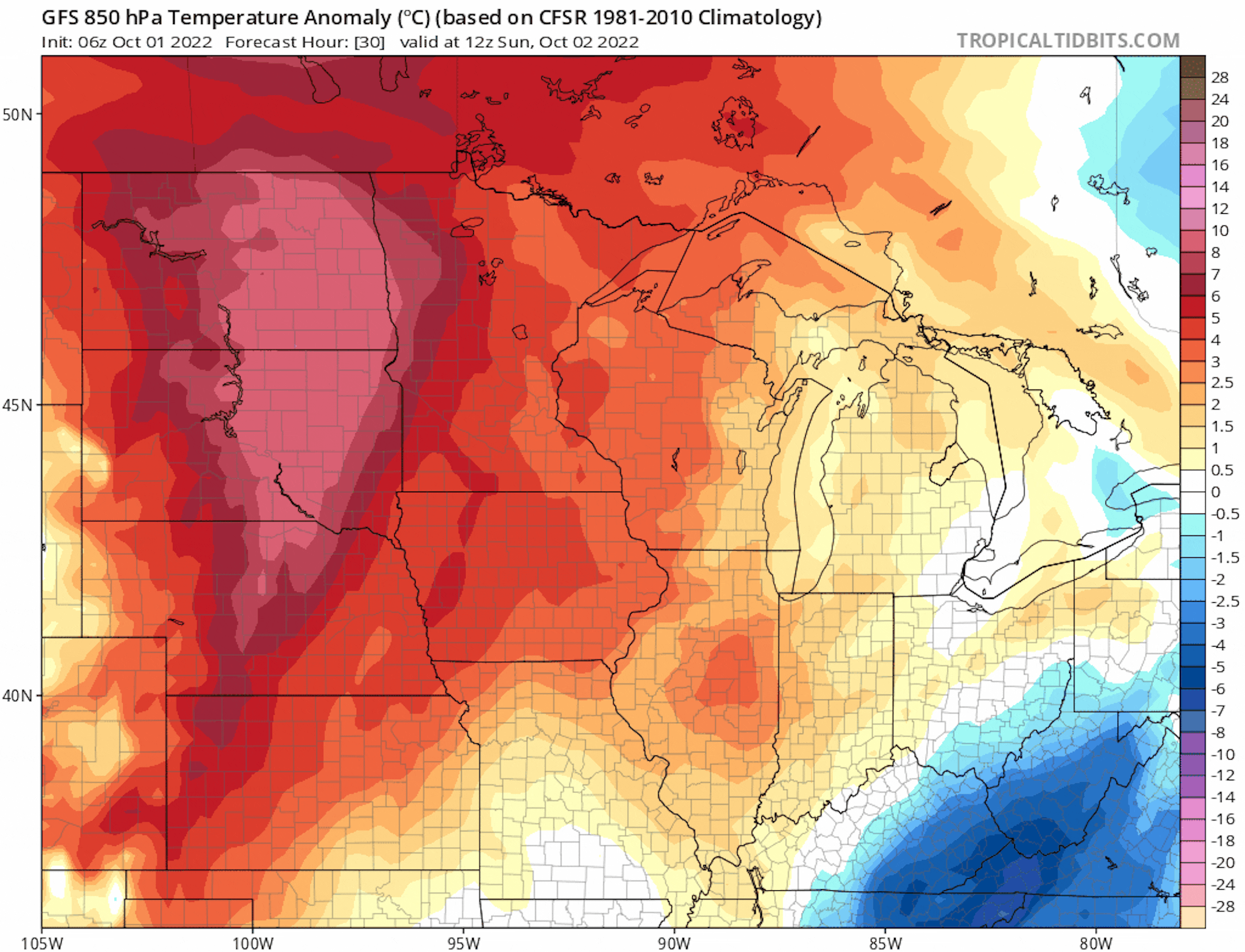
Sharp Cold Front Arrives Midweek
Here's the 850mb temp anomaly from AM Sunday to AM Saturday of next weekend. Note the oranges and reds in place through midweek, which suggests above average temps through that time frame. However, there is a sharp cold front that will blast through late Wednesday with temps tumbling into the 40s and 50s on Thursday and Friday across the state with widespread frost/freeze concerns.
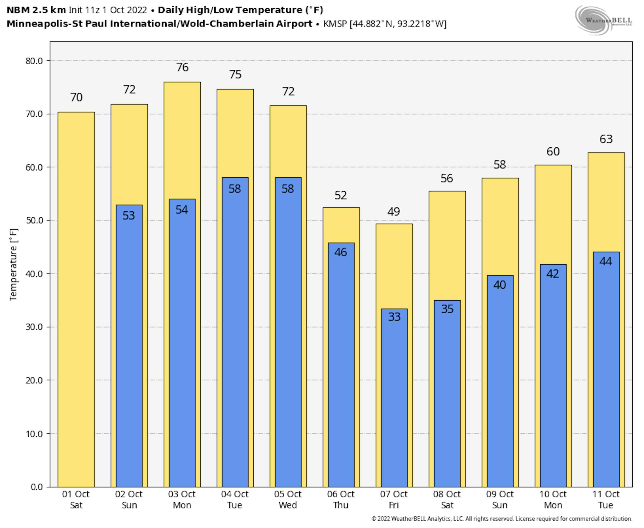
Much Colder Late Week
Here's a look at the extended temperature outlook for Minneapolis. Note that highs will warm into the 70s through Wednesday before the bottom falls out late week. High on Thursday and Friday will only warm into the 40s and 50s across the state, which will be well below average for early October.
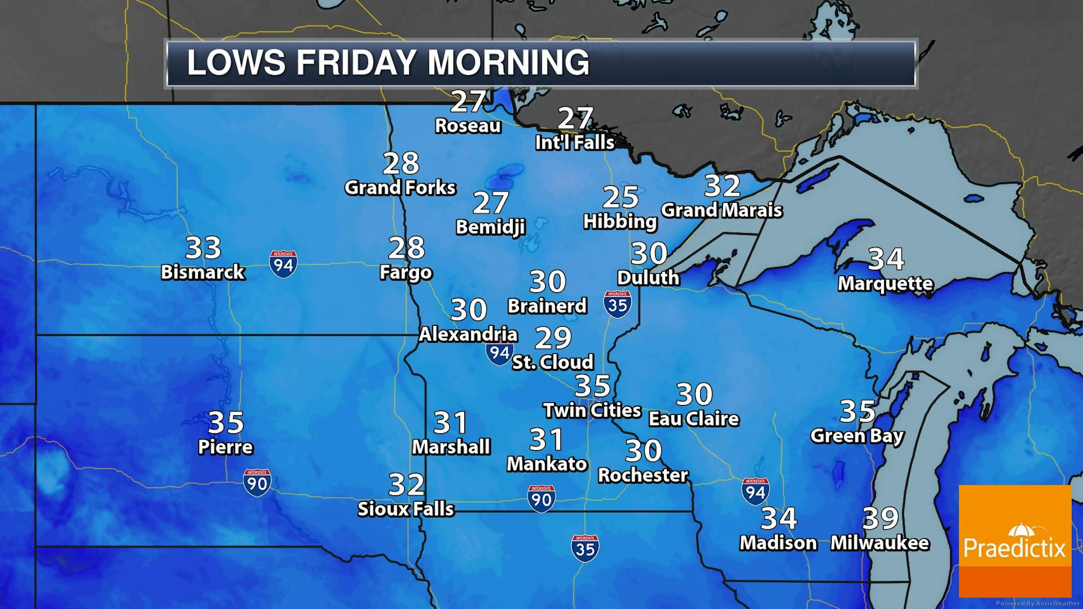
Widespread Frost/Freeze Friday Morning
This is fairly deep into the extended forecast, but there does appear to be fairly widespread frost/freeze potential on Friday morning. At this point, temps could dip into the 20s and 30s across much of the state. Stay tuned...
Severe Drought Continues in the Metro
According to the US Drought Monitor (updated September 27th), severe drought continues in the Twin Cities. Areas of moderate to severe drought stretch from the Twin Cities to the MN River Valley, where precipitation amounts are running several inches below average since January 1st.

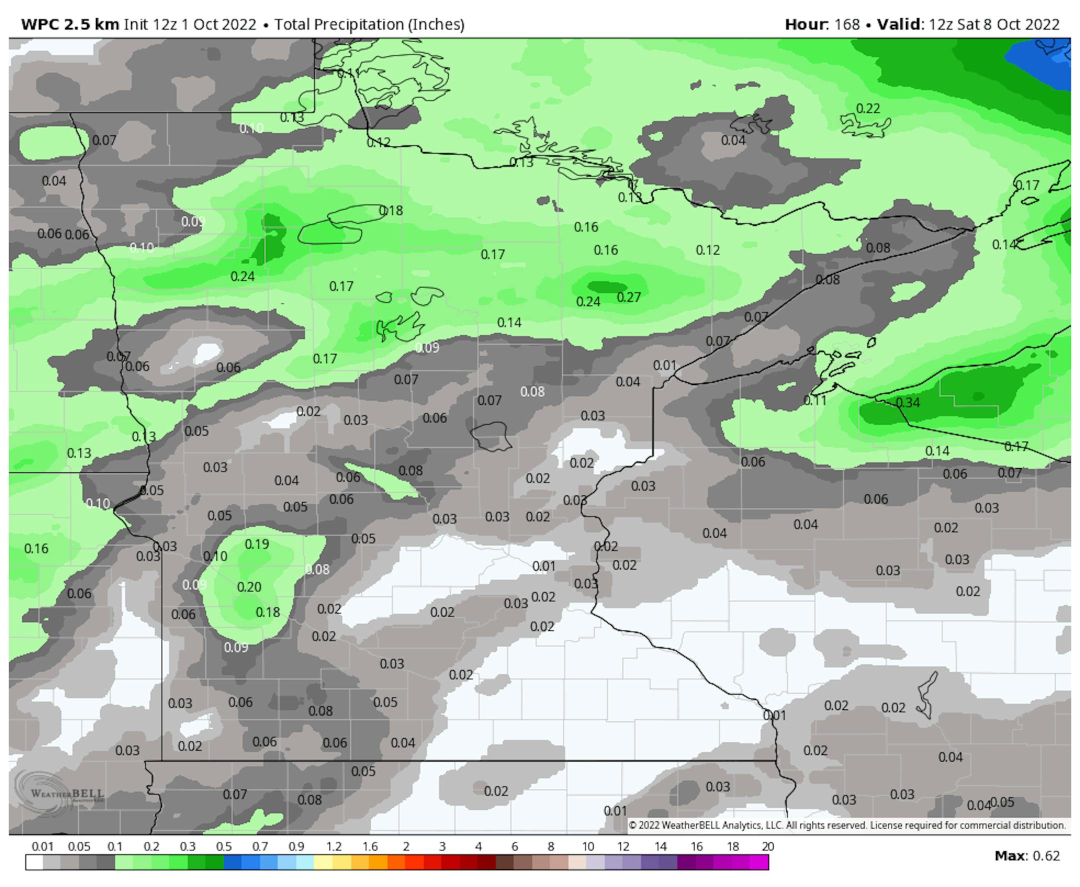
Mostly Dry Extended Forecast
Here's the precipitation outlook through the first full week of October, which shows very little rainfall across the region. The best chance of any accumulation will be across the northern and western part of the state, where up to 0.25" may be possible.
Little Rain Chance Into Early October
Here's the weather outlook through the first week of October, which shows isolated rain chances through midweek. These rain chances will be fairly light across the Midwest with up to 0.25" rain possible for some. There will be a more potent front that arrives late Wednesday with more widespread showers across the Great Lakes Region and it could be cold enough for snow closer to the international border and the northern Great Lakes!