
Memorial Day
"Each year in the United States, Americans observe the Federal holiday, Memorial Day, the last Monday in May. It honors and remembers all men and women who have died while serving in the United States Armed Forces. Memorial Day is also a day to remember all loved ones who have passed away. Traditionally on Memorial Day, the flag of the United States of America is raised briskly to the top of the staff then solemnly lowered to the half-staff position where it remains until noon. At noon, it is then raised to full-staff for the remainder of the day. When the flag is at half-staff, the position is in remembrance of the more than one million men and women who gave their lives for their country. Raising the flag at noon signifies the nation lives, that the country is resolved not to let their sacrifice be in vain but to rise up in their honor and continue to fight for liberty and justice for all. In the United States, Memorial Day also traditionally marks the beginning of summer."

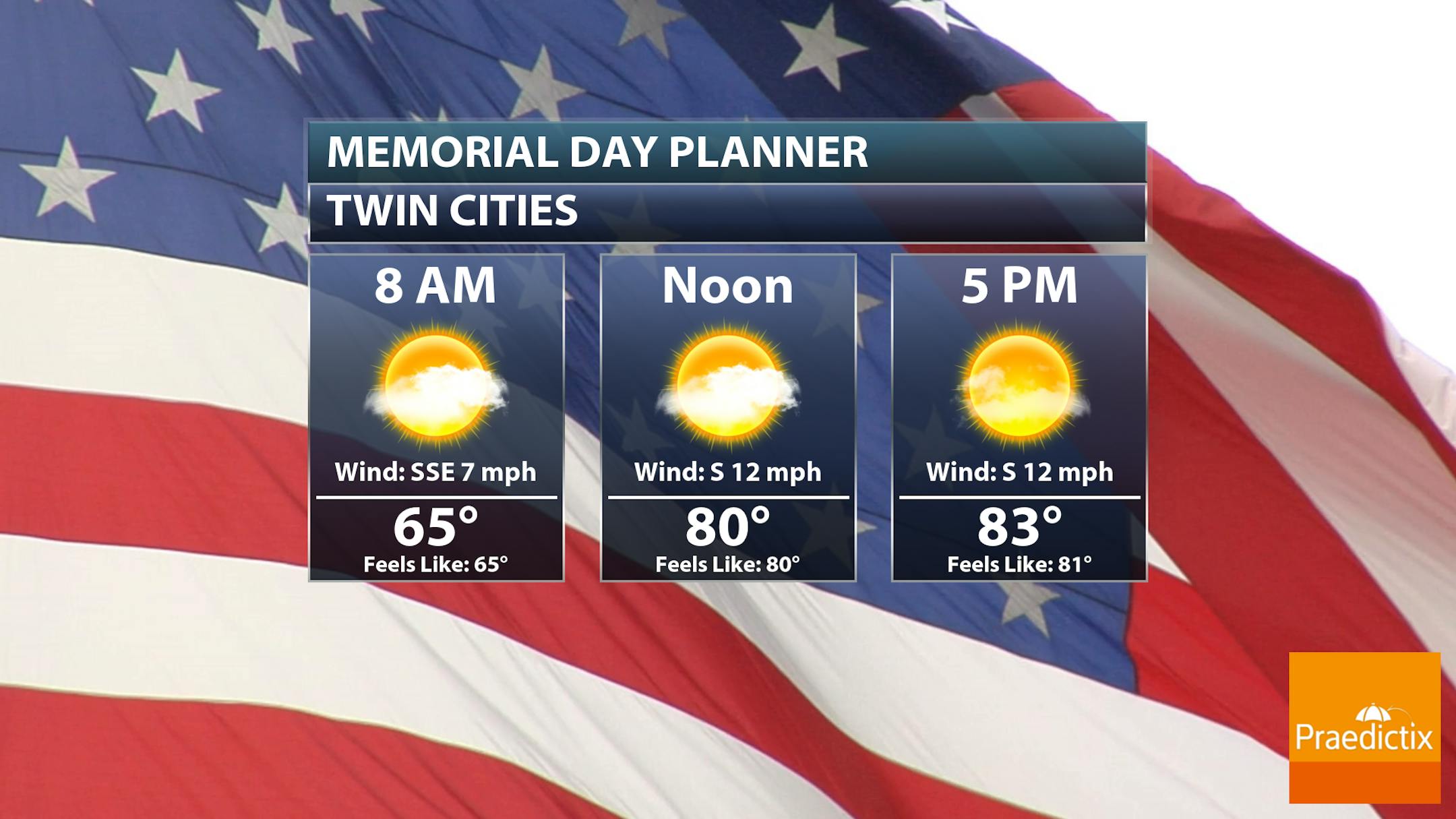
Twin Cities Weather Outlook For Memorial Day Monday
Memorial Day Monday will be another beautifully warm and sunny weather day with highs warming back into the 80s. If you have outdoor plans through the day or plan on attending any memorial services, there won't be any weather worries. It looks very nice and quiet. Just don't forget the SPF!
Up North Forecast For Memorial Day Monday
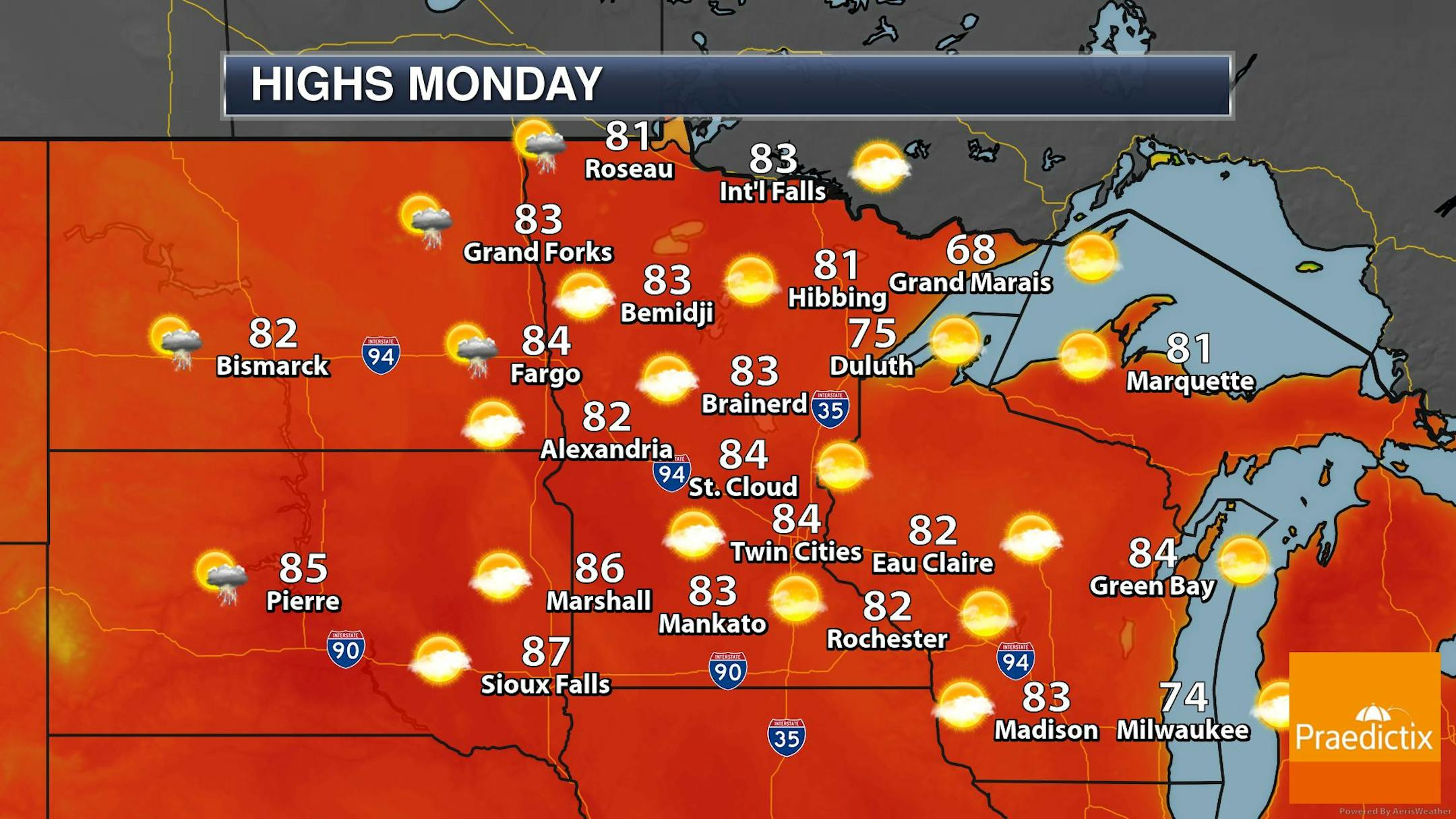
Hard to believe that our Memorial Day Weekend has been as nice as it has been already and it will continue again today. Temps will warm into the low/mid 80s with bright sunshine across the state.

Weather Outlook For Memorial Day Monday
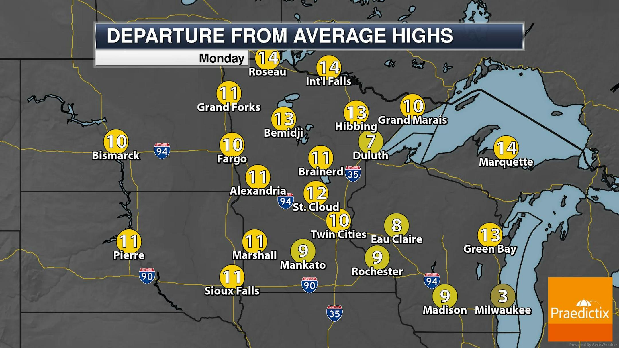
Here's the weather outlook across the rest of state on Memorial Day. High temps will warm into the 80s for many locations, which will be nearly +10F to +15F above average for the end of May. Isolated t-showers will be possible in the far northwestern corner of the state near the Red River Valley.
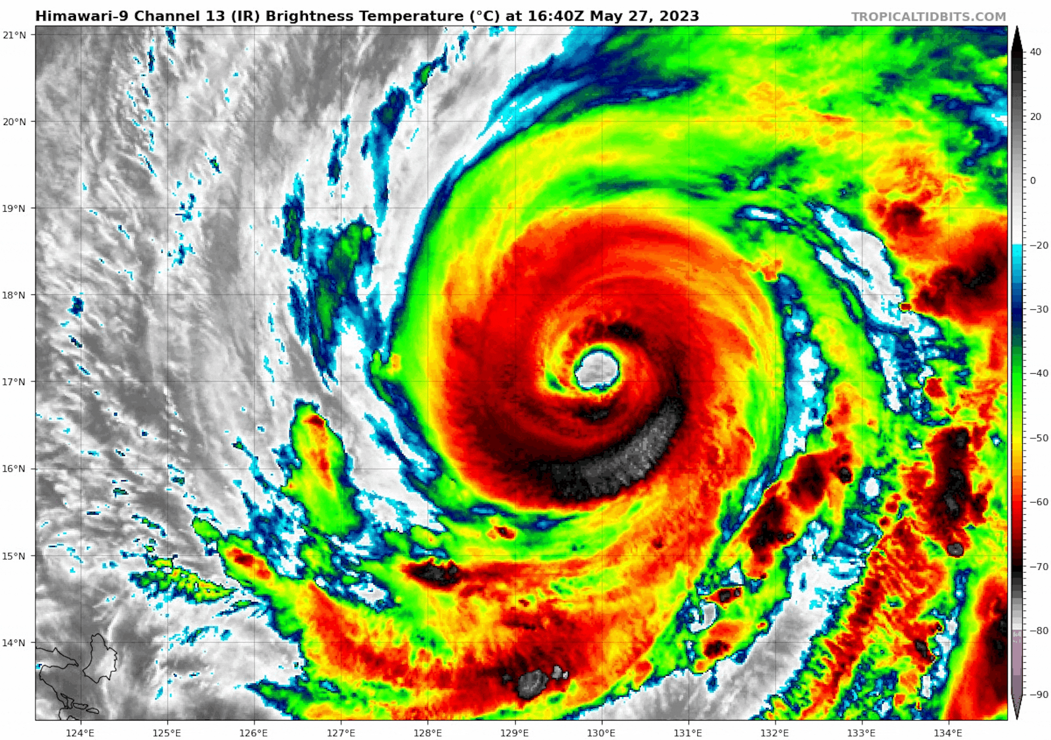
"Typhoon Mawar sets sights on Philippines, Taiwan and Japan after blow to Guam"
"The powerhouse typhoon is the equivalent of a Category 3 hurricane as it approaches the northernmost island of the Philippines before turning to the north, continuing its damaging path. Typhoon Mawar, which pounded Guam with destructive winds and flooding downpours earlier this week, is continuing to churn west across the Pacific Ocean and will impact more landmasses in the western Pacific and eastern Asia this week, according to AccuWeather forecasters. Mawar already achieved the status of strongest tropical cyclone on the planet so far this year, and it will remain a powerful storm as it aims for portions of the Philippines, Japan and Taiwan, with more flooding rainfall and strong winds expected this week. As of Sunday afternoon, local time, Mawar was centered across the central Philippine Sea, packing winds equivalent to that of a Category 3 hurricane on the Saffir-Simpson hurricane wind scale (maximum sustained winds of 111-126 mph, or 178-208 km/h), according to the Japanese Meteorological Agency (JMA), which monitors and tracks tropical cyclones in this portion of the western Pacific tropical basin. Mawar peaked at the equivalent of a Category 5 hurricane (maximum sustained winds of at least 157 mph, or 252 km/h) on Friday after passing by Guam."
Weather Outlook Through Next Week
Thanks to a large bubble of high pressure stalled over the Great Lakes Region, sunny and mild weather conditions will remain in place across the Upper Midwest through at least Monday. The high pressure system will slowly nudge east after Monday, which will allow more unsettled weather to creep back into the picture throughout most of next week. Daily afternoon thunderstorms will be possible across much of the state with pockets of locally heavy rainfall.


