Thursday Marked The Third Straight 90F+ High At MSP
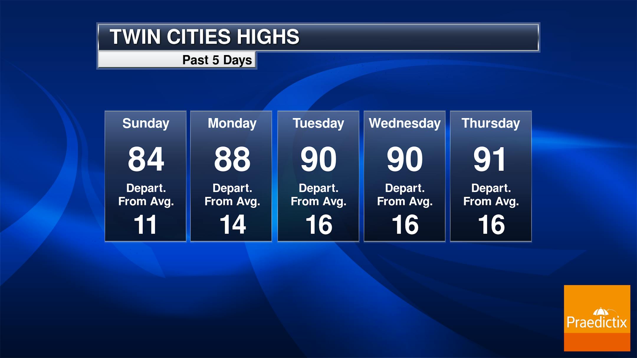
Thursday marked the third day in a row with a high of at least 90F in the Twin Cities, meaning we are officially in a heat wave. While we just barely didn't tie/break the record for the day in the Twin Cities (92F in 1939), we did see record highs in Fargo and Marquette on Thursday.
_______________________________________________
Rinse-And-Repeat Saturday
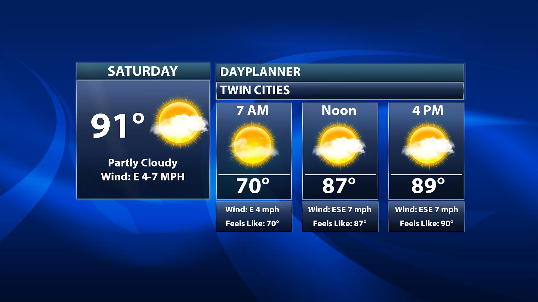
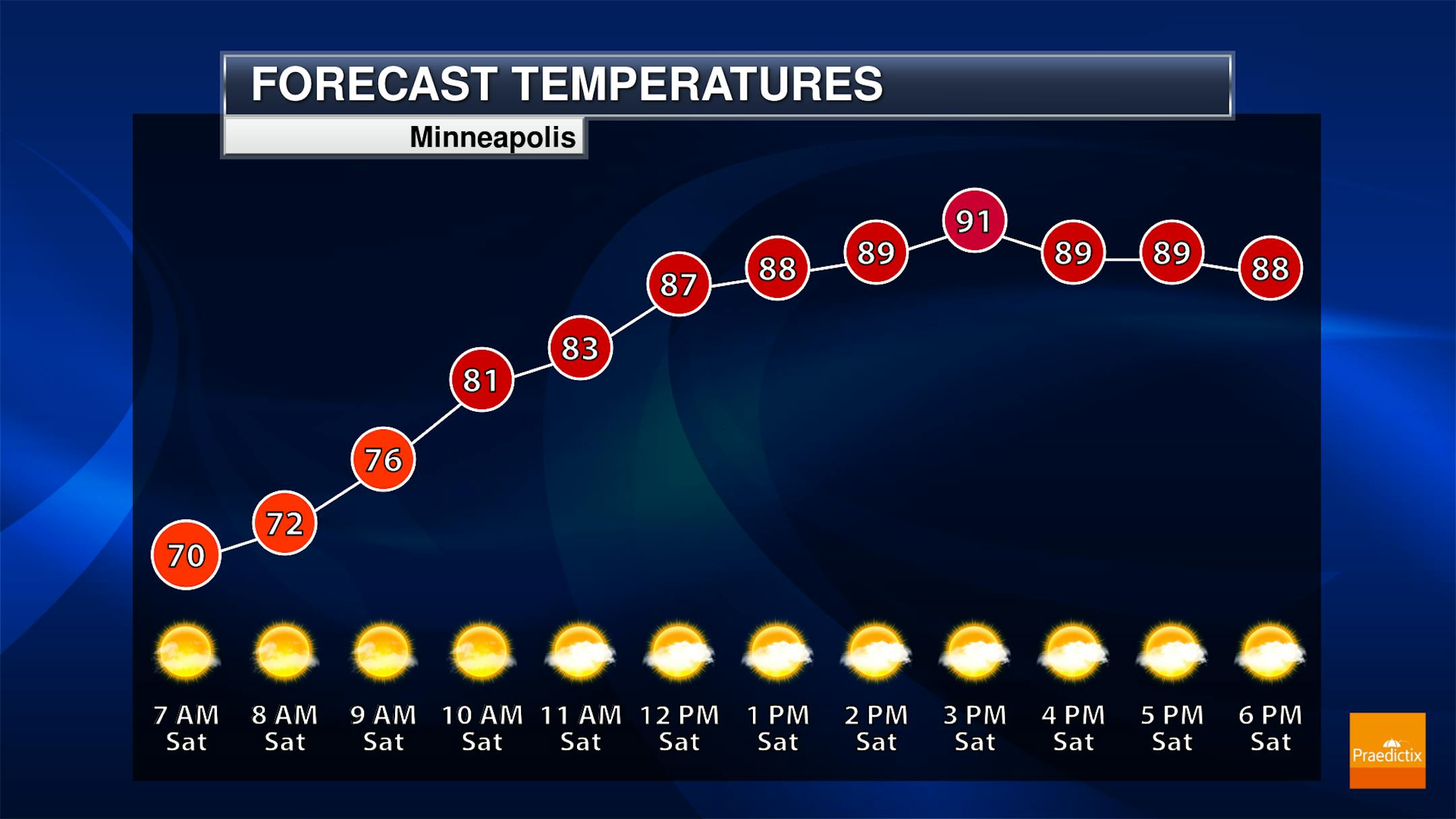
Another 90F degree day is expected in the Twin Cities on Saturday as highs approach the record for the day (92F in 1923). While most of the day will feature a mix of sun and clouds to mainly sunny skies, we will once again be watching the chance of pop-up showers and storms scattered across the region in the afternoon/evening hours.
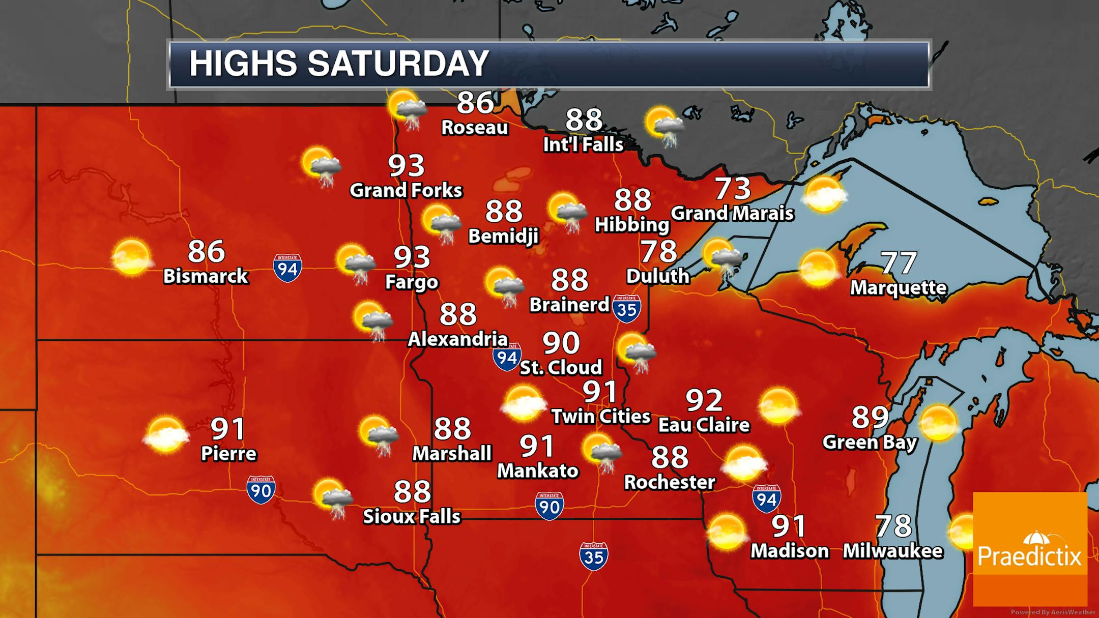
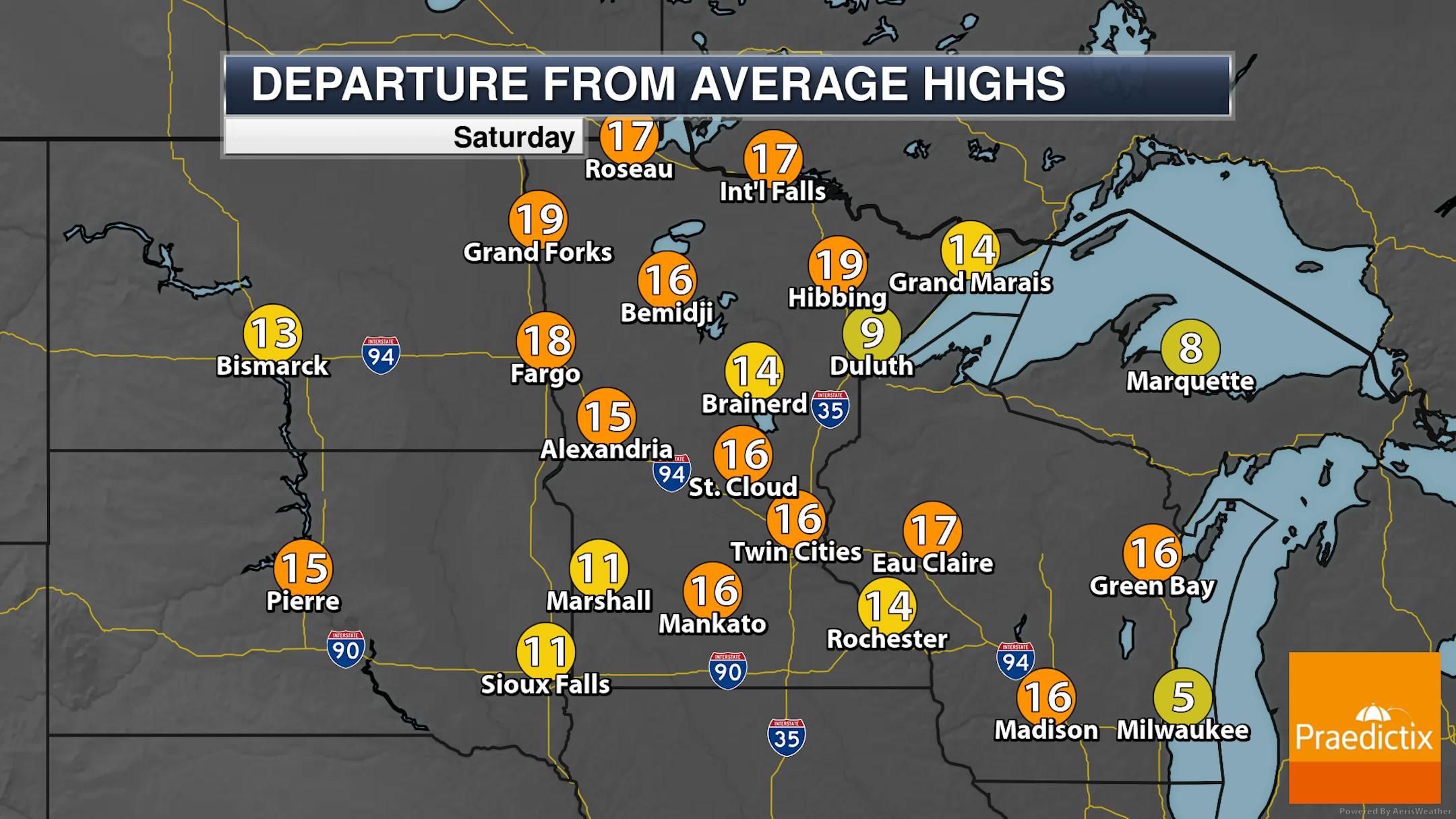
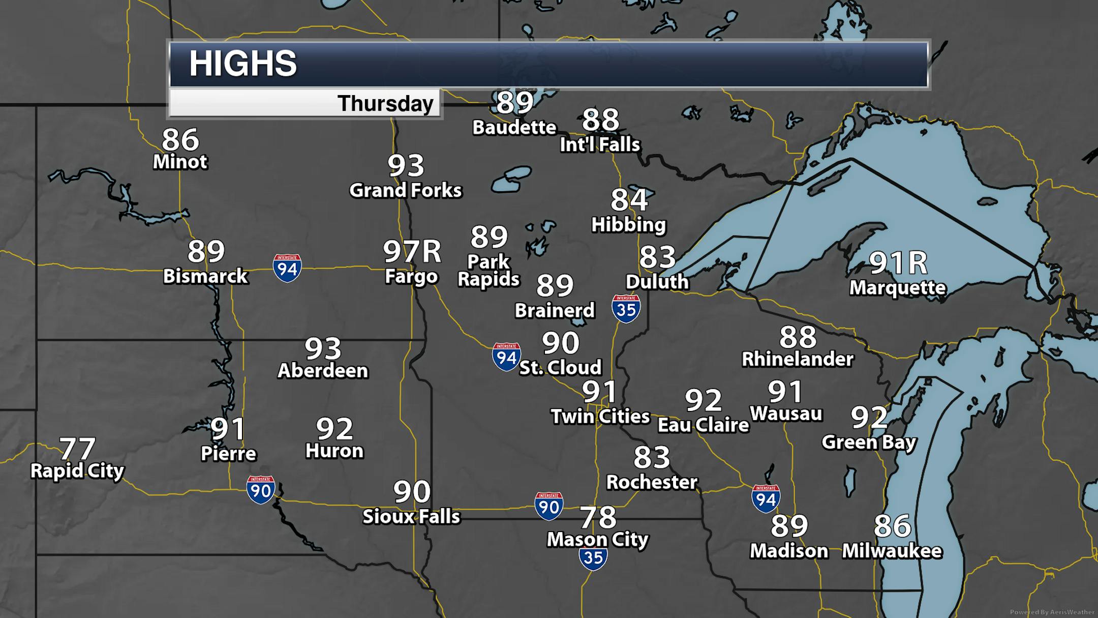
Looking statewide, it's another rinse-and-repeat day on Saturday, similar to the past few days, where pop-up showers and storms capable of heavy rain will occur during the afternoon and evening hours. Otherwise, a mix of sun and clouds to mainly sunny skies are expected. Highs range from the 70s along and near the North Shore to the 80s and low 90s elsewhere.
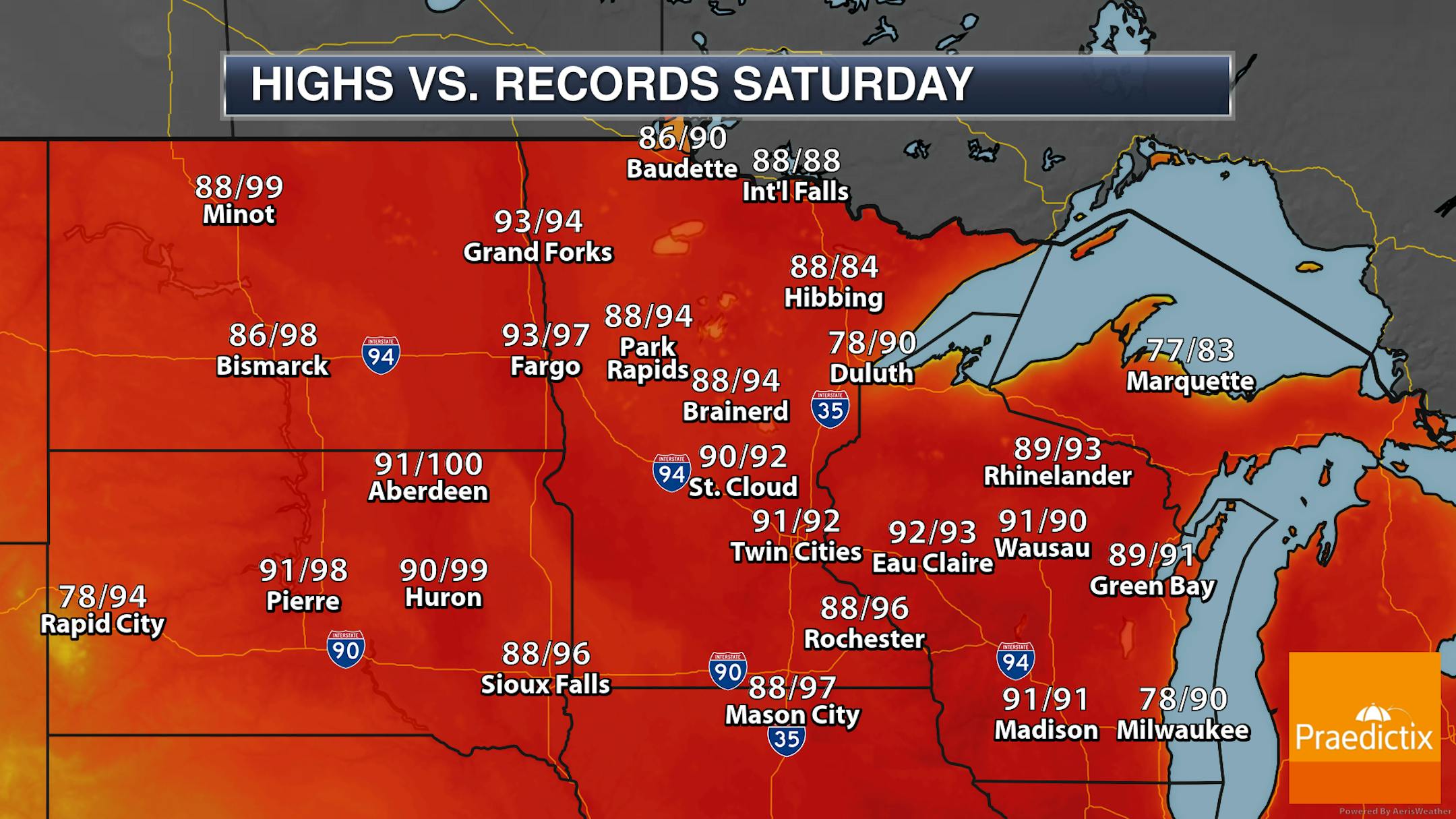
Several record highs (or near record highs) will be possible across the state as we head through Saturday. The best chances will be in areas like the Twin Cities, St. Cloud, Hibbing, and International Falls - as well as over in parts of Wisconsin and in the Red River Valley.
_______________________________________________
Sunny, Hot Sunday With Lesser Storm Chances
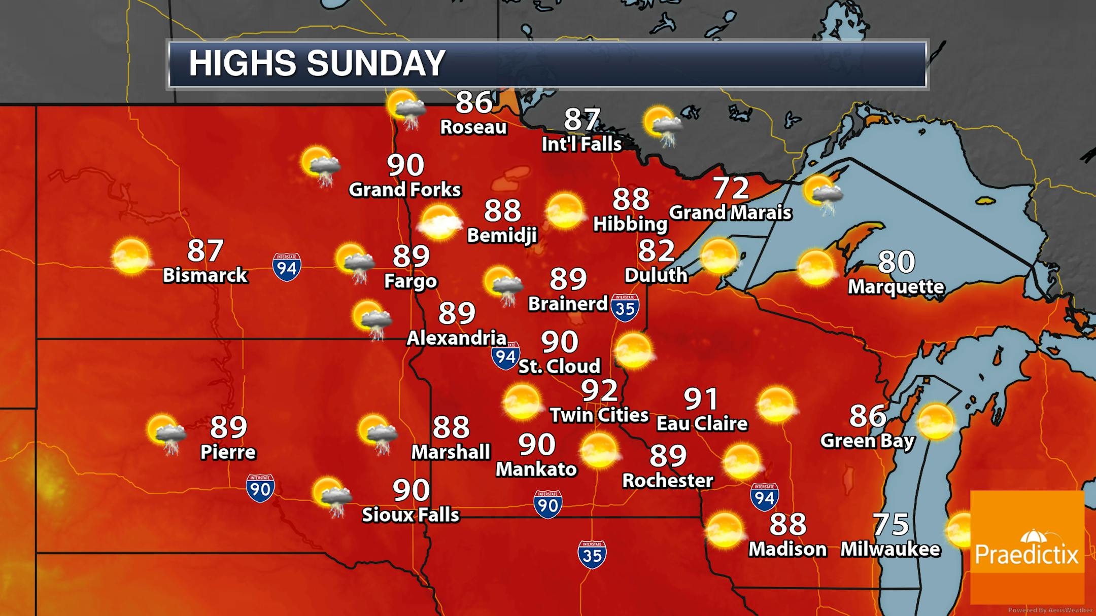
As we head toward the second half of the weekend, the hot weather sticks around with most areas of Minnesota reaching the 80s and low 90s once again. There won't be as much of a storm chance across the state on Sunday, with the best chance occurring in northern Minnesota near the Canadian border.
_______________________________________________