
Hurricane Ida
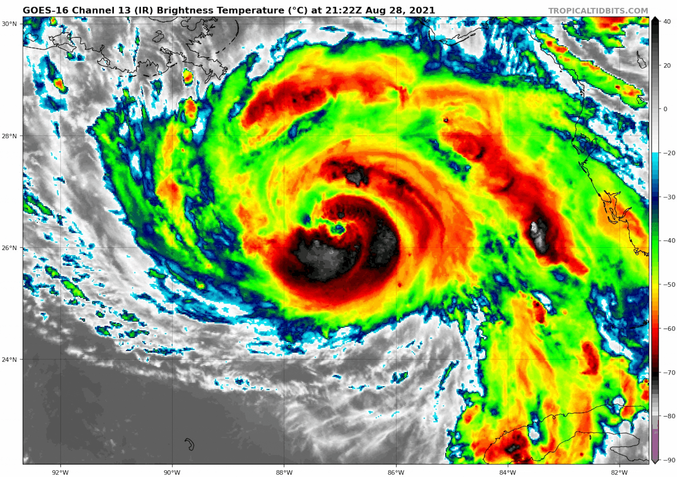
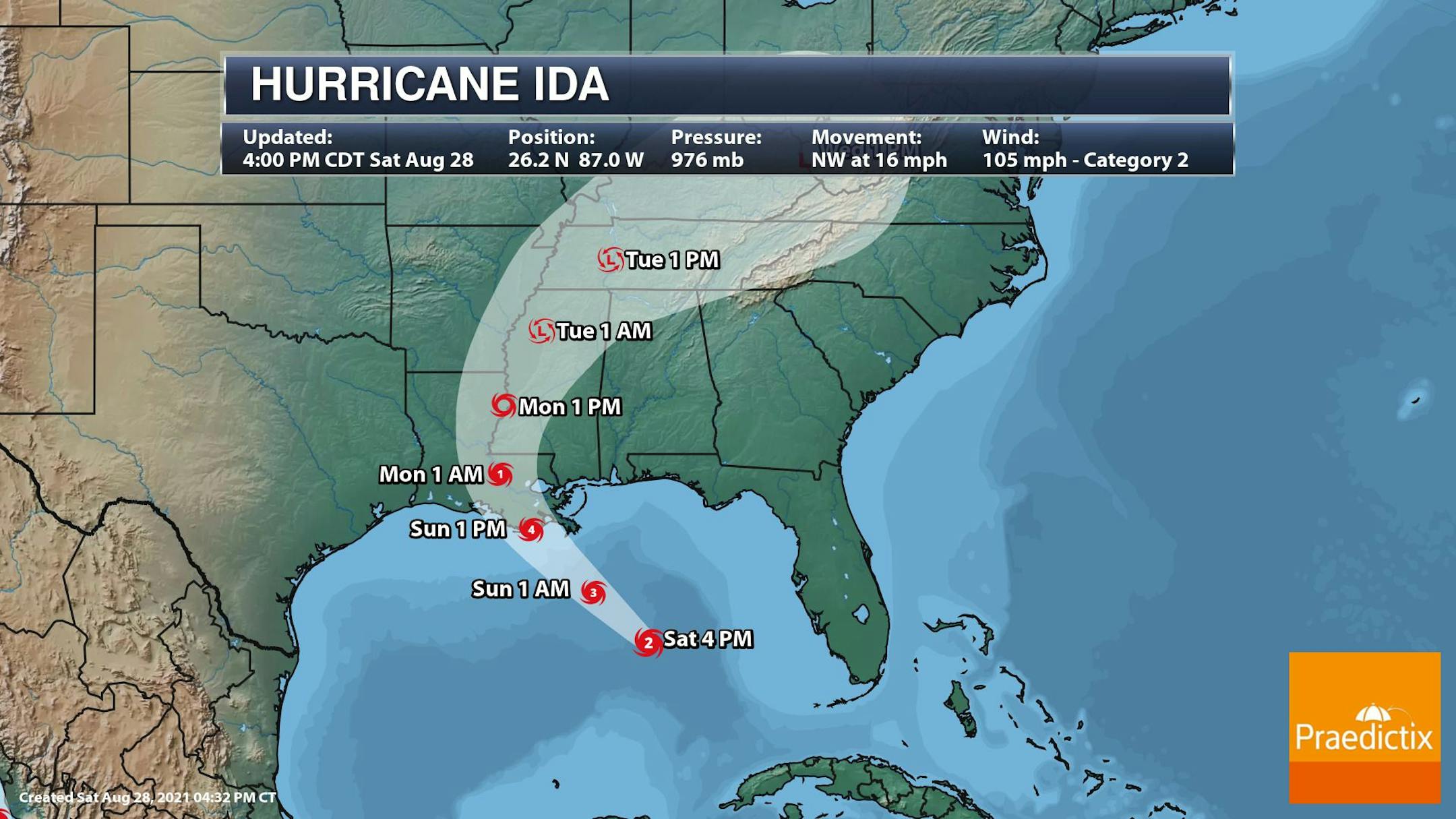
The IR Satellite from Saturday evening showed Category 2 Hurricane Ida centered in the Gulf of Mexico with sustained winds of 105mph as 7pm. Hurricane Ida is expected to make landfall along the Louisiana Coast late Sunday, possibly as a Category 4 storm.
Tracking Ida
According to NOAA's NHC, Ida will quickly intensify through the weekend and could reach major category 4 status on Sunday with winds of 130mph before landfall late in the day. This is shaping up to be an extremely dangerous storm with life-threatening rainfall, storm surge, inland flooding and strong winds.
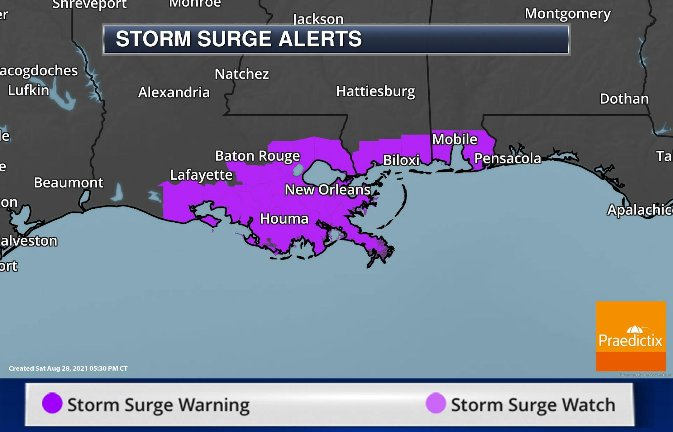
Hurricane Watches & Warnings
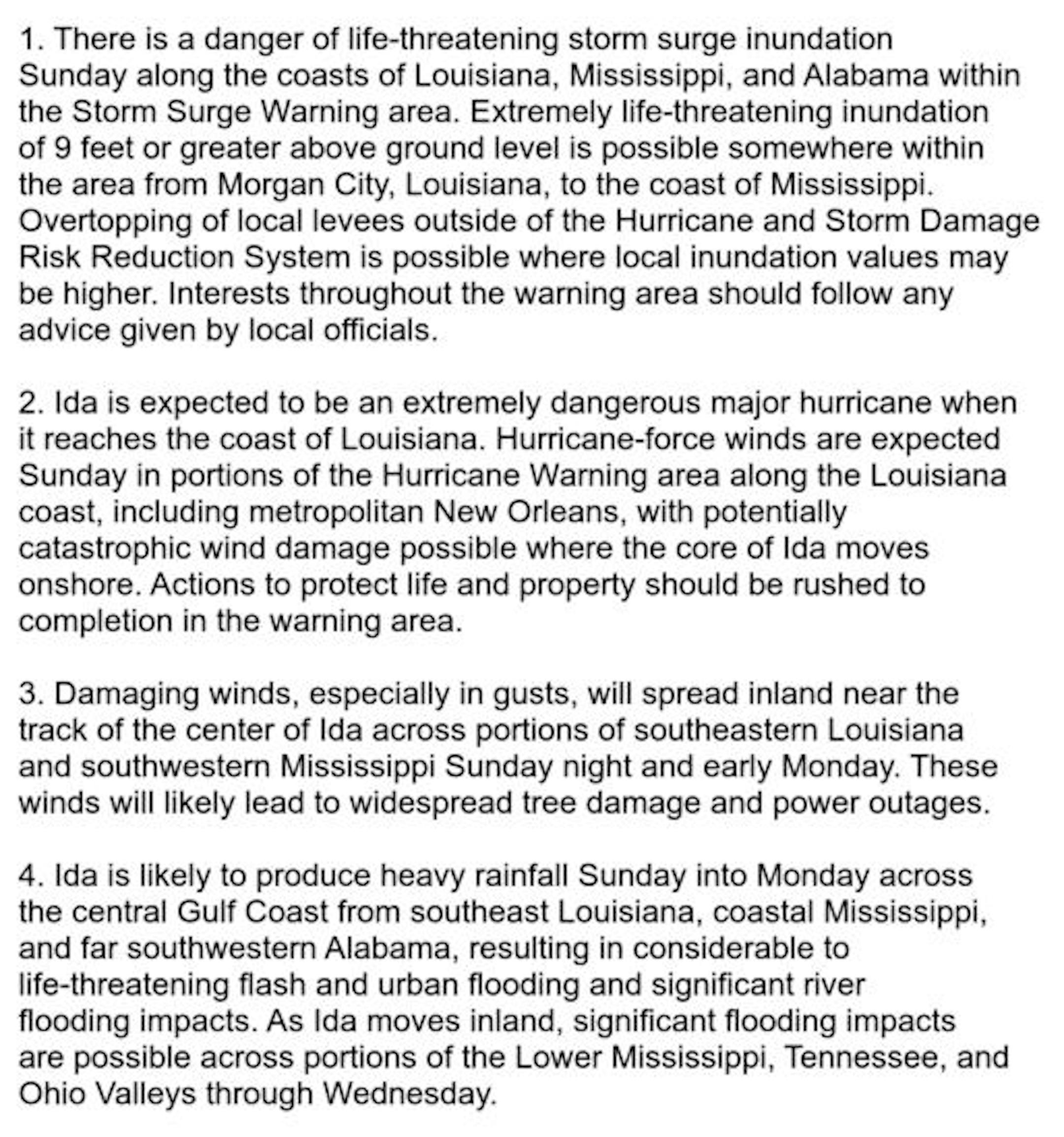
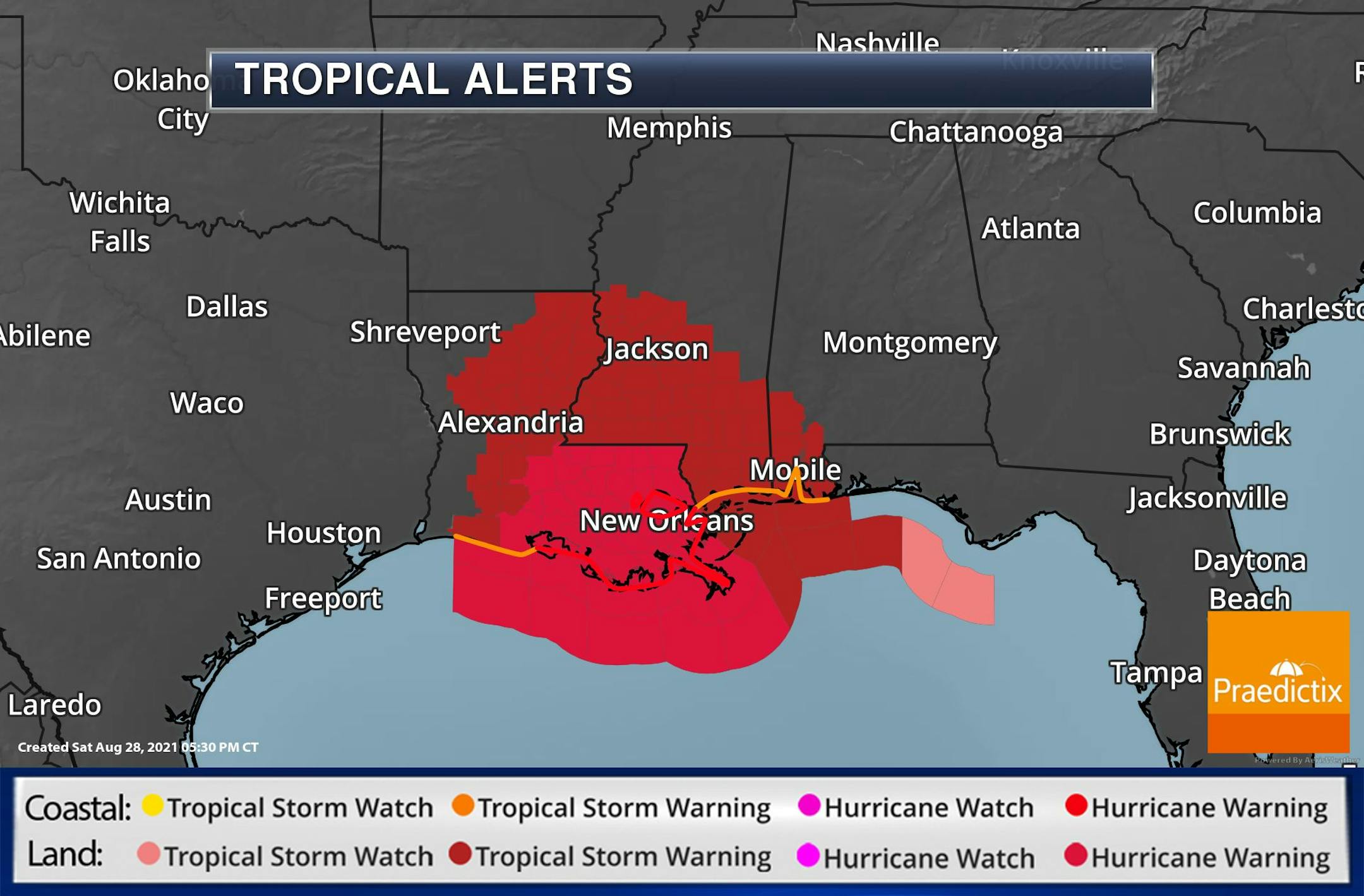
A number of Tropical Alerts have been issued along the Gulf Coast in advance of Ida. Here are some of the Key Messages from NOAA's NHC regarding Ida:
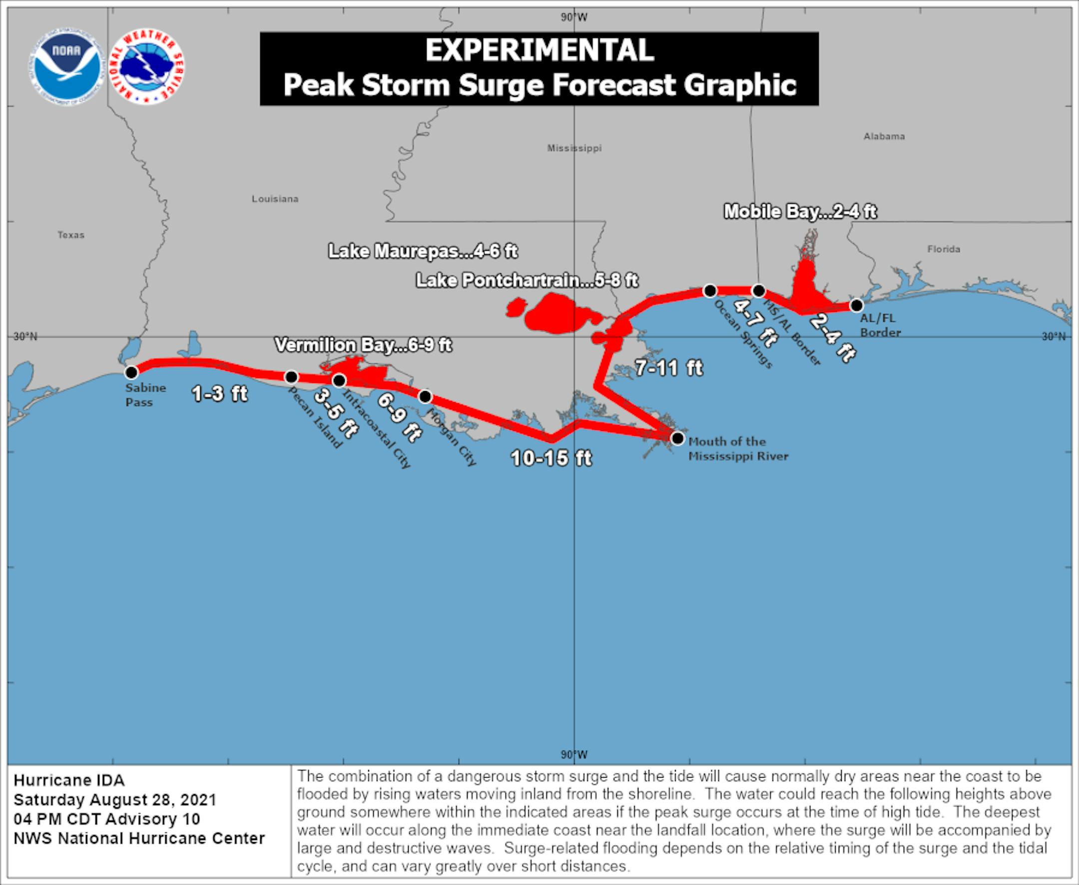
Storm Surge Concerns
One of the biggest concerns with Ida will be the life-threatening storm surge. A storm surge of 10ft to 15ft could be possible on the southeast side of the Louisiana Coast. Again, this will be a dangerous storm with life-threatening impacts in terms of highs winds, storm surge and inland flooding.
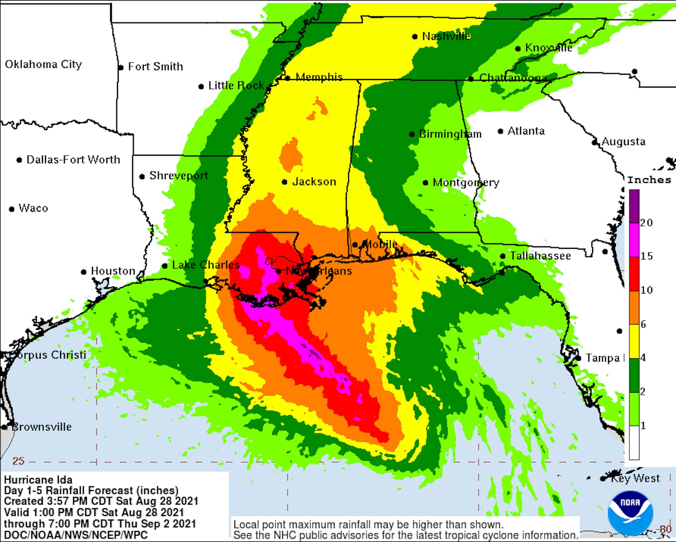
Heavy Rains From Ida
Another big concerns will be heavy rainfall with some spots seeing as much as 10" to near 20" in southeastern Louisiana. Heavy rainfall and flooding could cause life-threatening situations as well. Do not take this storm lightly.
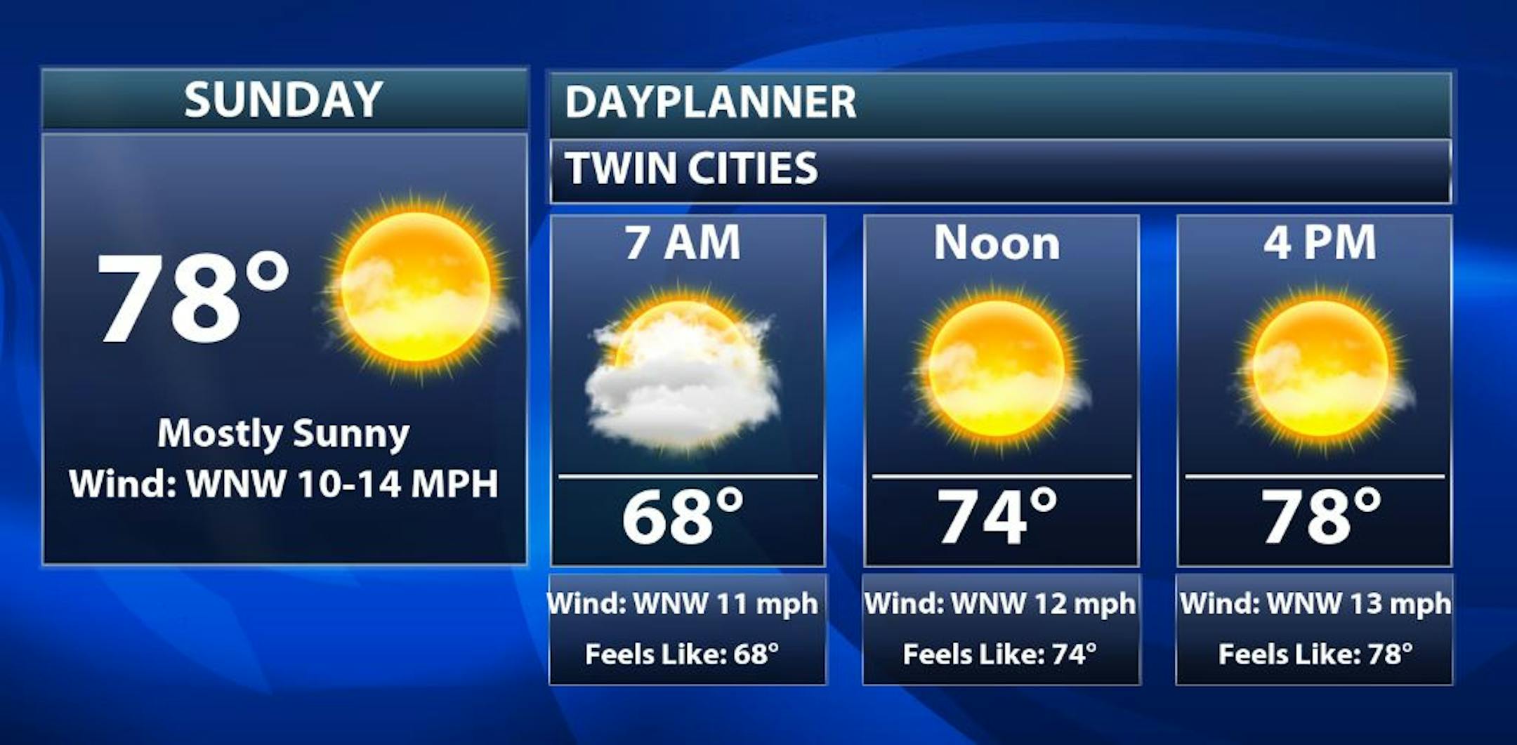
Sunday Weather Outlook
The weather outlook for the Twin Cities on Sunday, August 29th looks much better and drier than is was on Saturday. Temps and dewpoint values will be lower, so it will feel much better with sunnier skies later in the day.
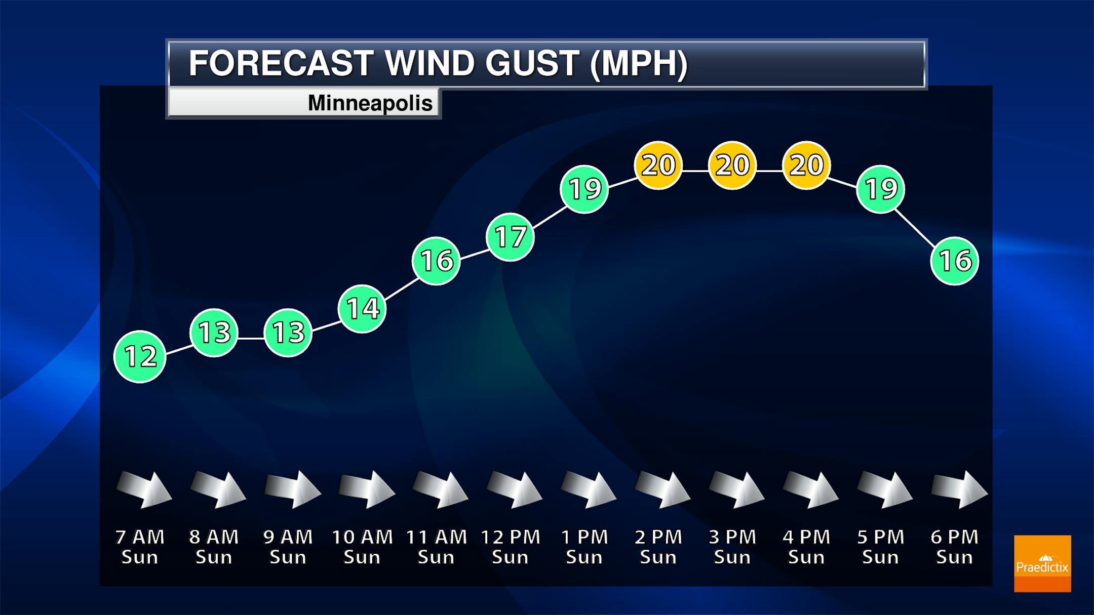
Minneapolis Meteograms
The meteograms for Minneapolis on Sunday shows temps warming from near 70F in the morning to the mid to upper 70s by the afternoon. Skies will be a bit cloudy in the morning, but we should be able to sun up through the rest of the day. West to northwesterly winds will be a bit breezy with gusts approaching 20mph through the afternoon.

Regional Weather Outlook for Sunday
The weather outlook across the region on Sunday shows temps running at or slightly below average for late August. Much of the state will warm into the 70s with a few lingering showers early in the day.


