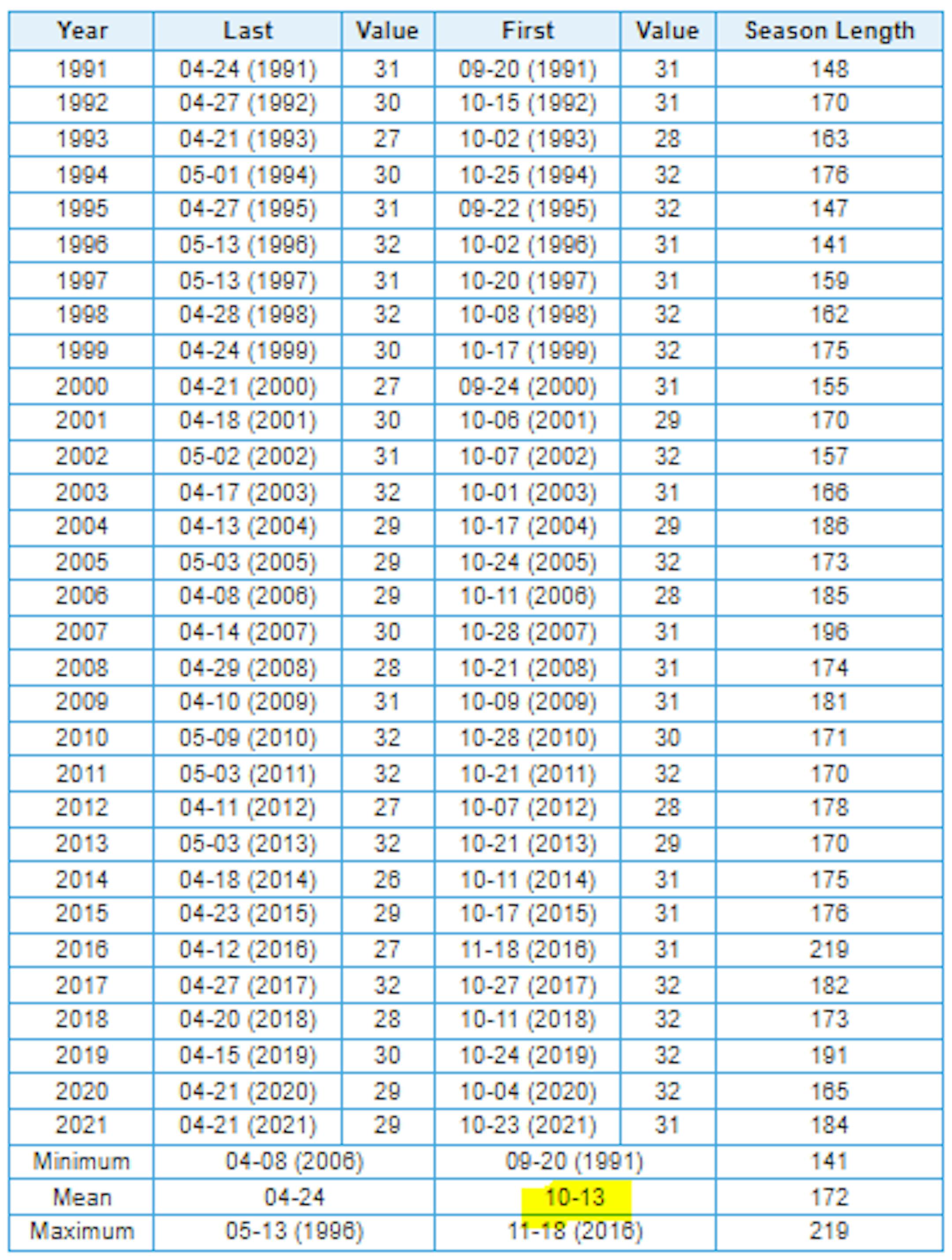
Isolated Severe Threat PM Tuesday
"A storm system moving over the Upper Midwest Tuesday afternoon and evening, will develop an area of thunderstorms along and ahead of a cold front. Due to ample wind shear and weak instability, isolated severe hail and gusty winds will accompany the strongest storms during the early evening before weakening, and moving east of our region."

Simulated Radar Tuesday
Here's the simulated radar from 7am Tuesday to 7am Wednesday, which shows a line of strong to severe storms developing in the southeastern part of the state late in the day. This line of storms could potentially bring isolated large hail and damaging winds to a few locations in the marginal risk area.

Fall Color Update
Here's the fall color update for Minnesota & Wisconsin. Thanks to recent frost overnight lows and dwindling daylight - peak color is coming fast to a backyard near you. Note that peak color is already being reported across parts of northern Minnesota and Wisconsin with near peak color in many other locations. Get out there and enjoy it quick before it's too late!
See more from the MN DNR HERE & Travel Wisconsin HERE:


Average Fall Color
The MN DNR has put together a nice graphic that shows typical dates for peak fall color. The northern par of the state starts to peak during the 2nd half of September into early October. Meanwhile, folks in the central part of the state and into the metro typically don't see peak color until the end of September into the middle part of October. It won't be long now - enjoy!

What Causes Fall Colors?
The chemicals
Four main groups of biochemicals are responsible for the various yellows, oranges, reds and browns that we see in the fall: Chlorophyll, Carotenoids, Anthocyanins, Tannins. Each has its own color and chemistry. As the amount of these chemicals vary, they will cause subtle variations in color from one leaf to the next, or even from tree to tree.