

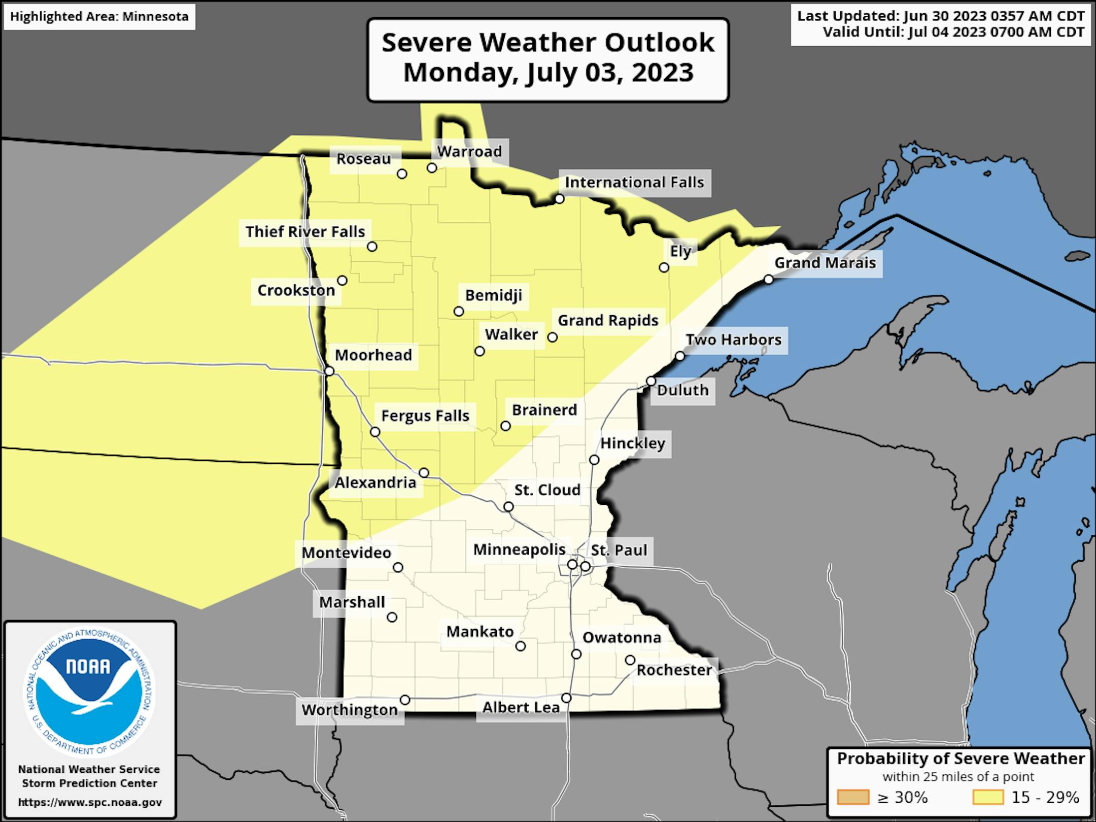
Severe Threat on Monday
According to NOAA's Storm Prediction Center, there is a risk of strong to severe thunderstorms on Monday across parts of northern Minnesota. It is still quite early, so things could change, but it maybe a little more unsettled as we slide into the early part of next week, including the 4th of July on Tuesday.
Simulated Radar
The simulated radar from AM Saturday to Midday Sunday shows mostly dry and quiet weather across the state with the exception of the far NW corner of the state later into the weekend. The thunder threat will increase even more as we head into the early part of next week. Stay tuned...

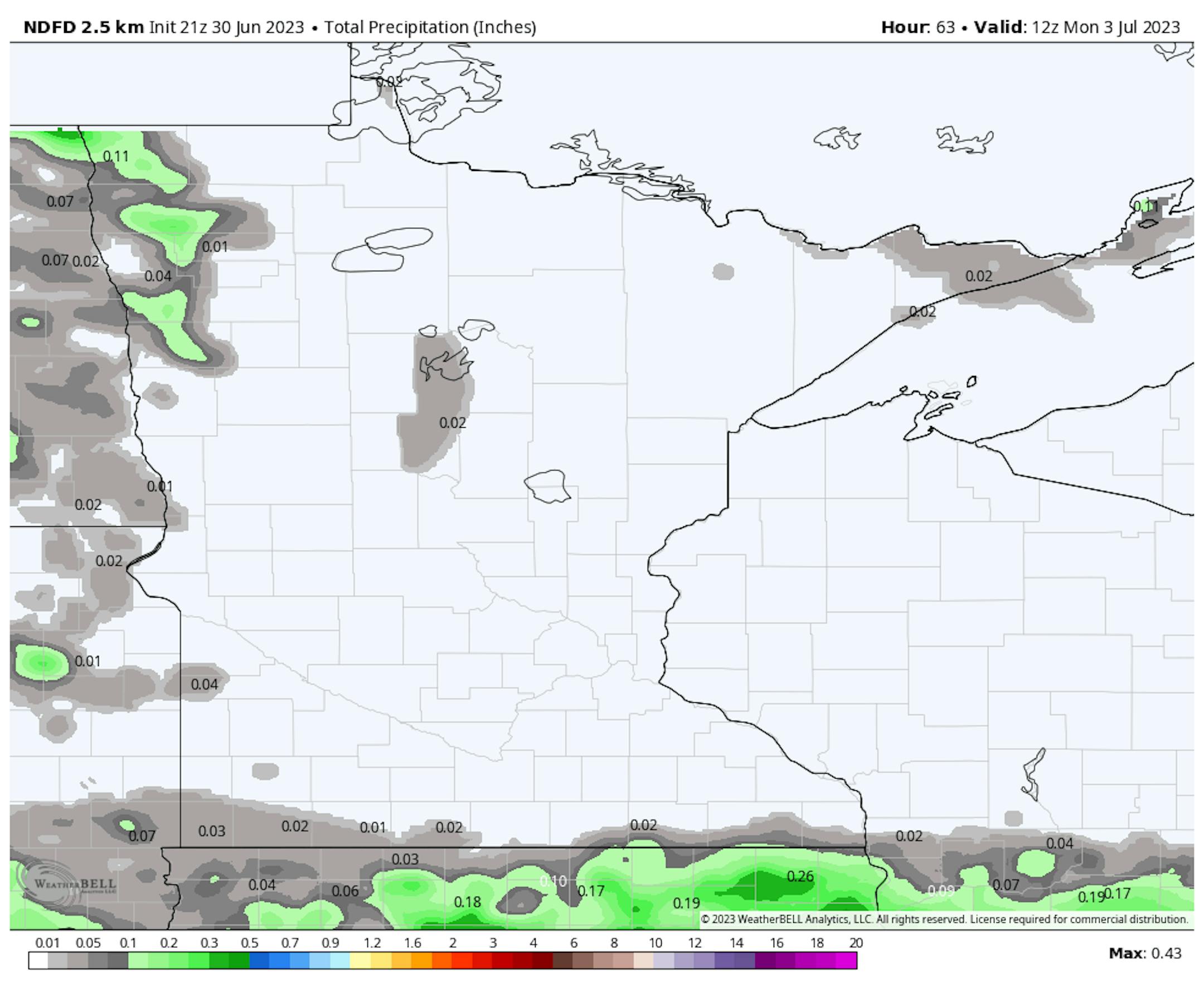
Precipitation Potential
Here's the precipitation outlook through AM Monday, which shows very little precipitation across the state. However, rainfall potential will increase as we slide into early next week.
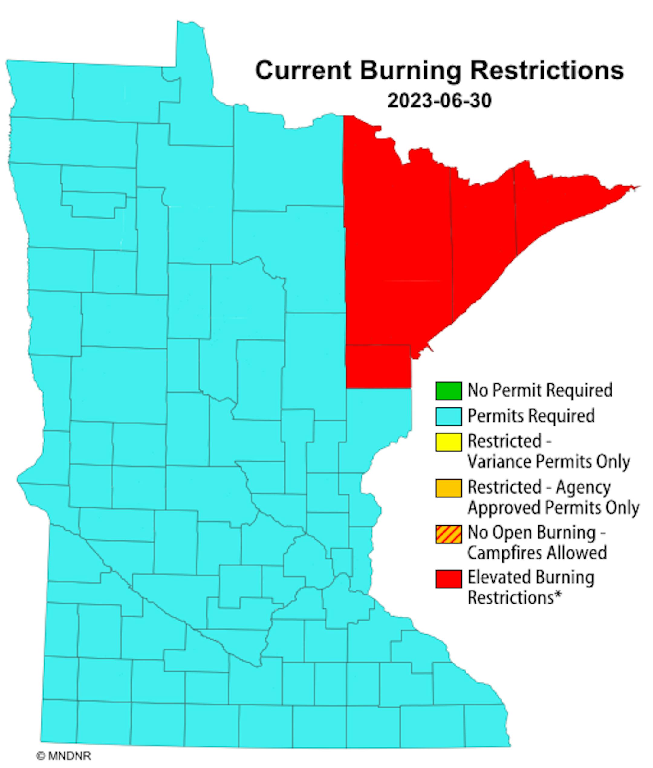
Current Burning Restrictions
Thanks to several days and weeks of hot and extremely dry weather, there remains a burning restriction across northeastern Minnesota.
Drought Update
It has been an extremely dry stretch of weather across much of the station over the last several weeks. Only a few locations have seen decent pockets of rain, but the drought is expanding. Severe drought conditions have popped up across parts of central Minnesota with moderate drought now in place across parts of the Twin Cities.

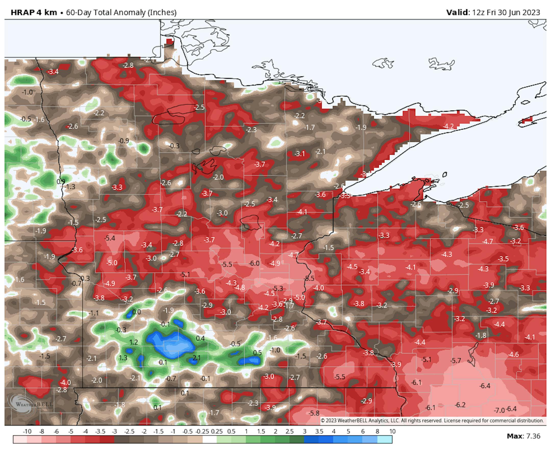
60 Day Precipitation Anomaly
The map below shows the 60 day precipitation anomaly, which indicates that some locations are nearly -3.00" to nearly -6.00" below average (in red) since mid May. This is where drought conditions are expanding.
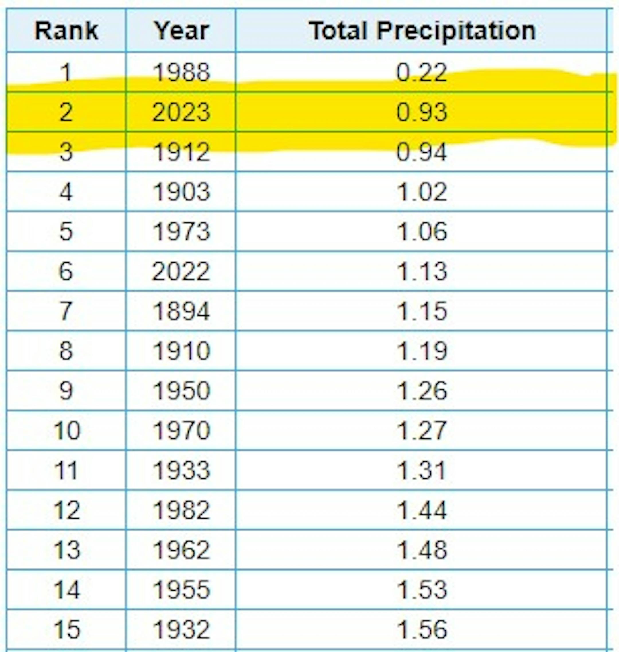
2nd Driest June on Record at MSP
Believe it or not, the MSP Airport only saw 0.93" of rain for the month of June, which is good enough for the 2nd driest June on record. Note that there have only been 3 Junes on record that have seen less 1" of rain since records began in the 1870s.
4th Driest May 1st - June 30th on Record at MSP
There has only been 2.55" of rain at the MSP Airport since May 1st, which is the 4th driest May 1st - June 30th on record. The driest such stretch was back in 1988, when only 1.92" of rain fell.


